 Английский язык
Похожие презентации:


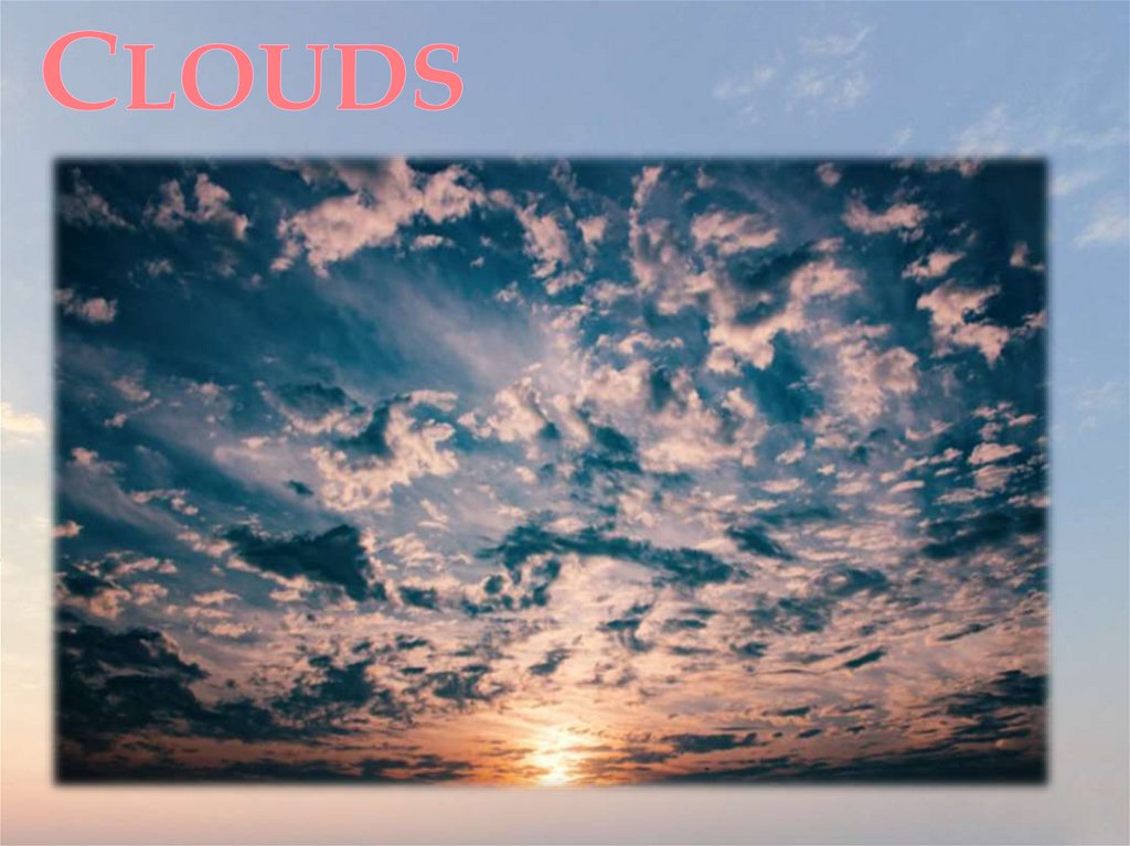
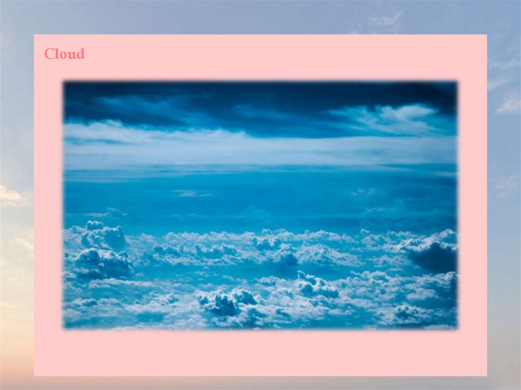
Clouds
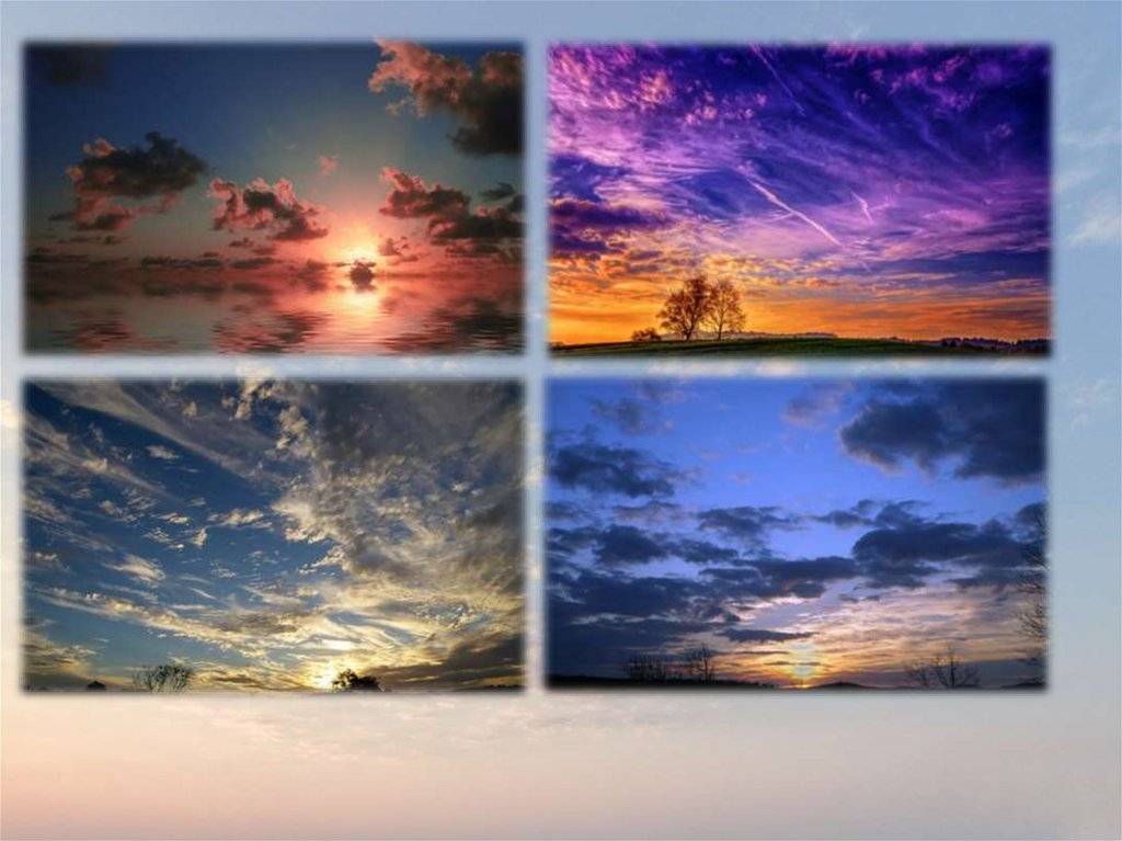
1.
2.
3.
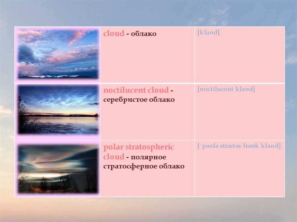
cloud - облако[klaʊd]
noctilucent cloud -
[noctilucent klaʊd]
серебристое облако
polar stratospheric
cloud - полярное
стратосферное облако
[ˈpəʊlə strætəsˈfɪərɪk klaʊd]
4.
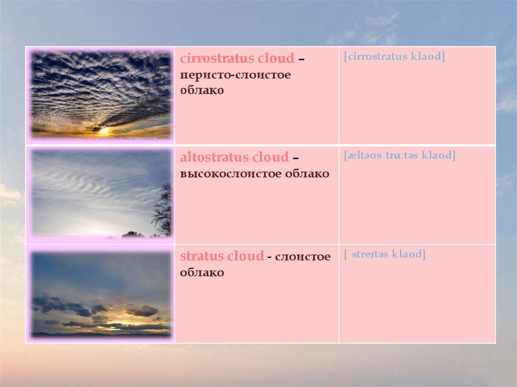
cirrostratus cloud –[cirrostratus klaʊd]
перисто-слоистое
облако
altostratus cloud –
[æltəʊsˈtrɑːtəs klaʊd]
высокослоистое облако
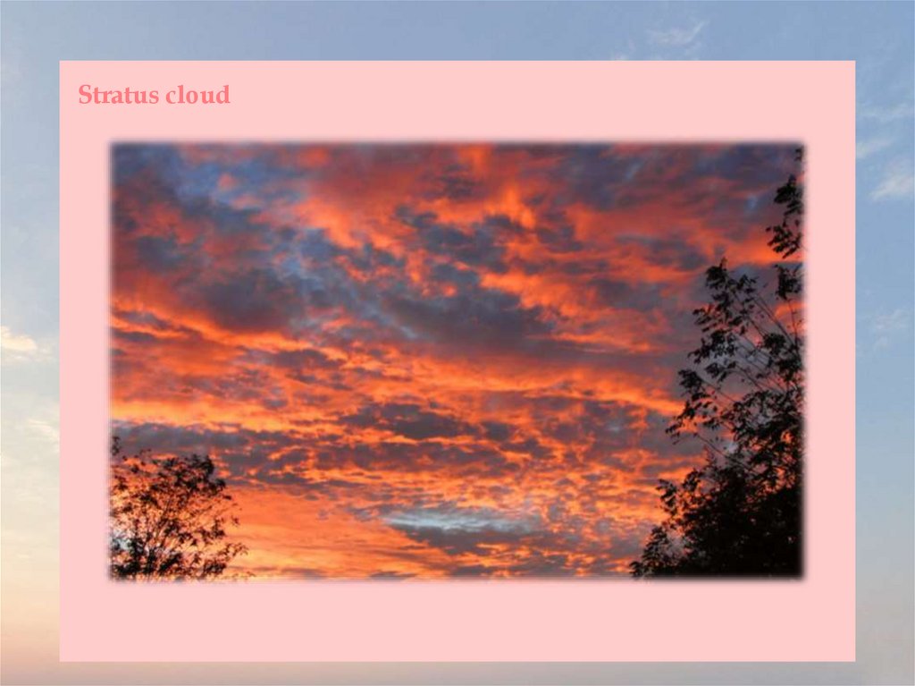
stratus cloud - слоистое
облако
[ˈstreɪtəs klaʊd]
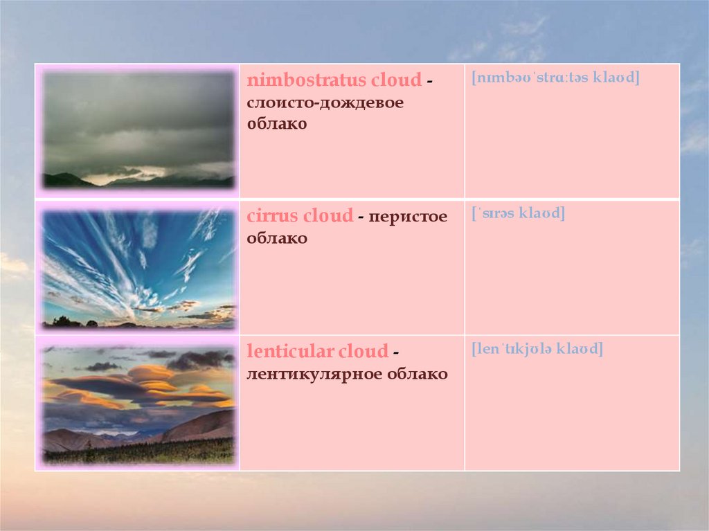
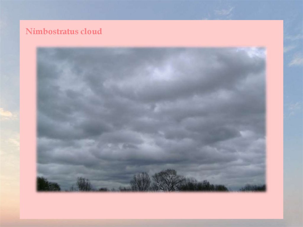
5.
nimbostratus cloud -[nɪmbəʊˈstrɑːtəs klaʊd]
слоисто-дождевое
облако
cirrus cloud - перистое
[ˈsɪrəs klaʊd]
облако
lenticular cloud лентикулярное облако
[lenˈtɪkjʊlə klaʊd]
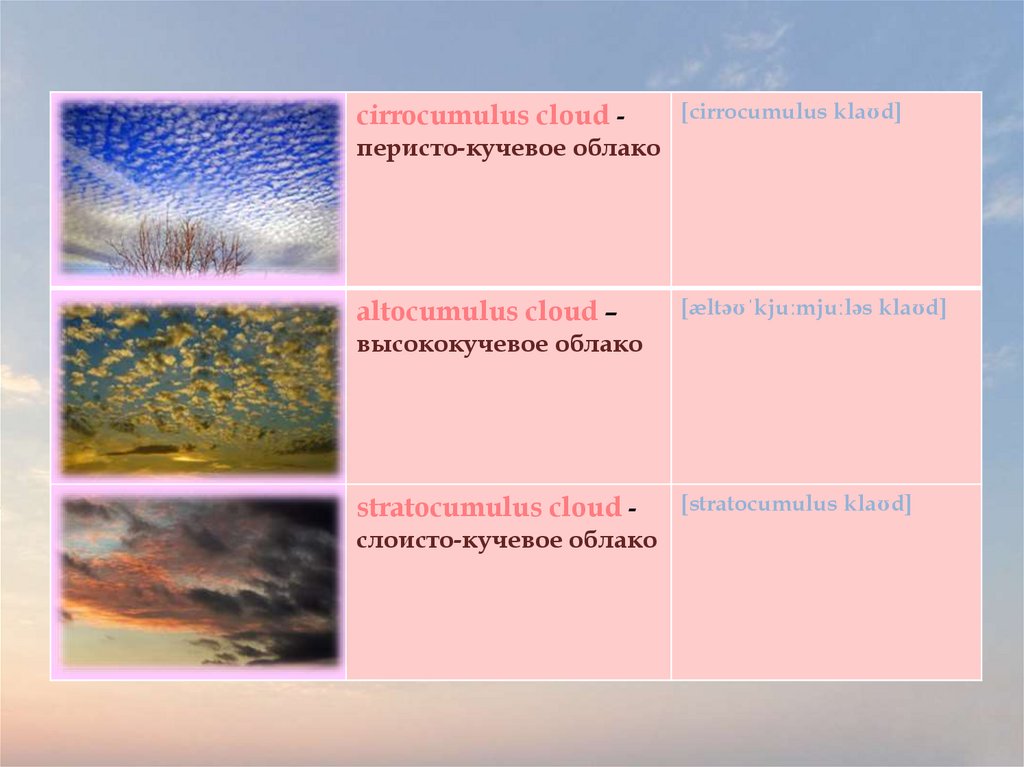
6.
cirrocumulus cloud -[cirrocumulus klaʊd]
перисто-кучевое облако
altocumulus cloud –
[æltəʊˈkjuːmjuːləs klaʊd]
высококучевое облако
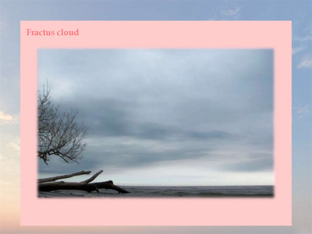
stratocumulus cloud слоисто-кучевое облако
[stratocumulus klaʊd]
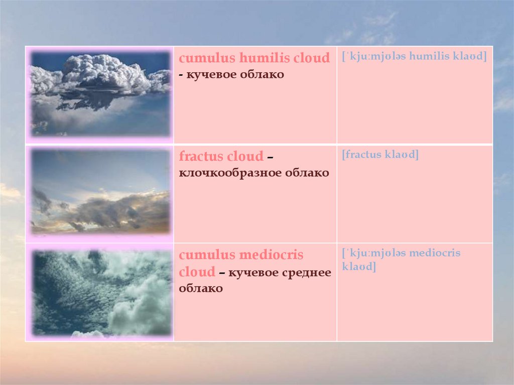
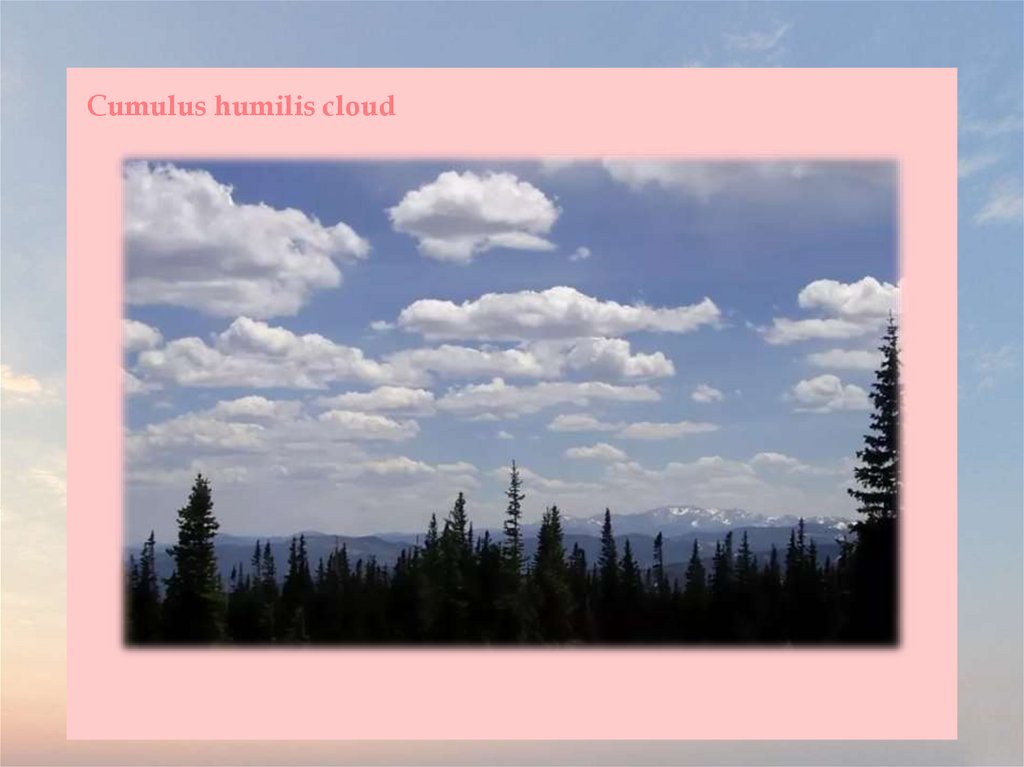
7.
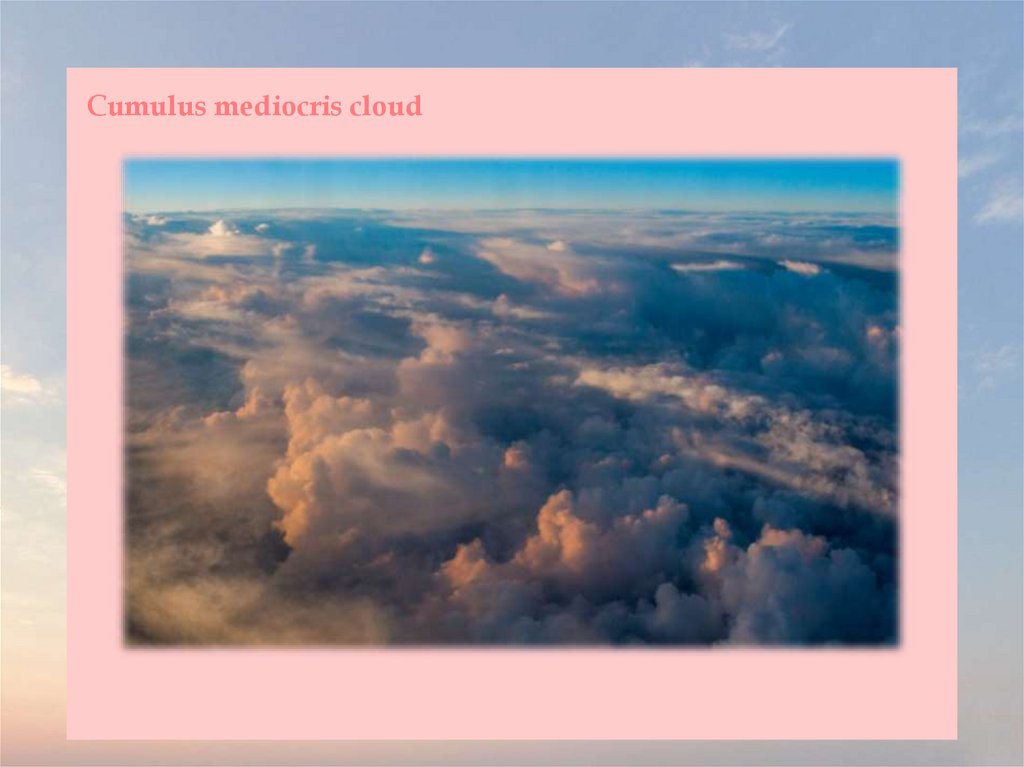
cumulus humilis cloud[ˈkjuːmjʊləs humilis klaʊd]
- кучевое облако
fractus cloud –
[fractus klaʊd]
клочкообразное облако
cumulus mediocris
cloud – кучевое среднее
облако
[ˈkjuːmjʊləs mediocris
klaʊd]
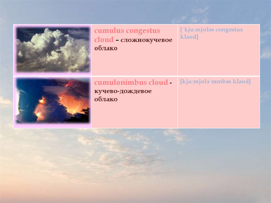
8.
cumulus congestuscloud – сложнокучевое
[ˈkjuːmjʊləs congestus
klaʊd]
облако
cumulonimbus cloud кучево-дождевое
облако
[kjuːmjʊləˈnɪmbəs klaʊd]
9.
Cloud10.
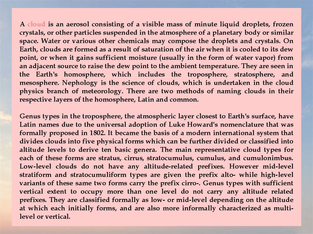
A cloud is an aerosol consisting of a visible mass of minute liquid droplets, frozencrystals, or other particles suspended in the atmosphere of a planetary body or similar
space. Water or various other chemicals may compose the droplets and crystals. On
Earth, clouds are formed as a result of saturation of the air when it is cooled to its dew
point, or when it gains sufficient moisture (usually in the form of water vapor) from
an adjacent source to raise the dew point to the ambient temperature. They are seen in
the Earth's homosphere, which includes the troposphere, stratosphere, and
mesosphere. Nephology is the science of clouds, which is undertaken in the cloud
physics branch of meteorology. There are two methods of naming clouds in their
respective layers of the homosphere, Latin and common.
Genus types in the troposphere, the atmospheric layer closest to Earth's surface, have
Latin names due to the universal adoption of Luke Howard's nomenclature that was
formally proposed in 1802. It became the basis of a modern international system that
divides clouds into five physical forms which can be further divided or classified into
altitude levels to derive ten basic genera. The main representative cloud types for
each of these forms are stratus, cirrus, stratocumulus, cumulus, and cumulonimbus.
Low-level clouds do not have any altitude-related prefixes. However mid-level
stratiform and stratocumuliform types are given the prefix alto- while high-level
variants of these same two forms carry the prefix cirro-. Genus types with sufficient
vertical extent to occupy more than one level do not carry any altitude related
prefixes. They are classified formally as low- or mid-level depending on the altitude
at which each initially forms, and are also more informally characterized as multilevel or vertical.
11.
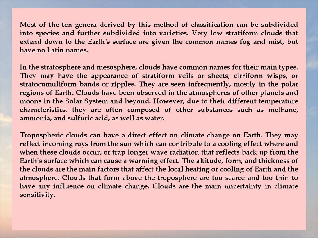
Most of the ten genera derived by this method of classification can be subdividedinto species and further subdivided into varieties. Very low stratiform clouds that
extend down to the Earth's surface are given the common names fog and mist, but
have no Latin names.
In the stratosphere and mesosphere, clouds have common names for their main types.
They may have the appearance of stratiform veils or sheets, cirriform wisps, or
stratocumuliform bands or ripples. They are seen infrequently, mostly in the polar
regions of Earth. Clouds have been observed in the atmospheres of other planets and
moons in the Solar System and beyond. However, due to their different temperature
characteristics, they are often composed of other substances such as methane,
ammonia, and sulfuric acid, as well as water.
Tropospheric clouds can have a direct effect on climate change on Earth. They may
reflect incoming rays from the sun which can contribute to a cooling effect where and
when these clouds occur, or trap longer wave radiation that reflects back up from the
Earth's surface which can cause a warming effect. The altitude, form, and thickness of
the clouds are the main factors that affect the local heating or cooling of Earth and the
atmosphere. Clouds that form above the troposphere are too scarce and too thin to
have any influence on climate change. Clouds are the main uncertainty in climate
sensitivity.
12.
Noctilucent cloud13.
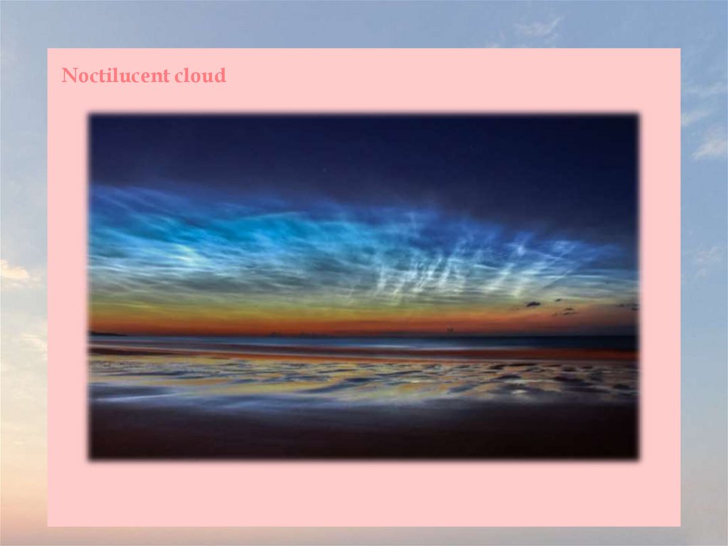
Noctilucent clouds, or night shining clouds, are tenuous cloud-like phenomena in theupper atmosphere of Earth. They consist of ice crystals and are only visible during
astronomical twilight. Noctilucent roughly means "night shining" in Latin. They are
most often observed during the summer months from latitudes between ±50° and
±70°. They are visible only during local summer months and when the Sun is below
the observer's horizon, but while these very high clouds are still in sunlight. Recent
studies suggest that increased atmospheric methane emissions produce additional
water vapor once the methane molecules reach the mesosphere – creating, or
reinforcing existing noctilucent clouds.
They are the highest clouds in Earth's atmosphere, located in the mesosphere at
altitudes of around 76 to 85 km. They are too faint to be seen in daylight, and are
visible only when illuminated by sunlight from below the horizon while the lower
layers of the atmosphere are in Earth's shadow.
No confirmed record of their observation exists before 1885, although they may have
been observed a few decades earlier by Thomas Romney Robinson in Armagh.
Doubts now surround Robinson's out-of-season records, following observations,
from several points around high northern latitudes, of NLC-like phenomena
following the Chelyabinsk superbolide entry in February 2013 (outside the NLC
season) that were in fact stratospheric dust reflections visible after sunset.
14.
Noctilucent clouds can form only under very restricted conditions during localsummer; their occurrence can be used as a sensitive guide to changes in the upper
atmosphere. They are a relatively recent classification. The occurrence of noctilucent
clouds appears to be increasing in frequency, brightness and extent.
Noctilucent clouds are composed of tiny crystals of water ice up to 100 nm in
diameter and exist at a height of about 76 to 85 km, higher than any other clouds in
Earth's atmosphere. Clouds in the Earth's lower atmosphere form when water collects
on particles, but mesospheric clouds may form directly from water vapour in addition
to forming on dust particles.
Data from the Aeronomy of Ice in the Mesosphere satellite suggests that noctilucent
clouds require water vapour, dust, and very cold temperatures to form. The sources of
both the dust and the water vapour in the upper atmosphere are not known with
certainty. The dust is believed to come from micrometeors, although particulates from
volcanoes and dust from the troposphere are also possibilities. The moisture could be
lifted through gaps in the tropopause, as well as forming from the reaction of
methane with hydroxyl radicals in the stratosphere.
15.
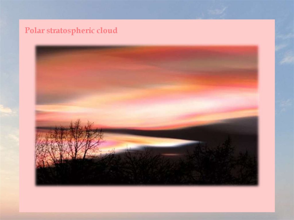
Polar stratospheric cloud16.
Polar stratospheric clouds (PSCs) are clouds in the winter polar stratosphere ataltitudes of 15,000–25,000 m. They are best observed during civil twilight, when the
Sun is between 1 and 6 degrees below the horizon, as well as in winter and in more
northerly latitudes. One main type of PSC is made up mostly of supercooled droplets
of water and nitric acid and is implicated in the formation of ozone holes. The other
main type consists only of ice crystals which are not harmful. This type of PSC is also
referred to as nacreous, from nacre, or mother of pearl, due to its iridescence).
The stratosphere is very dry; unlike the troposphere, it rarely allows clouds to form.
In the extreme cold of the polar winter, however, stratospheric clouds of different
types may form, which are classified according to their physical state and chemical
composition.
Due to their high altitude and the curvature of the surface of the Earth, these clouds
will receive sunlight from below the horizon and reflect it to the ground, shining
brightly well before dawn or after dusk.
PSCs form at very low temperatures, below −78 °C. These temperatures can occur in
the lower stratosphere in polar winter. In the Antarctic, temperatures below −88 °C
frequently cause type II PSCs. Such low temperatures are rarer in the Arctic. In the
Northern hemisphere, the generation of lee waves by mountains may locally cool the
lower stratosphere and lead to the formation of lenticular PSCs.
17.
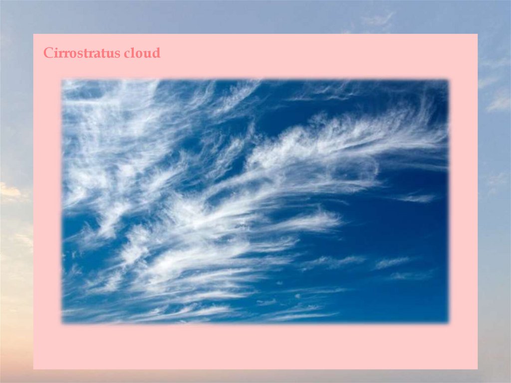
Cirrostratus cloud18.
Cirrostratus is a high-level, very thin, generally uniform stratiform genus-type ofcloud. It is made out of ice-crystals, which are pieces of frozen water. It is difficult to
detect and it can make halos. These are made when the cloud takes the form of thin
cirrostratus nebulosus. The cloud has a fibrous texture with no halos if it is thicker
cirrostratus fibratus. On the approach of a frontal system, the cirrostratus often begins
as nebulous and turns to fibratus. If the cirrostratus begins as fragmented of clouds in
the sky it often means the front is weak. Cirrostratus is usually located above 5.5 km.
Its presence indicates a large amount of moisture in the upper troposphere. Clouds
resembling cirrostratus occasionally form in polar regions of the lower stratosphere.
Polar stratospheric clouds can take on this appearance when composed of tiny
supercooled droplets of water or nitric acid.
Cirrostratus clouds sometimes signal the approach of a warm front if they form after
cirrus and spread from one area across the sky, and thus may be signs that
precipitation might follow in the next 12 to 24 hours or as soon as 6–8 hours if the
front is fast moving. If the cirrostratus is broken fibratus, it can mean that the front is
weak and that stratus rather than nimbostratus will be the precipitating cloud
(meaning drizzle or snow grains instead of moderate rain or snow). Cumulus humilis
or stratocumulus clouds are often found below cirrostratus formations, due to the
stable air associated with cirrostratus creating an inversion and restricting convection,
causing cumuliform clouds to become flattened. Contrails also tend to spread out and
can be visible for up to an hour in cirrostratus.
19.
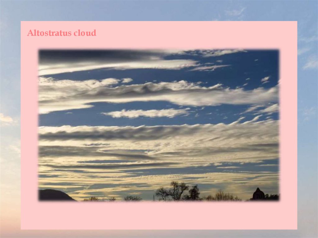
Altostratus cloud20.
Altostratus is a middle-altitude cloud genus belonging to the stratiform physicalcategory characterized by a generally uniform gray to bluish-green sheet or layer. It is
lighter in color than nimbostratus and darker than high cirrostratus. The sun can be
seen through thin altostratus, but thicker layers can be quite translucent.
Altostratus is formed by the lifting of a large mostly stable air mass that causes
invisible water vapor to condense into cloud. It can produce light precipitation, often
in the form of virga. If the precipitation increases in persistence and intensity, the
altostratus cloud may thicken into nimbostratus.
Altostratus most often takes the form of a featureless sheet of cloud but can be wavy
(undulatus) as a result of wind shear through the cloud. It can also be fragmented
(fibratus) with clear sky visible, which often precedes the approach of a weakened or
upper level warm front.
Altostratus can be composed of ice crystals. In some ice crystal altostratus, very thin,
rapidly disappearing horizontal sheets of water droplets appear at random. The sizes
of the ice crystals in the cloud tended to increase as altitude decreased. However,
close to the bottom of the cloud, the particles decreased in size again. During the
sampling of one cloud, the scientists noted a halo while flying near the top of the
cloud, which indicated that the ice crystals were hexagonal near the top. However,
farther down, the ice crystals became more conglomerated.
21.
Stratus cloud22.
Stratus clouds are low-level clouds characterized by horizontal layering with auniform base, as opposed to convective or cumuliform clouds that are formed by
rising thermals. More specifically, the term stratus is used to describe flat, hazy,
featureless clouds at low altitudes varying in color from dark gray to nearly white.
The word stratus comes from the Latin prefix strato-, meaning "layer". Stratus clouds
may produce a light drizzle or a small amount of snow. These clouds are essentially
above-ground fog formed either through the lifting of morning fog or through cold
air moving at low altitudes over a region. Some call these clouds "high fog" for their
fog-like form. While light rain may fall, this cloud does not indicate much
meteorological precipitation.
Stratus clouds form when a sheet of warm, moist air lifts off the ground and
depressurizes, following the lapse rate. This causes the relative humidity to increase
due to the adiabatic cooling.
Stratus clouds look like featureless gray to white sheets of cloud. They can be
composed of water droplets, supercooled water droplets, or ice crystals depending
upon the ambient temperature.
23.
Nimbostratus cloud24.
A nimbostratus cloud is a multi-level, grey, often dark, amorphous, nearly uniformcloud that usually produces continuous rain, snow, or sleet but no lightning or
thunder. Although it is usually a low-based cloud, it actually forms most commonly
in the middle level of the troposphere and then spreads vertically into the low and
high levels. Nimbostratus usually produces precipitation over a wide area.
Nimbo- is from the Latin word nimbus, which denotes cloud or halo. Downwardgrowing nimbostratus can have the same vertical extent as most large upwardgrowing cumulus, but its horizontal extent tends to be even greater.
Nimbostratus has a diffuse cloud base generally found anywhere from near surface
in the low levels to about 3,000 m in the middle level of the troposphere. Although
usually dark at its base, it often appears illuminated from within to a surface
observer. Nimbostratus usually has a thickness of about 2000 to 4000 m. Though
found worldwide, nimbostratus occurs more commonly in the middle latitudes. It is
coded CM2 on the SYNOP report.
Nimbostratus occurs along a warm front or occluded front where the slowly rising
warm air mass creates nimbostratus along with shallower stratus clouds producing
less rain, these clouds being preceded by higher-level clouds such as cirrostratus and
altostratus. Often, when an altostratus cloud thickens and descends into lower
altitudes, it will become nimbostratus.
25.
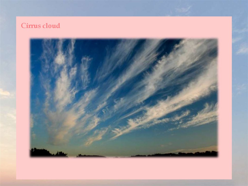
Cirrus cloud26.
Cirrus is a genus of atmospheric cloud generally characterized by thin, wispy strands,giving the type its name from the Latin word cirrus, meaning a ringlet or curling lock
of hair. Such a cloud can form at any altitude between 5,000 and 13,700 m above sea
level. The strands of cloud sometimes appear in tufts of a distinctive form referred to
by the common name of "mares' tails".
From the surface of Earth, cirrus clouds typically appear white, or a light grey, in
color; they form when water vapor undergoes deposition at altitudes above 5,500 m,
in temperate regions, and above 6,400 m in tropical ones. They also form from the
outflow of tropical cyclones, and from the anvils of cumulonimbus clouds. They also
arrive in advance of those storms' associated frontal systems, likely presaging a
deterioration in weather conditions. Though indicating the arrival of precipitation,
these clouds produce, themselves, at most fall streaks, whose ice crystals evaporate in
warmer and drier air, without reaching ground level.
Jet stream-powered cirrus can grow long enough to stretch across continents, while
remaining only a few kilometers deep. Interaction of visible light with the ice crystals
in them produces, below, optical phenomena such as sun dogs and halos. Cirrus is
known to raise the temperature (due the heat released as water vapor freezes) of the
air beneath the main cloud layer, by an average of 10 °C, When the individual
filaments become so extensive as to be virtually indistinguishable, one from another,
they form a sheet of high cloud called cirrostratus.
27.
Convection at high altitudes can produce another high-based genus of cloud,cirrocumulus, with a pattern of small cloud tufts containing droplets of supercooled
water. Some polar stratospheric clouds can resemble cirrus, and noctilucent clouds
typically become structured in ways similar to those of cirrus.
Cirrus clouds also form in the atmospheres of other planets, including Mars, Jupiter,
Saturn, Uranus, and Neptune, and have been seen even on Titan, one of Saturn's
larger moons. Some of these extraterrestrial cirrus clouds are composed of ammonia
or ices of methane, much as with terrestrial water ice. The term cirrus also applies to
certain interstellar clouds, composed of sub-micrometer-sized grains of dust.
Cirrus clouds range in thickness from 100 m to 8,000 m, with an average thickness of
1,500 m. There are, on average, 30 ice crystals per liter, but this ranges from one ice
crystal per 10,000 liters to 10,000 ice crystals per liter, a difference of eight orders of
magnitude. The length of each of these ice crystals is usually 0.25 millimeters long,
but they range from as short as 0.01 millimeters or as long as several millimeters. The
ice crystals in contrails are much smaller than those in naturally occurring cirrus
cloud, as they are around 0.001 millimeters to 0.1 millimeters in length. Cirrus can
vary in temperature from −20 °C to −30 °C.
28.
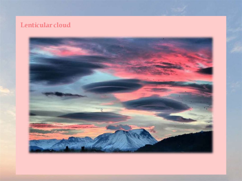
Lenticular cloud29.
Lenticular clouds are stationary clouds that form mostly in the troposphere, typicallyin parallel alignment to the wind direction. They are often comparable in appearance
to a lens or saucer. Nacreous clouds that form in the lower stratosphere sometimes
have lenticular shapes.
There are three main types of lenticular clouds: altocumulus standing lenticular,
stratocumulus standing lenticular, and cirrocumulus standing lenticular, varying in
altitude above the ground. Because of their unique appearance, they have been
suggested as an explanation for some unidentified flying object sightings.
As air travels along the surface of the Earth, obstructions are often encountered. These
include both natural features of the Earth, such as mountains or hills, and artificial
structures, such as buildings and other structures. These disrupt the flow of air into
"eddies", or areas of turbulence influenced by these obstructions.
When moist, stable air flows over a larger eddy, such as those caused by mountains, a
series of large-scale standing waves form on the leeward side of the mountain. If the
temperature at the crest of the wave drops below the local dew point, moisture in the
air may condense to form lenticular clouds. Under certain conditions, long strings of
lenticular clouds may form near the crest of each successive wave, creating a
formation known as a "wave cloud".
30.
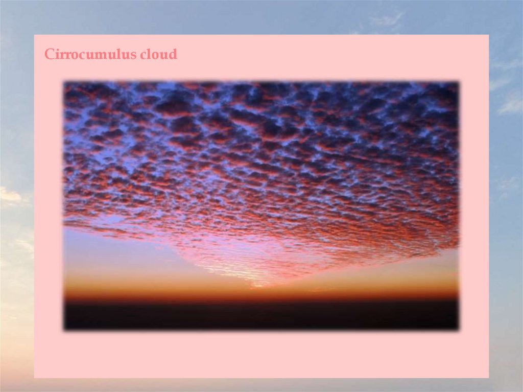
Cirrocumulus cloud31.
Cirrocumulus is one of the three main genus-types of high-altitude troposphericclouds, the other two being cirrus and cirrostratus. They usually occur at an altitude
of 5 to 12 km. Like lower-altitude cumuliform and stratocumuliform clouds,
cirrocumulus signifies convection. Unlike other high-altitude tropospheric clouds
like cirrus and cirrostratus, cirrocumulus includes a small amount of liquid water
droplets, although these are in a supercooled state. Ice crystals are the predominant
component, and typically, the ice crystals cause the supercooled water drops in the
cloud to rapidly freeze, transforming the cirrocumulus into cirrostratus. This process
can also produce precipitation in the form of a virga consisting of ice or snow. Thus,
cirrocumulus clouds are usually short-lived. They usually only form as part of a
short-lived transitional phase within an area of cirrus clouds and can also form
briefly as a result of the breaking up of part of a cumulonimbus anvil.
Properly, the term cirrocumulus refers to each cloud, but is typically also used to refer
to an entire patch of cirrocumulus. When used in this way, each cirrocumulus element
is referred to as a "cloudlet".
Cirrocumulus is a cloud of the stratocumuliform physical category that shows both
stratiform and cumuliform characteristics and typically appears as white, patchy
sheets with ripples or tufts without gray shading. Each cloudlet appears no larger
than a finger held at arm's length.
32.
These often are organized in rows like other cumuliform and stratocumuliformclouds, but since they are so small, cirrocumulus patches take on a finer appearance,
sometimes also referred to colloquially as "herringbone" or as a "mackerel sky".
Cirrocumulus is coded CH9 for the main genus-type and all subforms.
Cirrocumulus is distinguished from altocumulus in several ways, although the two
stratocumuliform genus types can occasionally occur together with no clear
demarcation between them. Cirrocumulus generally occur at higher altitudes than
altocumulus, thus the "cloudlets" appear smaller, as they are more distant from
observation at ground level. They are also colder. Cirrocumulus clouds never cast
self-shadows and are translucent to a certain degree. They are also typically found
amongst other cirrus clouds in the sky and are usually themselves seen to be
transforming into these other types of cirrus. This often occurs at the leading edge of
a warm front, where many types of cirriform clouds can be present.
Cirrocumulus clouds tend to reflect the red and yellow colours during a sunset and
sunrise, so they have been referred to as "one of the most beautiful clouds". This
occurs because they reflect the unscattered rays of light from the early morning or
evening sun, and those rays are yellow, orange, red, and sometimes purple.
33.
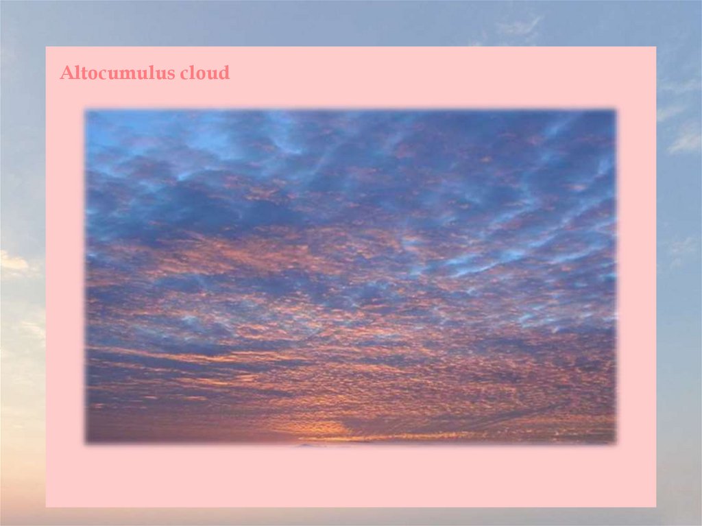
Altocumulus cloud34.
Altocumulus is a middle-altitude cloud genus that belongs mainly to thestratocumuliform physical category characterized by globular masses or rolls in layers
or patches, the individual elements being larger and darker than those of
cirrocumulus and smaller than those of stratocumulus. However, if the layers become
tufted in appearance due to increased airmass instability, then the altocumulus
clouds become more purely cumuliform in structure. Like other cumuliform and
stratocumuliform clouds, altocumulus signifies convection. A sheet of partially
conjoined altocumulus perlucidus is sometimes found preceding a weakening warm
front, where the altostratus is starting to fragment, resulting in patches of
altocumulus perlucidus between the areas of altostratus. Altocumulus is also
commonly found between the warm and cold fronts in a depression, although this is
often hidden by lower clouds.
Towering altocumulus, known as altocumulus castellanus, frequently signals the
development of thunderstorms later in the day, as it shows instability and convection
in the middle levels of the troposphere (the lowest layer of the atmosphere), the area
where towering cumulus clouds can turn into cumulonimbus. It is therefore one of
three warning clouds often recorded by the aviation industry, the other two being
towering cumulus and cumulonimbus. Altocumulus generally forms about 2,000 to
6,100 meters above ground level, a similar level to altostratus formations, and satellite
photography has revealed that the two types of cloud can create formations that can
stretch for thousands of square miles. Extensive altocumulus formations, particularly
if they take the form of undulatus are often referred to as altocumulus mackerel sky.
35.
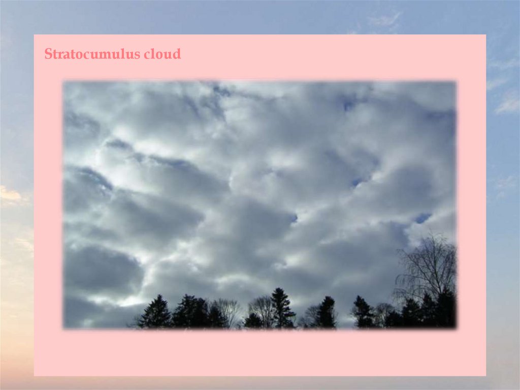
Stratocumulus cloud36.
A stratocumulus cloud, occasionally called a cumulostratus, belongs to a genus-typeof clouds characterized by large dark, rounded masses, usually in groups, lines, or
waves, the individual elements being larger than those in altocumulus, and the whole
being at a lower height, usually below 2,000 metres. Weak convective currents create
shallow cloud layers because of drier, stable air above preventing continued vertical
development. Historically, in English, this type of cloud has been referred to as a
twain cloud for being a combination of two types of clouds.
Vast areas of subtropical and polar oceans are covered with massive sheets of
stratocumulus. These may organize into distinctive patterns which are currently
under active study. In subtropics, they cover the edges of the horse latitude
climatological highs, and reduce the amount of solar energy absorbed in the ocean.
When these drift over land the summer heat or winter cold is reduced. 'Dull weather'
is a common expression incorporated with overcast stratocumulus days, which
usually occur either in a warm sector between a warm and cold front in a depression,
or in an area of high pressure, in the latter case, sometimes persisting over a specific
area for several days. If the air over land is moist and hot enough, stratocumulus may
develop to various cumulus clouds, or, more commonly, the sheet of stratocumulus
may become thick enough to produce some light rain. On drier areas they quickly
dissipate over land, resembling cumulus humilis. This often occurs in late morning in
areas under anticyclonic weather, the stratocumulus breaking up under the sun's heat
and often reforming again by evening as the heat of the sun decreases again.
37.
Cumulus humilis cloud38.
Cumulus humilis are cumuliform clouds with little vertical extent, common in thesummer, that are often referred to as "fair weather cumulus". If they develop into
cumulus mediocris or cumulus congestus, thunderstorms could form later in the day.
They generally form at lower altitudes (500–3000 m), but in hot countries or over
mountainous terrain these clouds can occur at an altitude of up to 6,000 m. They show
no significant vertical development, indicating that the temperature in the
atmosphere above them either drops off very slowly or not at all with altitude; that is,
the adiabatic lapse rate is small. Cumulus humilis may be accompanied by other
cloud types.
Air below the cloud base can be quite turbulent due to the thermals that formed the
clouds, giving occupants of light aircraft an uncomfortable ride. To avoid turbulence
where such clouds are present, pilots may climb above the cloud tops. However,
glider pilots actively seek out the rising air to gain altitude.
These clouds may later metamorphose into cumulus clouds when convection is
intense enough, though the presence of these types of clouds usually indicates fair
weather.
39.
Fractus cloud40.
Fractus clouds (scuds) are small, ragged cloud fragments that are usually found underan ambient cloud base. They form or have broken off from a larger cloud, and are
generally sheared by strong winds, giving them a jagged, shredded appearance.
Fractus have irregular patterns, appearing much like torn pieces of cotton candy. They
change constantly, often forming and dissipating rapidly. They do not have clearly
defined bases. Sometimes they are persistent and form very near the surface.
Common kinds include scud and cloud tags.
Fractus are accessory clouds, named for the type of cloud from which they were
sheared. The two principal forms are cumulus fractus (formerly, fractocumulus) and
stratus fractus (formerly, fractostratus). Fractus clouds may develop into cumulus if
the ground heats enough to start convection. Stratus fractus is distinguishable from
cumulus fractus by its smaller vertical extent, darker color, and by the greater
dispersion of its particles.
Cumulus fractus clouds actually look like ragged cumulus clouds. They may
originate from dissipated cumulus clouds, appearing in this case as white ragged
clouds located at significant distances from each other. Cumulus fractus in particular
form on the leading and trailing edges of summer storms in warm and humid
conditions. Observing fractus gives an indication of wind movements under the
parent cloud.
Masses of multiple fractus clouds, located under a main cloud, are called pannus.
41.
Cumulus mediocris cloud42.
Cumulus mediocris is a low to middle level cloud with some vertical extent of thegenus cumulus, larger in vertical development than Cumulus humilis. It also may
exhibit small protuberances from the top and may show the cauliflower form
characteristic of cumulus clouds. Cumulus mediocris clouds do not generally produce
precipitation of more than very light intensity, but can further advance into clouds
such as Cumulus congestus or Cumulonimbus, which do produce precipitation and
severe storms.
Cumulus mediocris is brilliantly white when sunlit, and is dark underneath. A single
pattern-based variety, Cumulus radiatus, is sometime seen when the individual
clouds are arranged into parallel rows. The resulting formations are known as "cloud
streets" and are aligned approximately parallel to the wind.
Cumulus mediocris may have precipitation-based features like virga, and may form
Cumulus praecipitato clouds. The pannus supplementary feature is sometimes seen
with precipitating Cumulus mediocris, but in this case the cloud reporting code
normally used with to identify pannus is usually superseded by it due to the
additional presence of significant vertical development. Pileus (cap cloud), velum
(apron), arcus (roll or shelf cloud) and tuba (vertical column) features are also
occasionally seen with cloud. They may form as a result of a partial transformation of
altocumulus or stratocumulus. This genus and species type may also be the result of a
complete transformation of stratocumulus or stratus.
43.
Cumulus congestus cloud44.
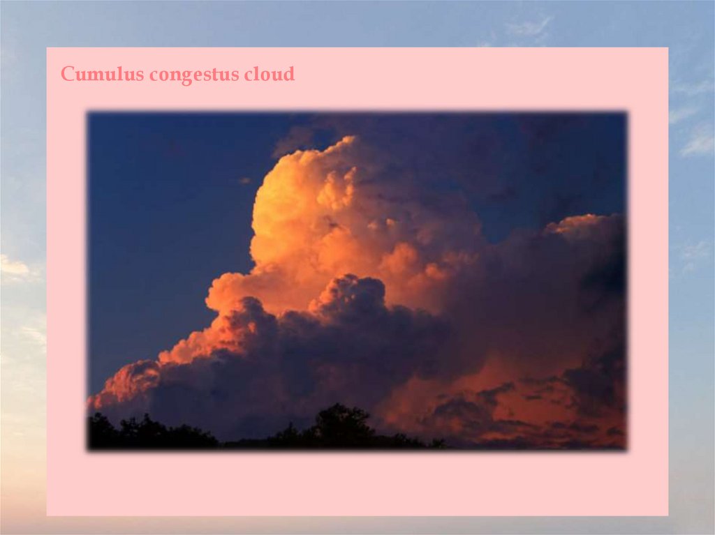
Cumulus congestus clouds, also known as towering cumulus, are a form of cumulusthat can be based in the low or middle height ranges. They achieve considerable
vertical development in areas of deep, moist convection. They are an intermediate
stage between cumulus mediocris and cumulonimbus, producing showers of snow,
rain or ice pellets.
Cumulus congestus clouds are characteristic of unstable areas of the atmosphere
which are undergoing convection. They are often characterized by sharp outlines and
great vertical development. Because they are produced by (and primarily composed
of) strong updrafts, they are typically taller than they are wide, and cloud tops can
reach 6 kilometres, or higher in the tropics.
Cumulus congestus clouds are formed by the development of cumulus mediocris
generally, though they can also be formed from altocumulus castellanus or
stratocumulus castellanus as well. The congestus species of cloud can only be found
in the genus cumulus and is designated as towering cumulus by the International
Civil Aviation Organization. Congestus clouds are capable of producing severe
turbulence and showers of moderate to heavy intensity. This species is classified as
vertical or multi-étage and is coded in the synop report. These clouds are usually too
large and opaque to have any opacity or pattern-based varieties.
45.
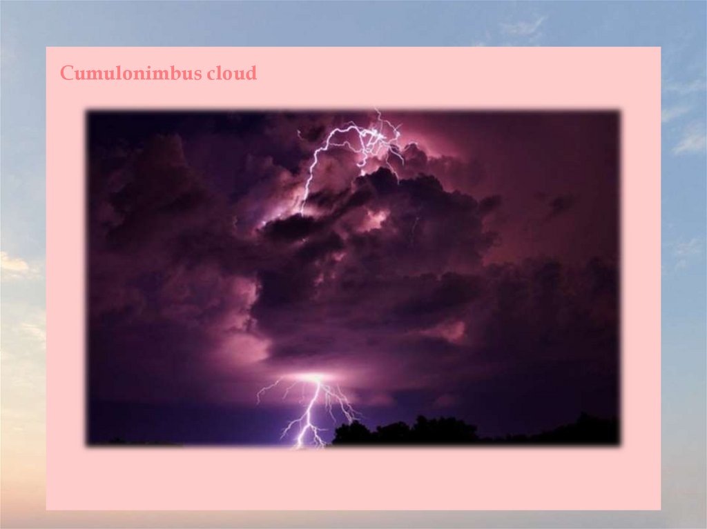
Cumulonimbus cloud46.
Cumulonimbus (from Latin cumulus, "heaped" and nimbus, "rainstorm") is a dense,towering vertical cloud, forming from water vapor carried by powerful upward air
currents. If observed during a storm, these clouds may be referred to as thunderheads.
Cumulonimbus can form alone, in clusters, or along cold front squall lines. These
clouds are capable of producing lightning and other dangerous severe weather, such
as tornadoes and hailstones. Cumulonimbus progress from overdeveloped cumulus
congestus clouds and may further develop as part of a supercell. Cumulonimbus is
abbreviated Cb.
Towering cumulonimbus clouds are typically accompanied by smaller cumulus
clouds. The cumulonimbus base may extend several kilometres across and occupy
low to middle altitudes - formed at altitude from approximately 200 to 4,000 m. Peaks
typically reach to as much as 12,000 m, with extreme instances as high as 21,000 m or
more. Well-developed cumulonimbus clouds are characterized by a flat, anvil-like top
(anvil dome), caused by wind shear or inversion near the tropopause. The shelf of the
anvil may precede the main cloud's vertical component for many kilometres, and be
accompanied by lightning. Occasionally, rising air parcels surpass the equilibrium
level (due to momentum) and form an overshooting top culminating at the maximum
parcel level. When vertically developed, this largest of all clouds usually extends
through all three cloud regions. Even the smallest cumulonimbus cloud dwarfs its
neighbors in comparison.