


 Информатика
Похожие презентации:


Introduction of the ILS/VOR/DME
1.
Introduction ofthe ILS/VOR/DME
Zhomart Mustafa
ЛЭ-4
2.
Main ideas• What is navigation?
• What is navigation used for?
• ILS ; VOR/DME
3.
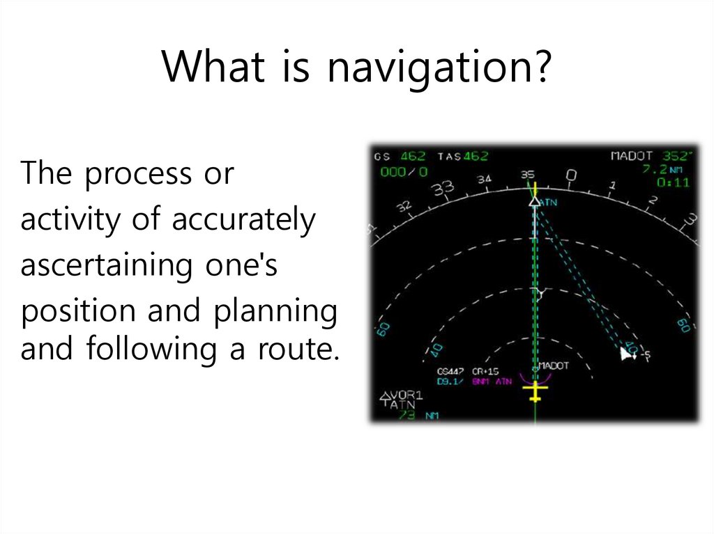
What is navigation?The process or
activity of accurately
ascertaining one's
position and planning
and following a route.
4.
What is navigation used for?Navigation is the art and science of
determining the position of a ship, plane or
other vehicle, and guiding it to a
specific destination. Navigation requires
a person to know the vehicle's relative
location, or position compared to
other known locations. Navigators
measure distance on the globe in degrees
5.
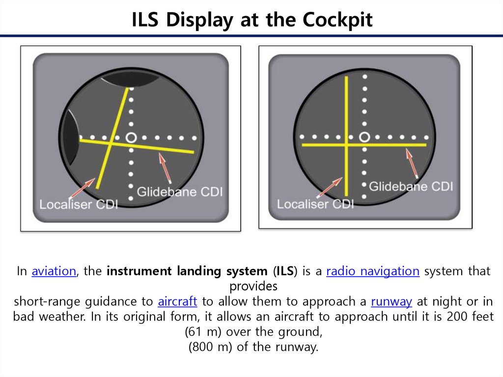
ILS Display at the CockpitIn aviation, the instrument landing system (ILS) is a radio navigation system that
provides
short-range guidance to aircraft to allow them to approach a runway at night or in
bad weather. In its original form, it allows an aircraft to approach until it is 200 feet
(61 m) over the ground,
(800 m) of the runway.
6.
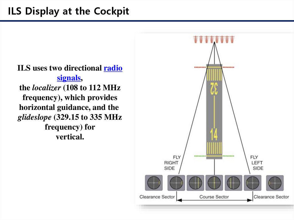
ILS Display at the CockpitILS uses two directional radio
signals,
the localizer (108 to 112 MHz
frequency), which provides
horizontal guidance, and the
glideslope (329.15 to 335 MHz
frequency) for
vertical.
7.
ILS Display at the Cockpit8.
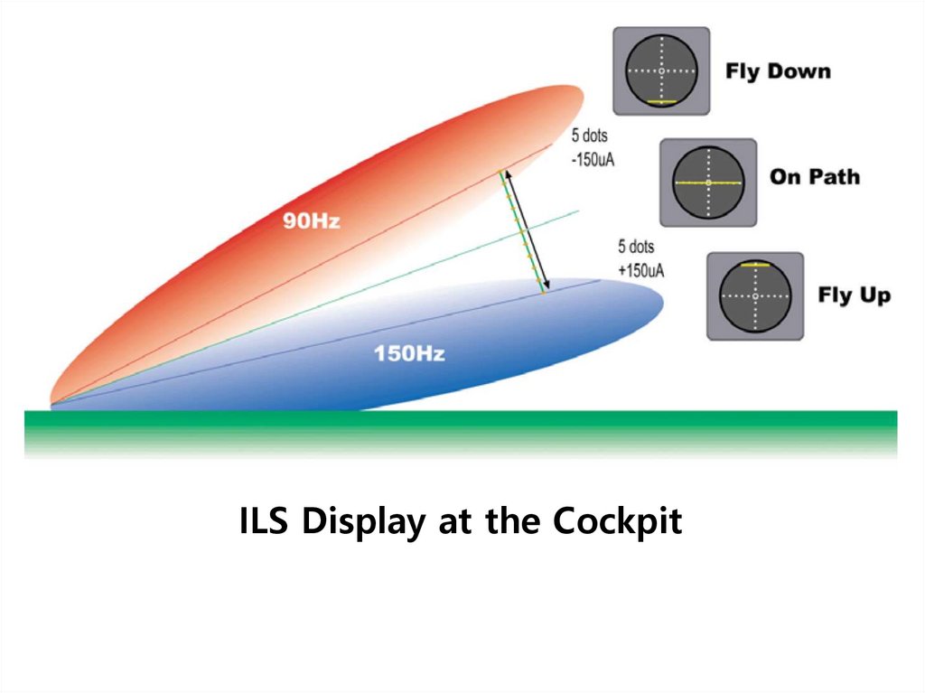
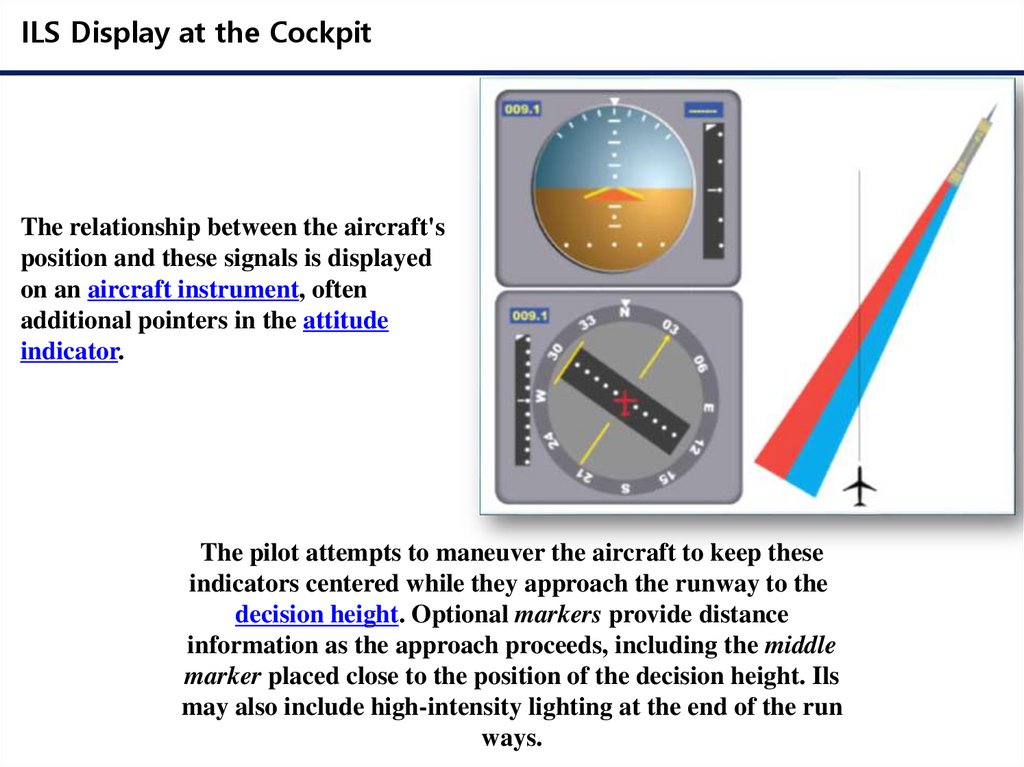
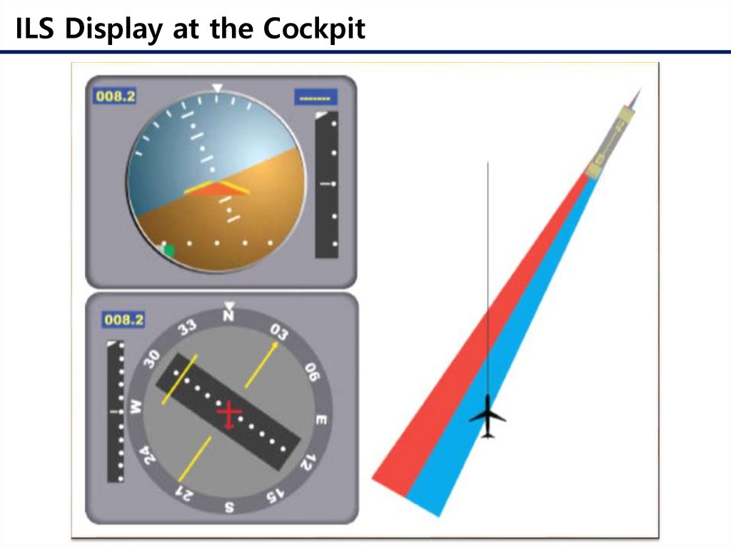
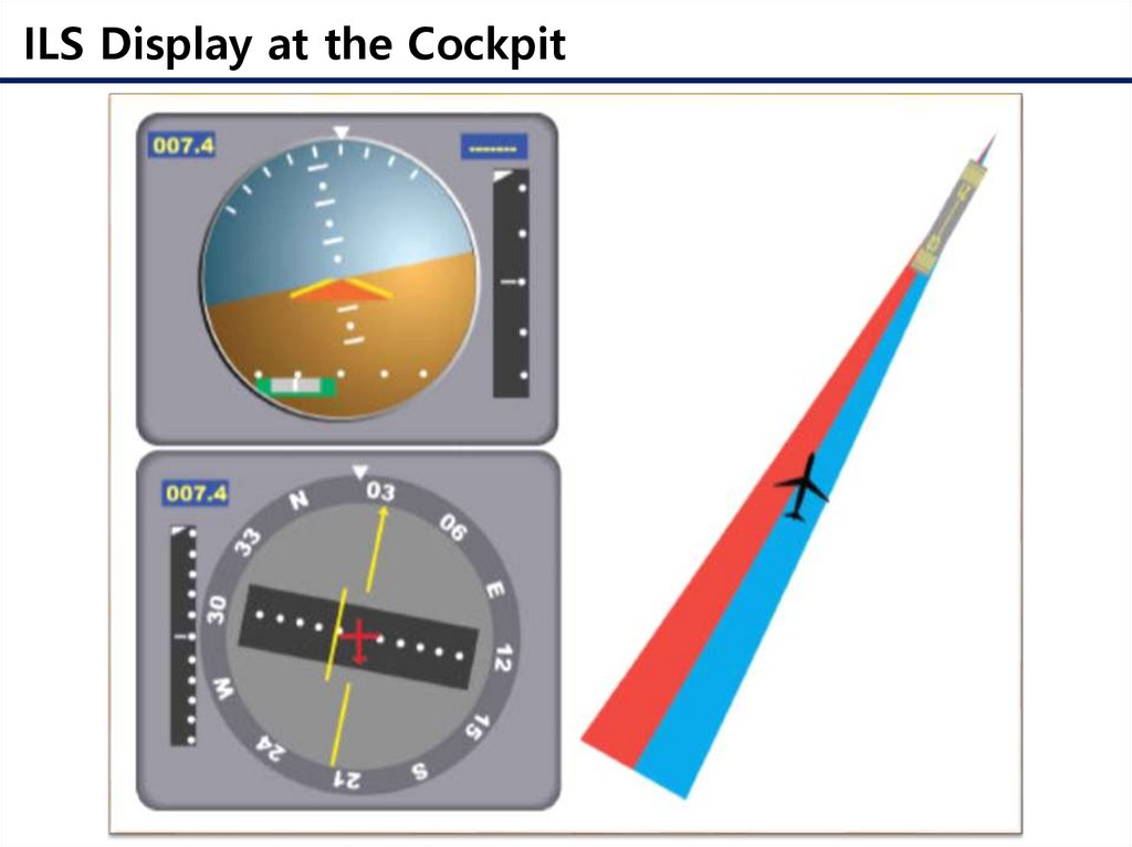
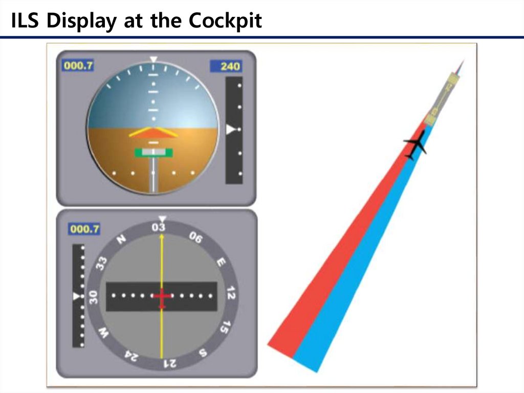
ILS Display at the CockpitThe relationship between the aircraft's
position and these signals is displayed
on an aircraft instrument, often
additional pointers in the attitude
indicator.
The pilot attempts to maneuver the aircraft to keep these
indicators centered while they approach the runway to the
decision height. Optional markers provide distance
information as the approach proceeds, including the middle
marker placed close to the position of the decision height. Ils
may also include high-intensity lighting at the end of the run
ways.
9.
ILS Display at the Cockpit10.
ILS Display at the Cockpit11.
ILS Display at the Cockpit12.
ILS Display at the Cockpit13.
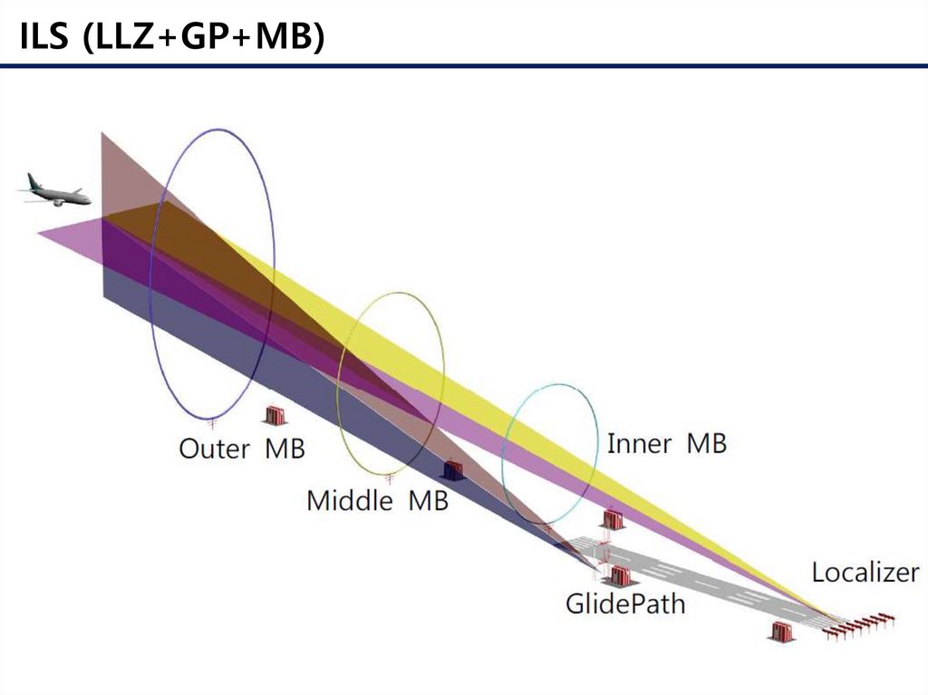
ILS (LLZ+GP+MB)14.
LLZ Antenna ArrayAn instrument landing system operates as a ground-based instrument approach
system that provides precision lateral and vertical guidance to an aircraft
approaching and landing on a runway, using a combination of radio signals and,
in many cases, high-intensity lighting arrays to enable a safe landing during
instrument meteorological conditions (IMC), such as low ceilings or reduced
visibility due to fog, rain, or blowing snow.
15.
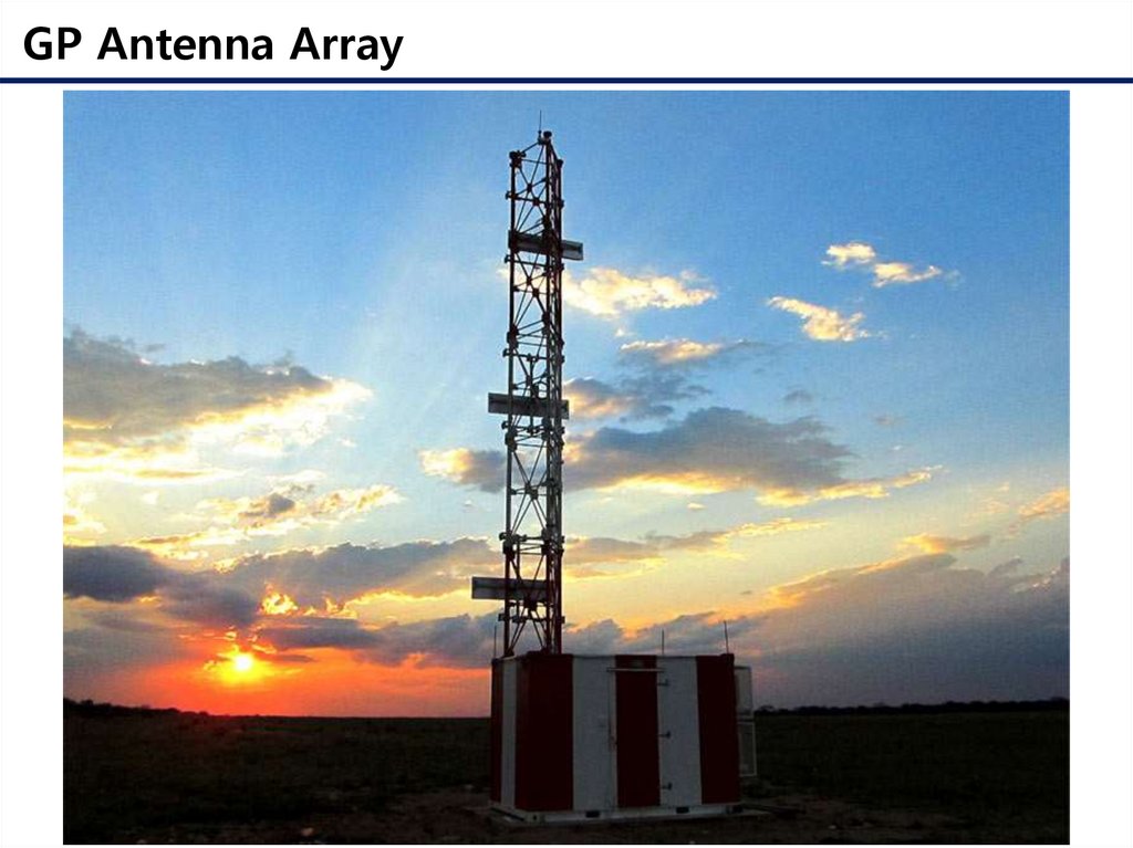
GP Antenna Array16.
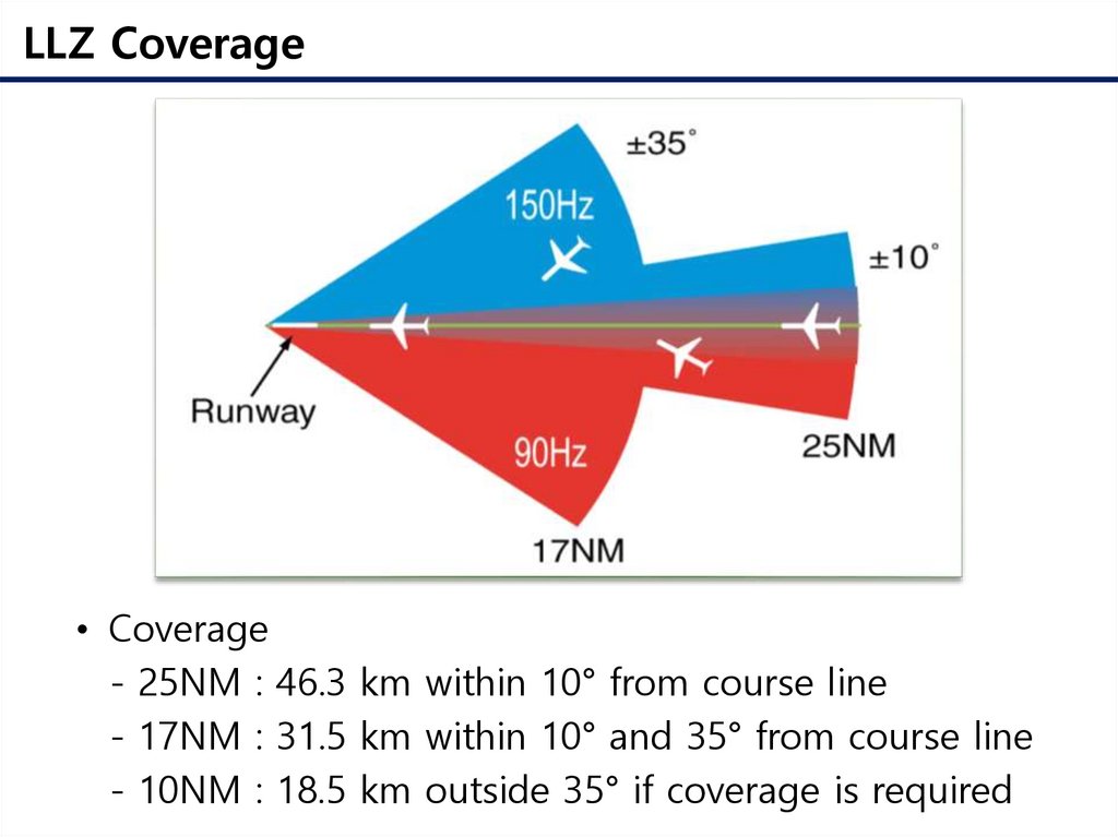
LLZ Coverage• Coverage
- 25NM : 46.3 km within 10° from course line
- 17NM : 31.5 km within 10° and 35° from course line
- 10NM : 18.5 km outside 35° if coverage is required
17.
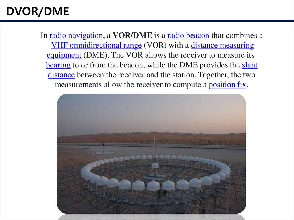
DVOR/DMEIn radio navigation, a VOR/DME is a radio beacon that combines a
VHF omnidirectional range (VOR) with a distance measuring
equipment (DME). The VOR allows the receiver to measure its
bearing to or from the beacon, while the DME provides the slant
distance between the receiver and the station. Together, the two
measurements allow the receiver to compute a position fix.
18.
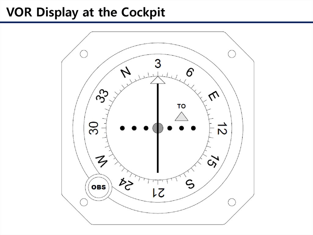
VOR Display at the Cockpit19.
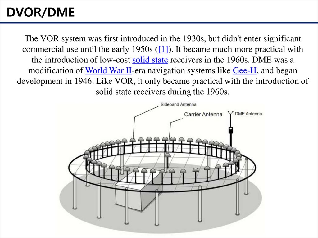
DVOR/DMEThe VOR system was first introduced in the 1930s, but didn't enter significant
commercial use until the early 1950s ([1]). It became much more practical with
the introduction of low-cost solid state receivers in the 1960s. DME was a
modification of World War II-era navigation systems like Gee-H, and began
development in 1946. Like VOR, it only became practical with the introduction of
solid state receivers during the 1960s.
20.
DVOR Antenna Array21.
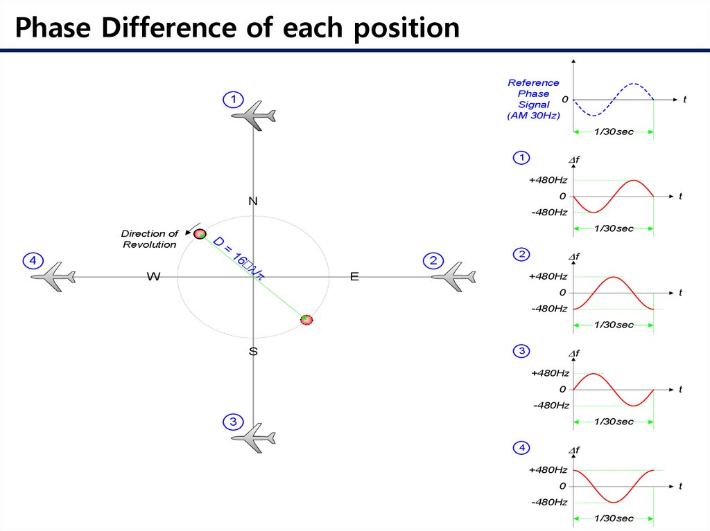
Phase Difference of each positionReference
Phase
0
Signal
(AM 30Hz)
1
t
1/30sec
Df
1
+480Hz
0
N
t
-480Hz
1/30sec
D
Direction of
Revolution
=
W
/p
´l
16
4
2
Df
2
E
+480Hz
0
t
-480Hz
1/30sec
S
Df
3
+480Hz
0
t
-480Hz
3
1/30sec
Df
4
+480Hz
0
t
-480Hz
1/30sec
22.
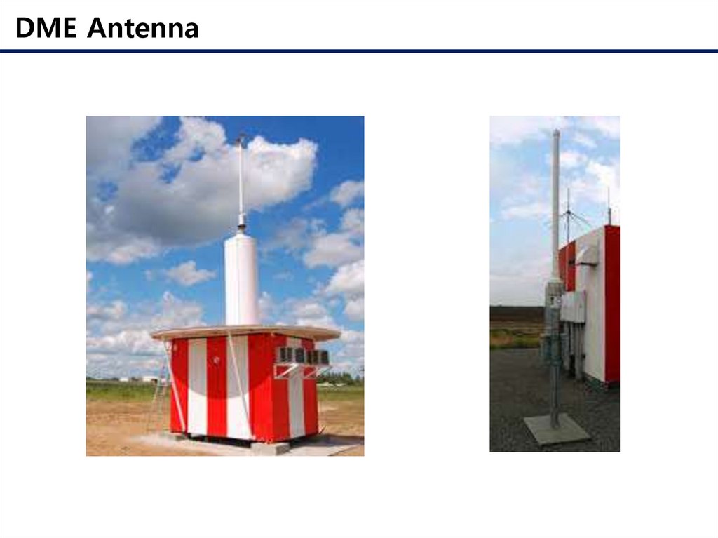
DME Antenna23.
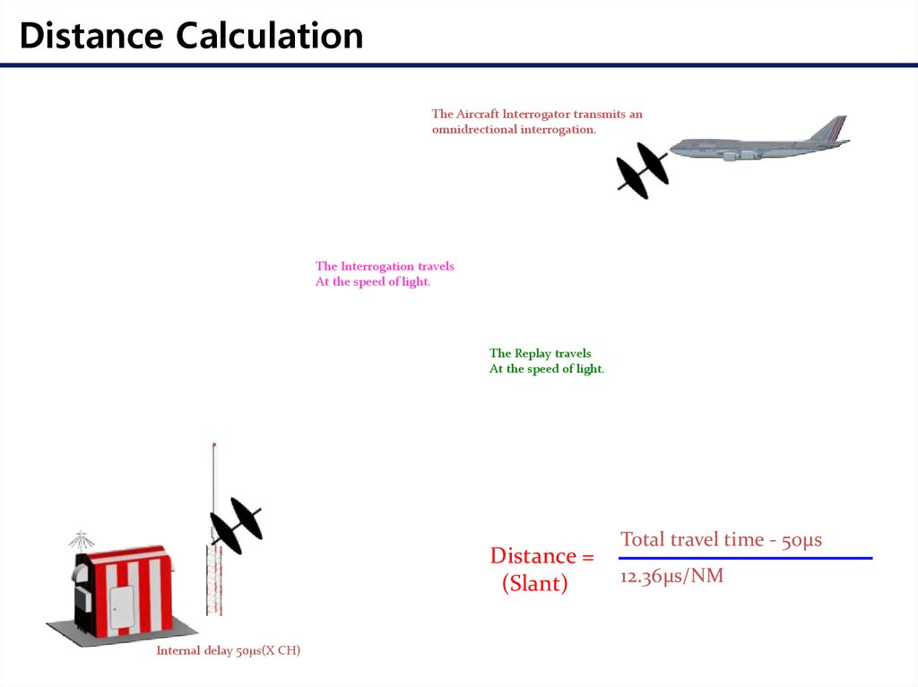
Distance CalculationThe Aircraft Interrogator transmits an
omnidrectional interrogation.
The Interrogation travels
At the speed of light.
The Replay travels
At the speed of light.
Distance =
(Slant)
Internal delay 50μs(X CH)
Total travel time - 50μs
12.36μs/NM