


")


 География
Похожие презентации:


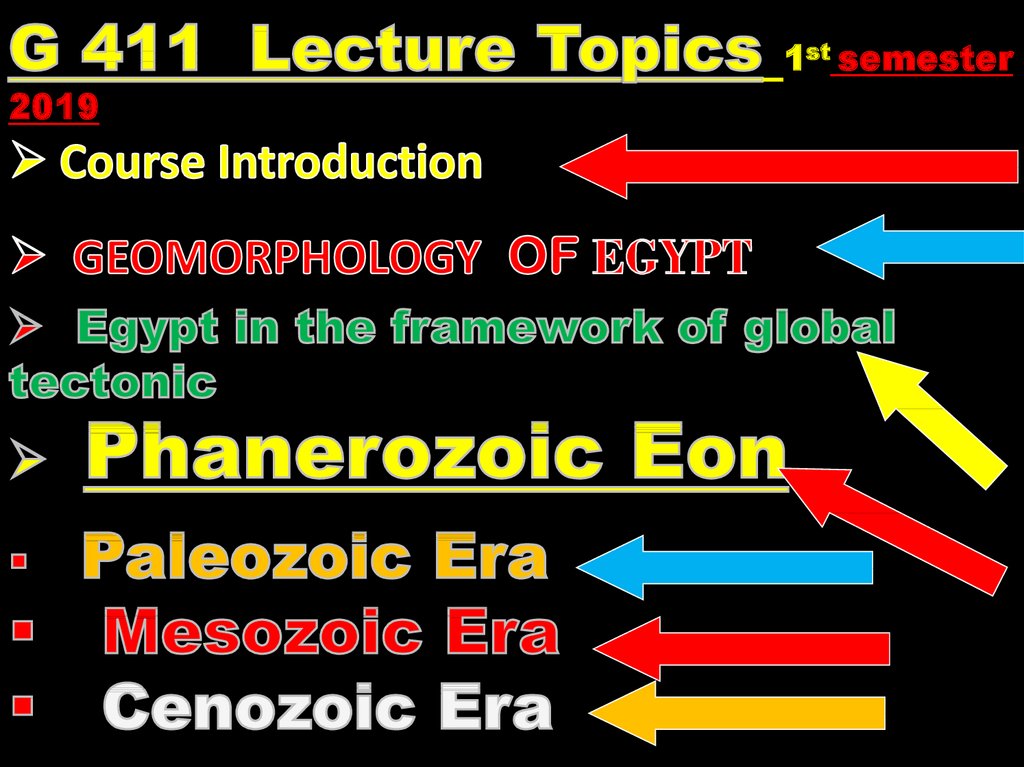
The Phanerozoic оf Egypt
1.
2.
3. THE PHANEROZOIC OF EGYPT
• Dr. Shehta Abou FandoudEweidhah
• Zagazig Univ.
Faculty of science
Geology Department
Fourth year of Geol. and chem.
&Geophysics
1st Semester 2019/2020
4.
Course GradingACTIVITIES
PERCENTAGES
Class Exercises
10 %
Lab exam
10 %
Midterm exam
10 %
Oral exam
10%
Total
40 %
Final exam
60 %
Total
10/11/2019
100 %
4
5.
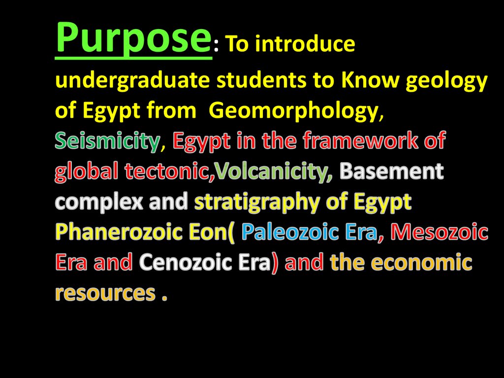
Purpose: To introduceundergraduate students to Know geology
of Egypt from Geomorphology,
,
6.
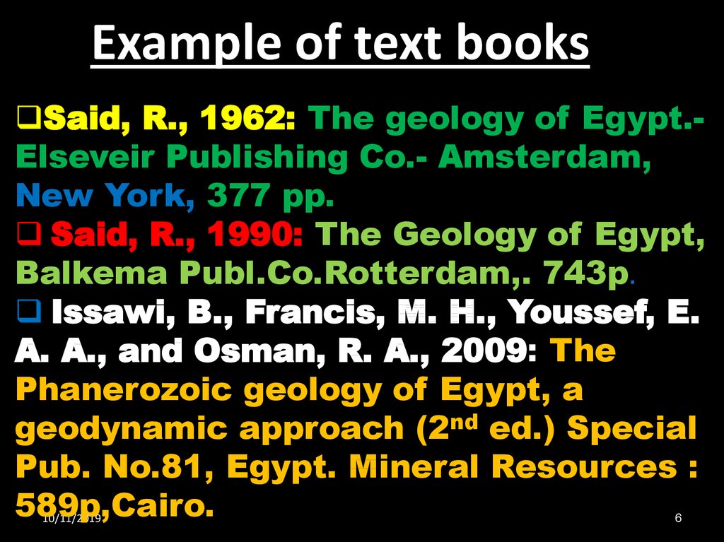
Example of text booksSaid, R., 1962: The geology of Egypt.Elseveir Publishing Co.- Amsterdam,
New York, 377 pp.
Said, R., 1990: The Geology of Egypt,
Balkema Publ.Co.Rotterdam,. 743p.
Issawi, B., Francis, M. H., Youssef, E.
A. A., and Osman, R. A., 2009: The
Phanerozoic geology of Egypt, a
geodynamic approach (2nd ed.) Special
Pub. No.81, Egypt. Mineral Resources :
589p,Cairo.
10/11/2019
6
7.
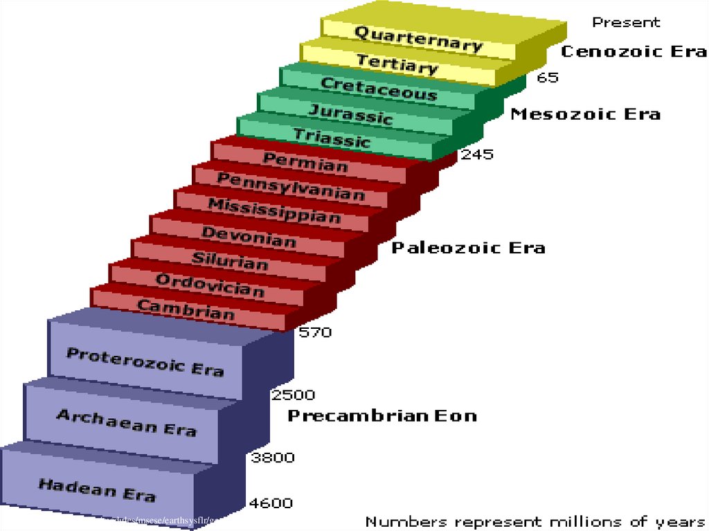
http://www.cotf.edu/ete/modules/msese/earthsysflr/geotime.html8. Introduction
• The present work presents theframework on the Phanerozoic of Egypt;
its stratigraphy & structural settings as
its sedimentary & economic mineral
and deposits.
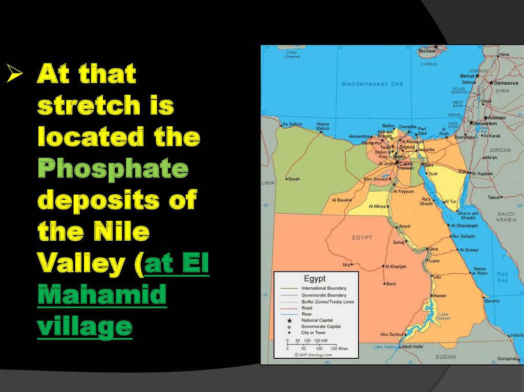
• Other geological branches,e.g.
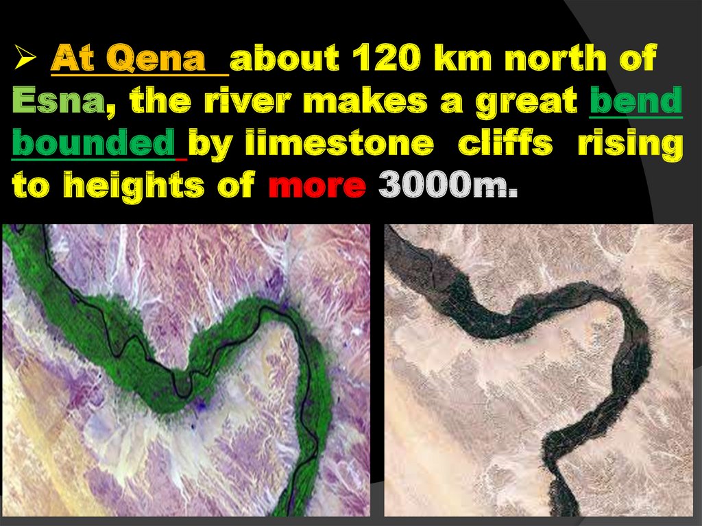
Geomorphology , paleontology (macro and micro – index fossil) etc…. Are in
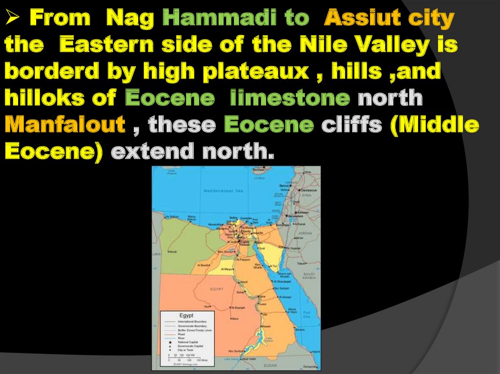
consideration .
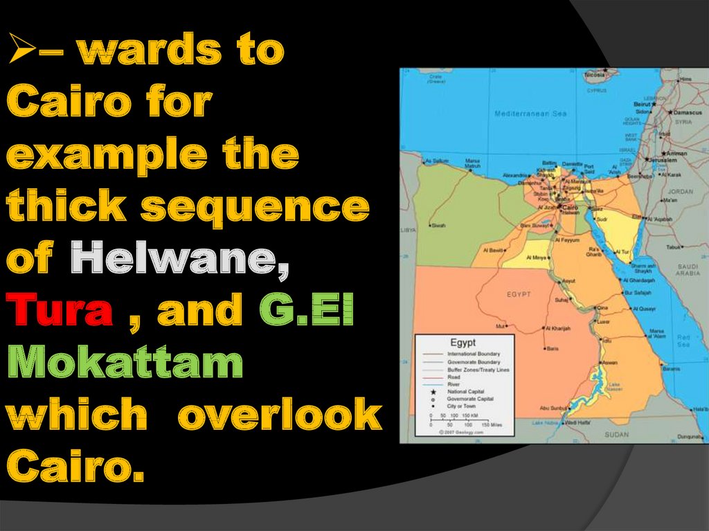
• Therefore, its highly recommended that
the reader must be aware at least the
general basis of the above mentioned
geological sciences / branches , to
follow and assimilate the content of
the present work.
9.
1st semester2019
10.
11. Geographic Situation
• Egypt forms thenortheast corner
of Africa and
occupies nearly
one-thirtieth
• (1/30) of the total
area of that
continent and
extends beyond
the Gulf of Suez
and the Suez
Canal into Asian
near East.
12. Geographic Situation
• Bounded by tothe North by the
Mediterranean
Sea, to the
south by
Republic of the
Sudan, to the
west by the
Republic of
Libya and to the
east by
Palestine, Gulf
of Aqaba and
the Red Sea.
13.
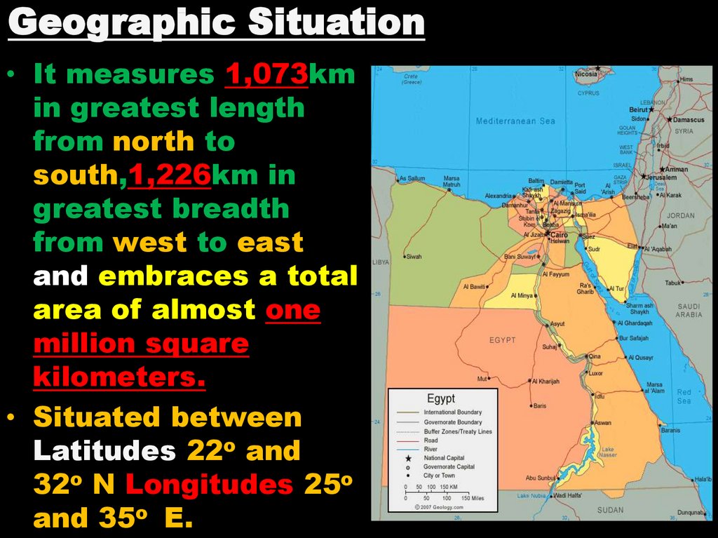
Geographic Situation• It measures 1,073km
in greatest length
from north to
south,1,226km in
greatest breadth
from west to east
and embraces a total
area of almost one
million square
kilometers.
• Situated between
Latitudes 22o and
32o N Longitudes 25o
and 35o E.
14.
Climatic Condition• Egypt lies for
the most part in
the temperate
zone, with less
than a quarter
of its area south
of the tropic
corner due to
the near of
tropic cancer.
15.
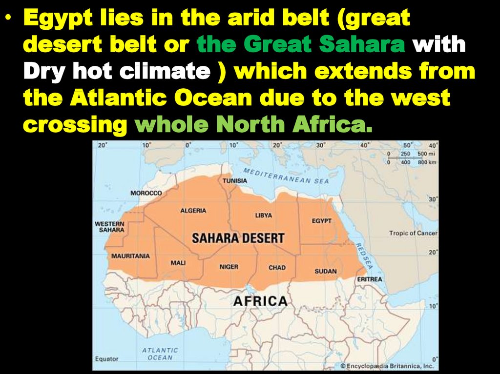
• Egypt lies in the arid belt (greatdesert belt or the Great Sahara with
Dry hot climate ) which extends from
the Atlantic Ocean due to the west
crossing whole North Africa.
16.
Morocco, Algeria, Tunis, Lybia andEgypt and further to the east ,Saudi
Arabia, Arab Gulf , Iran , and Pakistan
, passing by Afghanistan.
17.
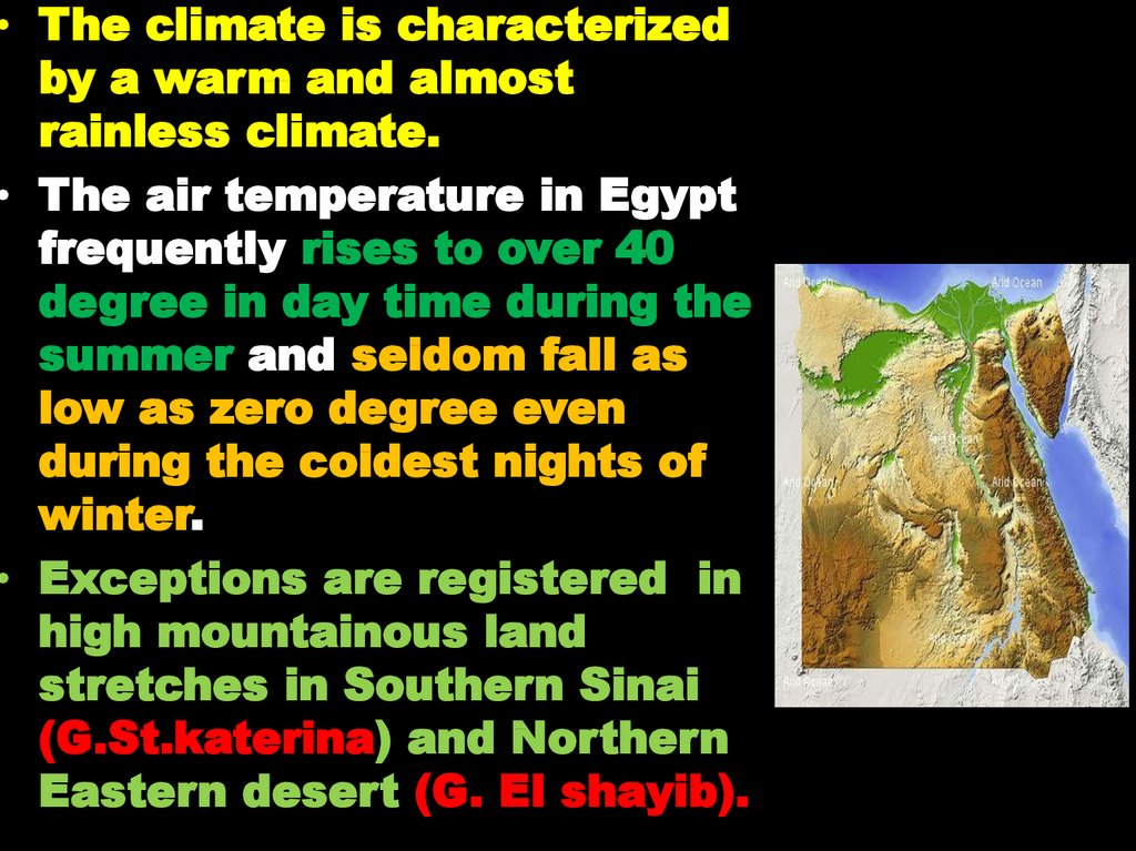
• The climate is characterizedby a warm and almost
rainless climate.
• The air temperature in Egypt
frequently rises to over 40
degree in day time during the
summer and seldom fall as
low as zero degree even
during the coldest nights of
winter.
• Exceptions are registered in
high mountainous land
stretches in Southern Sinai
(G.St.katerina) and Northern
Eastern desert (G. El shayib).
18.
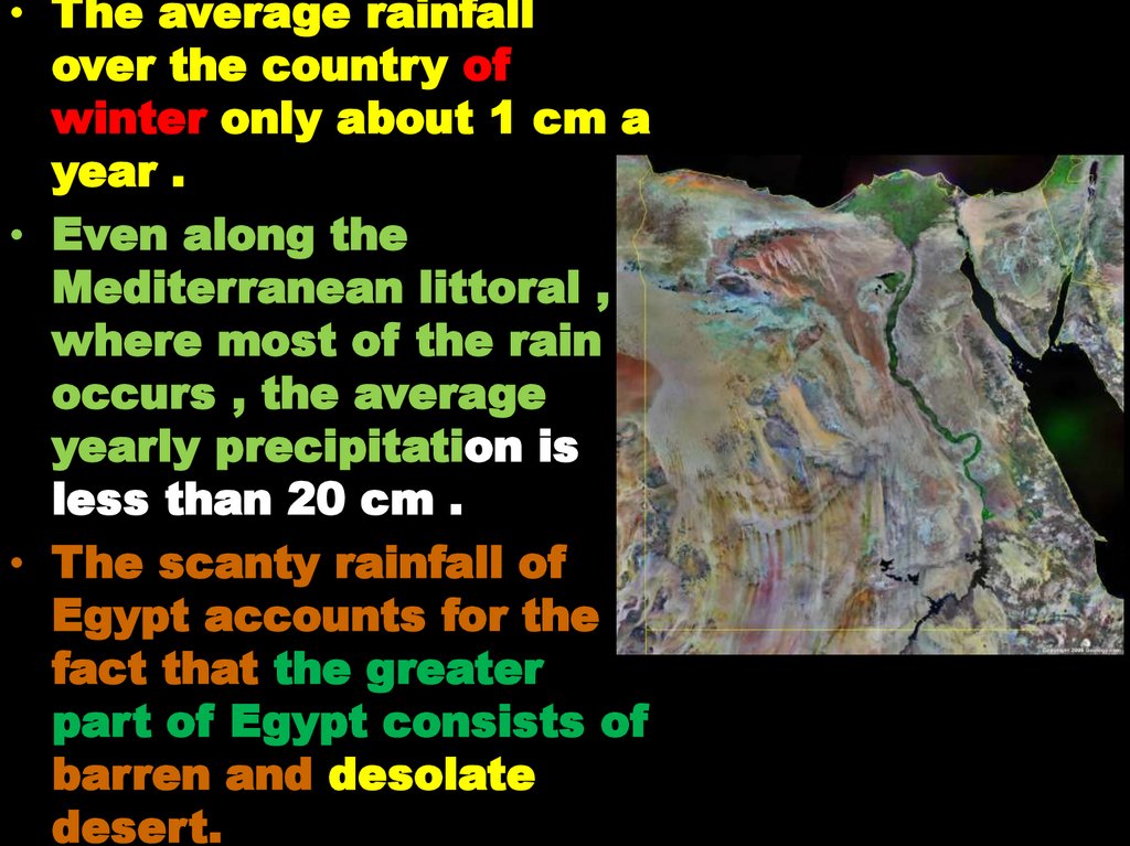
• The average rainfallover the country of
winter only about 1 cm a
year .
• Even along the
Mediterranean littoral ,
where most of the rain
occurs , the average
yearly precipitation is
less than 20 cm .
• The scanty rainfall of
Egypt accounts for the
fact that the greater
part of Egypt consists of
barren and desolate
desert.
19.
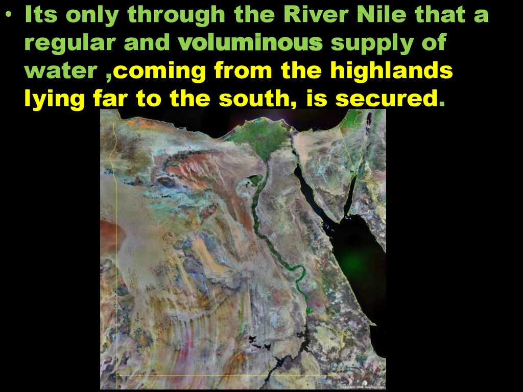
• Its only through the River Nile that aregular and voluminous supply of
water ,coming from the highlands
lying far to the south, is secured.
20.
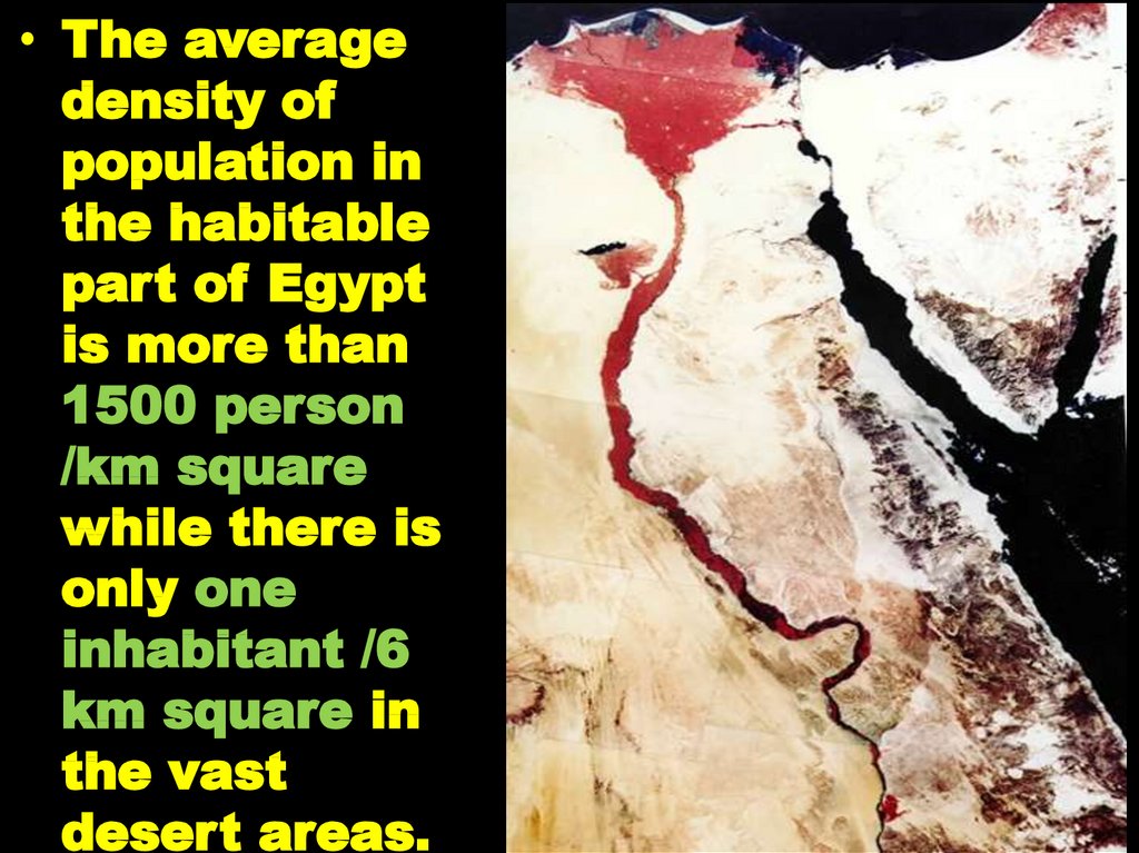
• The averagedensity of
population in
the habitable
part of Egypt
is more than
1500 person
/km square
while there is
only one
inhabitant /6
km square in
the vast
desert areas.
21.
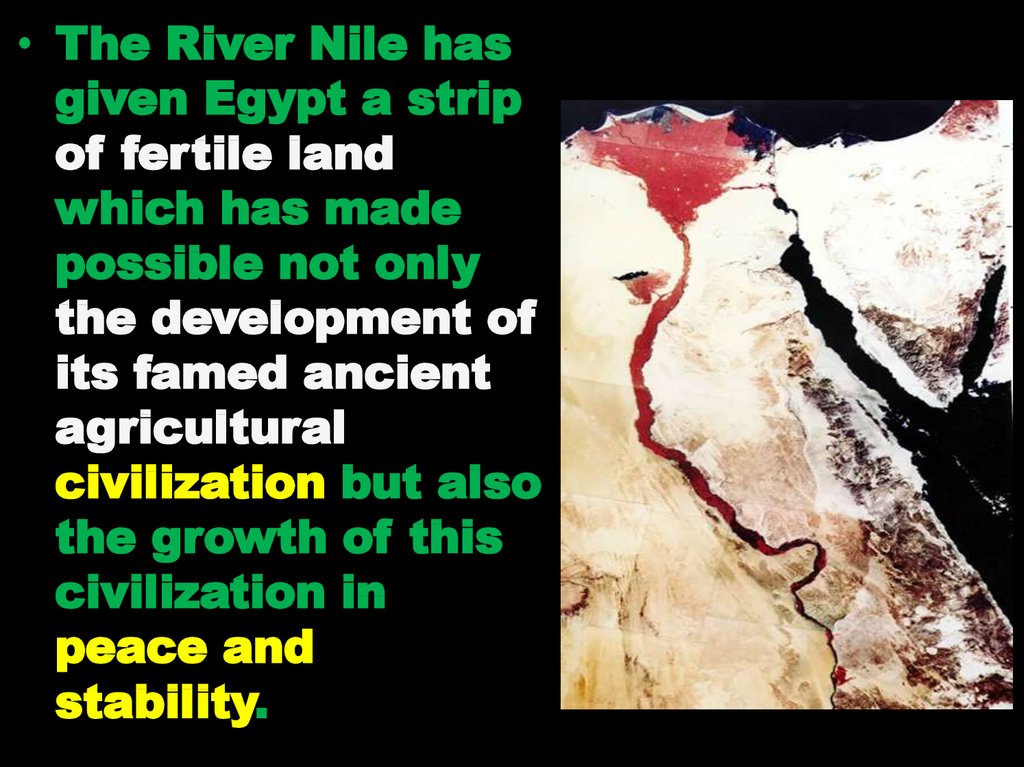
• The River Nile hasgiven Egypt a strip
of fertile land
which has made
possible not only
the development of
its famed ancient
agricultural
civilization but also
the growth of this
civilization in
peace and
stability.
22. NILE RIVER
• The statement “ TheNile is the gift of Egypt”
is true, since the Nile
gave and gives Egypt
not only fresh water for
living beings, but also
its old civilization and
agriculture.
• As a matter of fact,
without the Nile, Egypt
is a desert, as a
country.
23.
• The River Nile isconsidered a
conspicuous
geomorphologic
phenomena in Egypt.
• The River Nile
subdivided Egypt
into two distinct
morphological
region (The Western
Desert and the
Eastern Desert).
24.
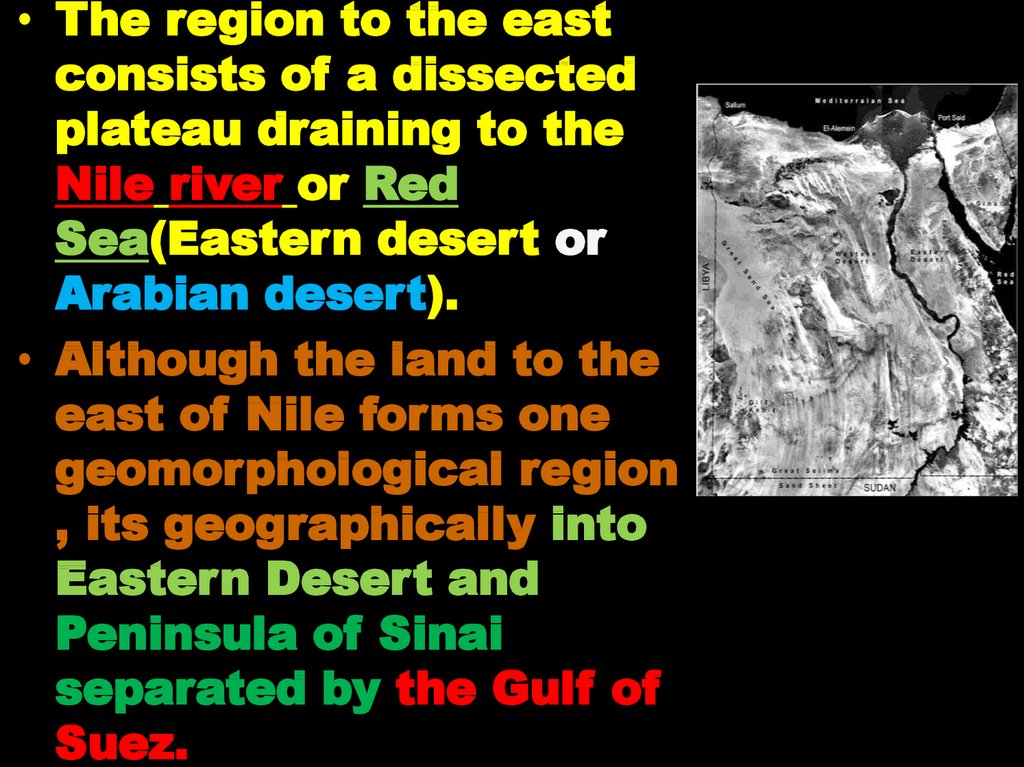
• The region to the eastconsists of a dissected
plateau draining to the
Nile river or Red
Sea(Eastern desert or
Arabian desert).
• Although the land to the
east of Nile forms one
geomorphological region
, its geographically into
Eastern Desert and
Peninsula of Sinai
separated by the Gulf of
Suez.
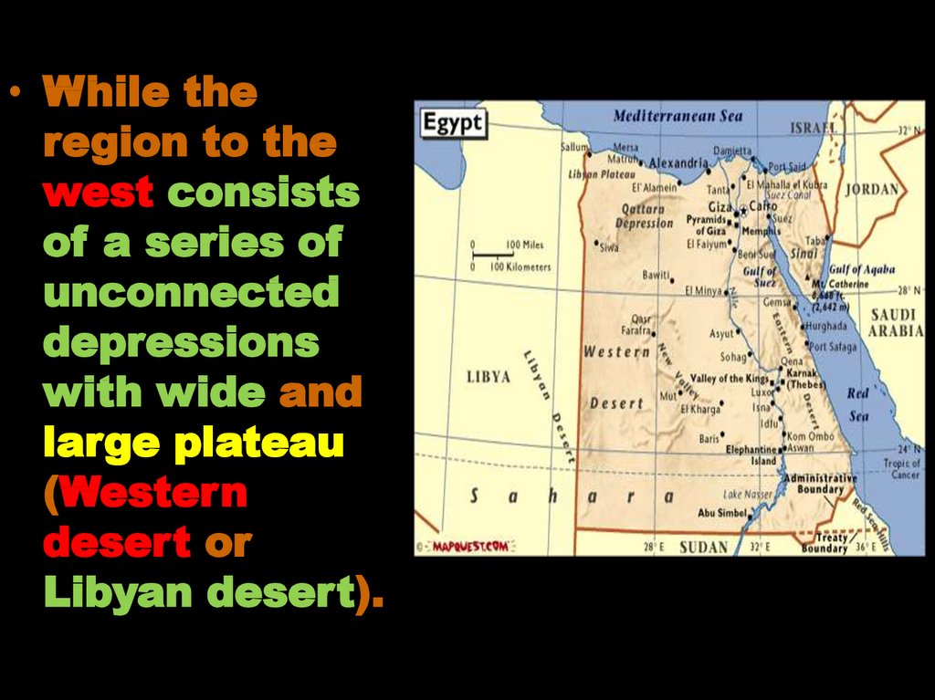
25.
• While theregion to the
west consists
of a series of
unconnected
depressions
with wide and
large plateau
(Western
desert or
Libyan desert).
26.
• The table - land between kharga Oasisand the Nile is in continuation with
Maasa plateau of the Eastern Desert.
27. Review
• Egypt forms the northeasterncorner of Africa and occupies
nearly 1/30th of the total area of
Africa.
• Total area 1.000,000 km², the
greatest N-S length: 1073 km, and
the greatest E-W breadth 1226
km.
• Egypt lies within the great desert
belt: the Sahara, i.e. of warm and
almost rainless climate.
28. Review
• Max. Summer temp. over 40ºC andmin. Winter temp. 0ºC.
• Average rainfall 1cm/y, along the
Mediter. coast >20 cm/y.
• The Nile is the most important
geomorphologic feature in Egypt.
It occupies 3% of the total
Egyptian area.
• Population on the Nile strip >
1500 person/km², population on
desert one person/ 6 km².
29. GEOMORPHOLOGICAL FEATURES OF EGYPT
30. Objectives
Baseof
geomorphological
classification
Main
units
Geomorphological
31. Base of geomorphological classification
The River Nile isconsidered a
conspicuous
geomorphologic
phenomena in
Egypt.
The River Nile
divided the desert
Land of Egypt into
two divisions: The
Western Desert
and the Eastern
Desert.
32. GEOMORPHOLOGICAL FEATURES OF EGYPT
Geomorphologically ( physiographyically)Egypt is classified into major super
geomorphic units:
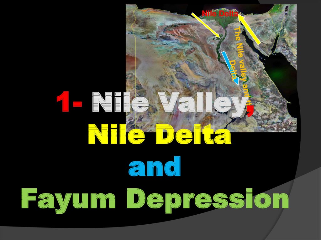
1- The Nile valley and the Delta.
2- The Western ( Libyian ) Desert.
3- The Eastern ( Arabian ) Desert.
4-The Sinai Peninsula.
Each of super unit above can
be geomorphologically
divided into small units .
33.
Nile Delta.1- Nile Valley,
Nile Delta
and
Fayum Depression
34.
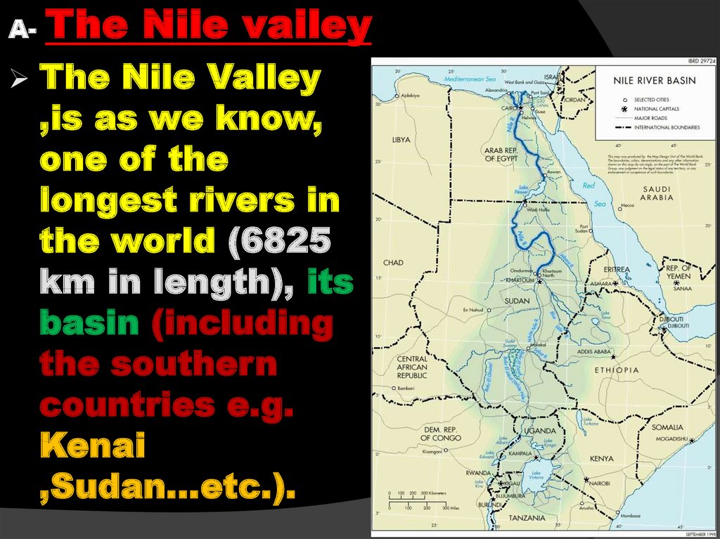
A-The Nile valley
The Nile Valley
,is as we know,
one of the
longest rivers in
the world (6825
km in length), its
basin (including
the southern
countries e.g.
Kenai
,Sudan…etc.).
35.
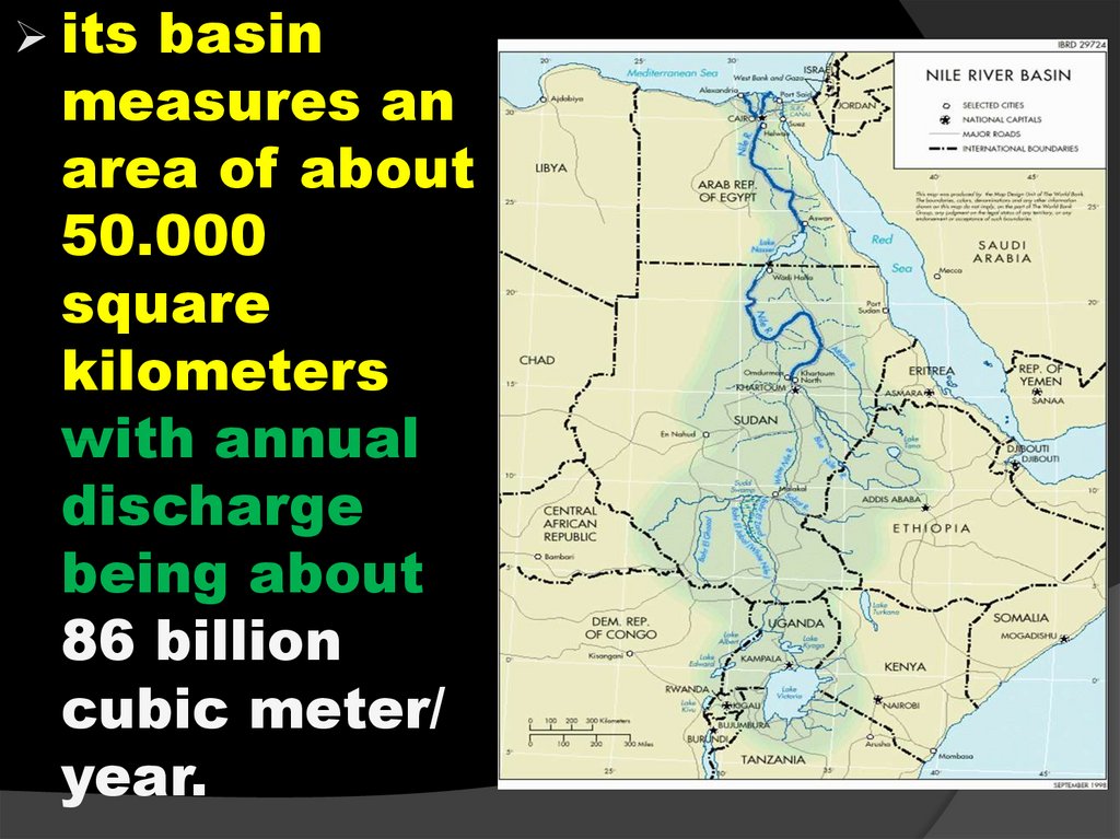
itsbasin
measures an
area of about
50.000
square
kilometers
with annual
discharge
being about
86 billion
cubic meter/
year.
36.
The Nile entersEgypt at Adindan
Village in Wadi Halfa
(at Egyptian Sudanese border),
and flows northward
without receiving
any tributaries until
debauching its load
in the Mediterranean
via Rossetta and
Damietta branches.
37.
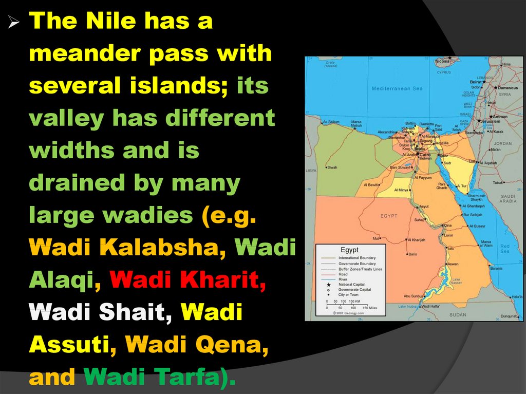
The Nile has ameander pass with
several islands; its
valley has different
widths and is
drained by many
large wadies (e.g.
Wadi Kalabsha, Wadi
Alaqi, Wadi Kharit,
Wadi Shait, Wadi
Assuti, Wadi Qena,
and Wadi Tarfa).
38.
The Nile valley andDelta occupy the
alluvial tract a long
1,350 km of the River
Nile .
These lie within the
border of Egypt.
Along this course no
tributary joins the Nile.
The valley is
embanked with
different rocks from
place to another.
39.
40. NILE VALLEY & DELTA
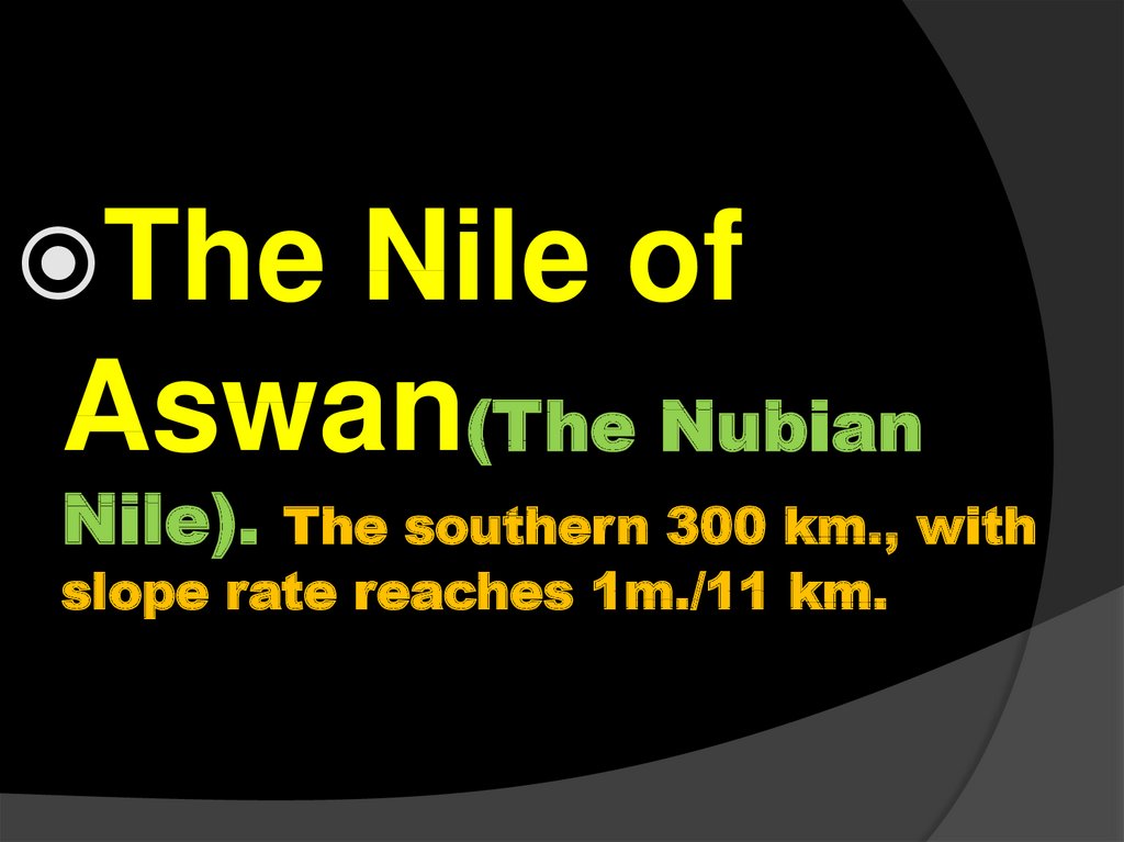
NILE VALLEY & DELTAThe
Nile of Aswan or The
Nubian Nile(the southern 300 km., with
slope rate reaches 1m./11 km).
The
Nile Aswan – Cairo
(940
km, little slope rate, passes through the Nubian
Sandstone till Qena bent, then through Limestone till
.
The Delta and Fayum
depression
Cairo )
41.
42.
TheNile of
Aswan(The Nubian
Nile).
The southern 300 km., with
slope rate reaches 1m./11 km.
43.
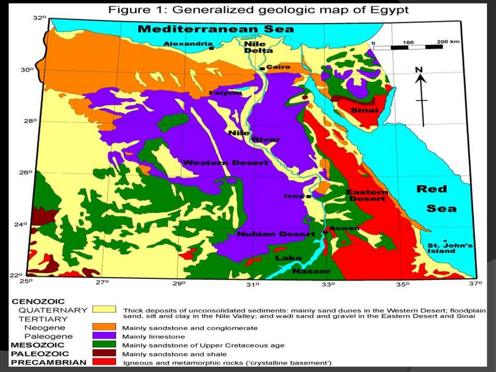
A- TheNile valley
After entering Egypt at
Adindan village in Wadi
Halfa, it passes for more
than 300 km throw a
narrow valley surrounded
by cliffs of the Cretaceous
sandstone and shale
rocks of the Nubia Group
and granite on both its
east and west sides until
it reaches the First
cataract which
commences about 7 km
south of Aswan.
44.
A- TheNile valley
The stretch, between
Adindan (at the
Sudanese – Egyptian
border ) and the cliffs
ordering the High Dam
(Nasser Lake) is
composed of sandstone
and quartzitic
sandstone with minor
shale intercalation
(know as Nubian
sandstone)attain an
elevation at 2oom a.s.l.
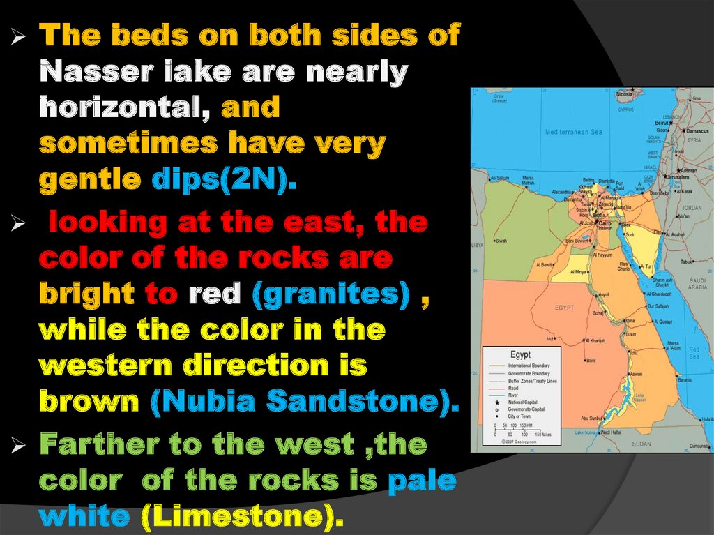
45.
The beds on both sides ofNasser lake are nearly
horizontal, and
sometimes have very
gentle dips(2N).
looking at the east, the
color of the rocks are
bright to red (granites) ,
while the color in the
western direction is
brown (Nubia Sandstone).
Farther to the west ,the
color of the rocks is pale
white (Limestone).
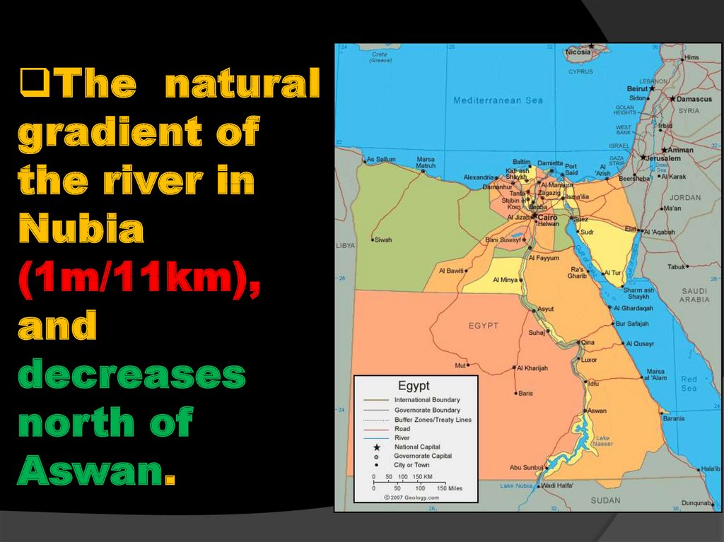
46.
The naturalgradient of
the river in
Nubia
(1m/11km),
and
decreases
north of
Aswan.
47.
The landestrechis dissected by
main wadies
draining in the lake
Nasser from the
east ,Wadi Alaqi
and from the west
Wadi Kalabash and
Wadi Kurkkur
(south of Aswan).
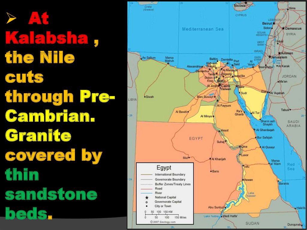
48.
AtKalabsha ,
the Nile
cuts
through PreCambrian.
Granite
covered by
thin
sandstone
beds.
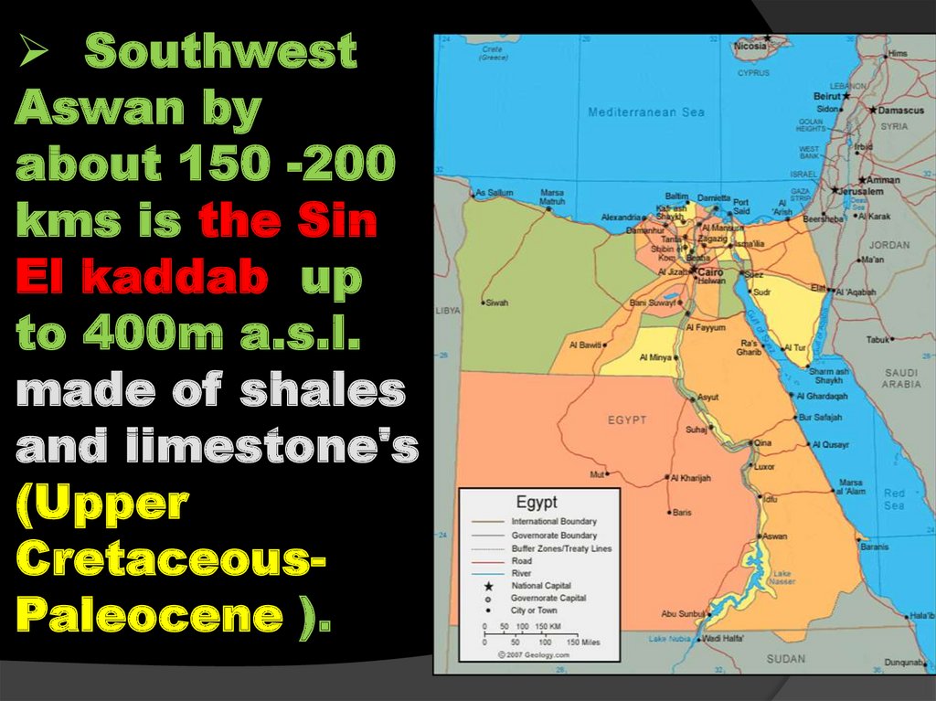
49.
SouthwestAswan by
about 150 -200
kms is the Sin
El kaddab up
to 400m a.s.l.
made of shales
and limestone's
(Upper
CretaceousPaleocene ).
50. Review (The Nubian Nile)
300km from Wadi Halfa to the
1st Cataract to the south of
Aswan.
Narrow valley, surrounded by
sandstone and granite cliffs from
both sides, now covered by Lake
Naser, one of the largest
artificial lakes in the world.
Gradient in Nubia: 1m/ 11km,
and decreases north of Aswan.
51.
TheNile
Aswan – Cairo
52.
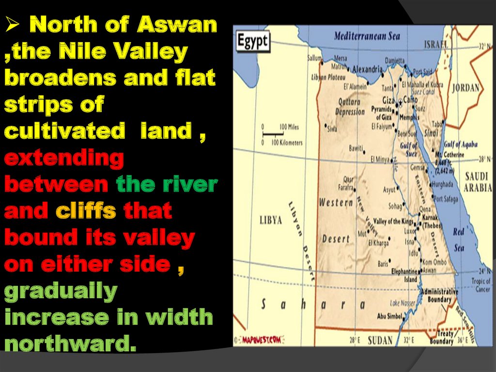
North of Aswan,the Nile Valley
broadens and flat
strips of
cultivated land ,
extending
between the river
and cliffs that
bound its valley
on either side ,
gradually
increase in width
northward.
53.
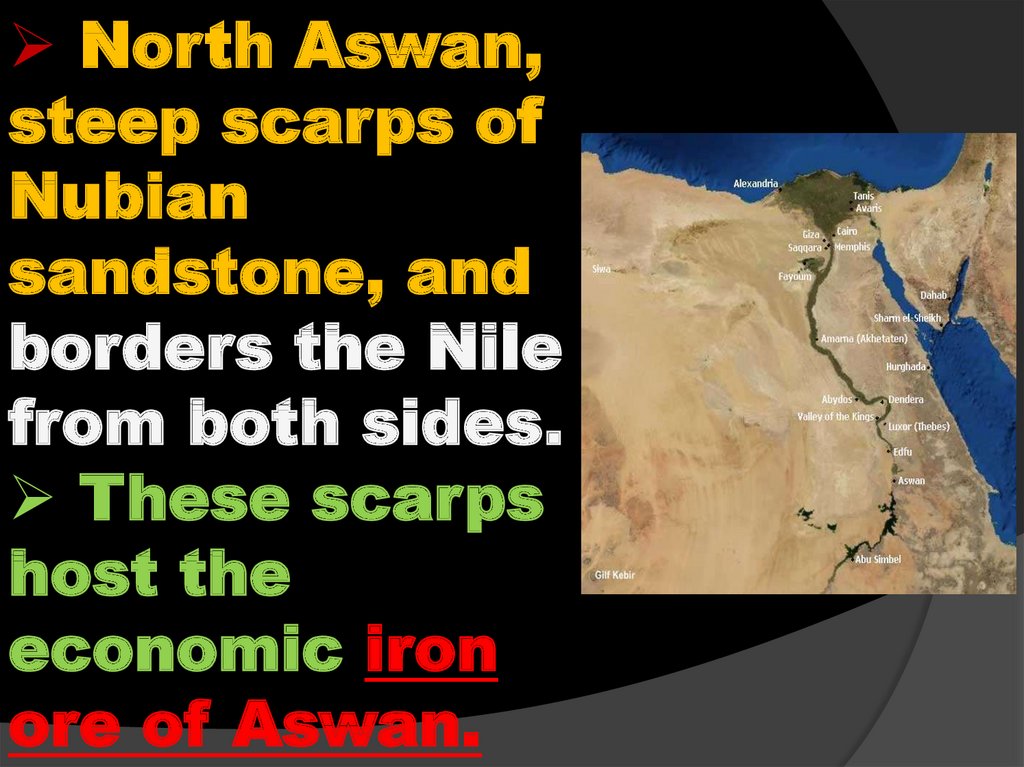
North Aswan,steep scarps of
Nubian
sandstone, and
borders the Nile
from both sides.
These scarps
host the
economic iron
ore of Aswan.
54.
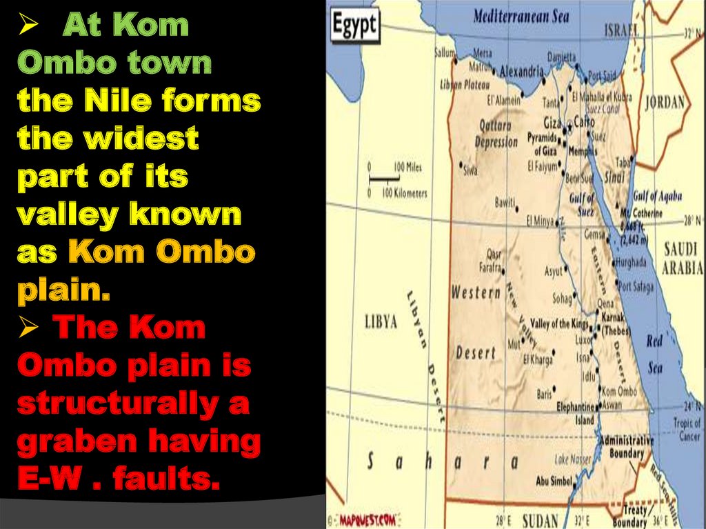
At KomOmbo town
the Nile forms
the widest
part of its
valley known
as Kom Ombo
plain.
The Kom
Ombo plain is
structurally a
graben having
E-W . faults.
55.
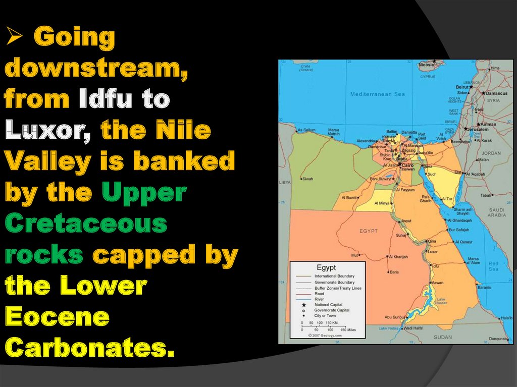
Goingdownstream,
from Idfu to
Luxor, the Nile
Valley is banked
by the Upper
Cretaceous
rocks capped by
the Lower
Eocene
Carbonates.
56.
At thatstretch is
located the
Phosphate
deposits of
the Nile
Valley (at El
Mahamid
village
57.
At Qena about 120 km north ofEsna, the river makes a great bend
bounded by limestone cliffs rising
to heights of more 3000m.
58.
From Nag Hammadi to Assiut citythe Eastern side of the Nile Valley is
borderd by high plateaux , hills ,and
hilloks of Eocene limestone north
Manfalout , these Eocene cliffs (Middle
Eocene) extend north.
59.
– wards toCairo for
example the
thick sequence
of Helwane,
Tura , and G.El
Mokattam
which overlook
Cairo.
60. REVIEW
940km, with gradient less than 1m/
11km.
From
Aswan to Esna (160 km)
surrounded by sandstone cliffs of
Nubia Formation.
To
the north of Esna by limestone
cliffs (Tertiary: Paleocene-Eocene).
The
limestone cliffs reach their max.
height at Assiut (300 m).
61. REVIEW
Theeastern cliff is always higher
than the western one and the age of
the cliffs becomes younger
northward.
The
average alluvial breadth is 10 km
and the average river breadth 0.75
km.
The
Nile tends to occupy the eastern
side of its valley
62. REVIEW
Isolated blocks of granites obstructthe Nile course forming cataracts (e.g.
Aswan cataract)
North Aswan, steep scarps of Nubian
sandstone rise which borders the Nile
from both sides. These scarps host the
economic iron ore of Aswan.
At Kom Ombo town (N. of Aswan) the
Nubian sandstone cliffs ,where the Nile
forms the widest part of its valley
known as Kom Ombo plain.
63. REVIEW
FromIdfu to Luxor, the Nile Valley is
banked by the Upper Cretaceous
rocks capped by the Lower Eocene
Carbonates.
At
Qena, the Nile forms its famous
bend (Qena bend), and from there to
Cairo, it is bordered from both sides
by the Eocene carbonates, which
build the Mokattam and Giza Pyramid
plateaus overlooking Cairo.
64.
B-TheDelta and
Fayum depression
65.
The Latitudeand Longitude of
CAIRO are 30
degree N and 31
degree E
respectively.
66. B-The Nile Delta
67. B.The Nile Delta
After passingCairo, the Nile
pursues a northwest
direction for about
20 km and then
divided into two
branches , each of
which meanders
separately through
the delta to the sea.
68.
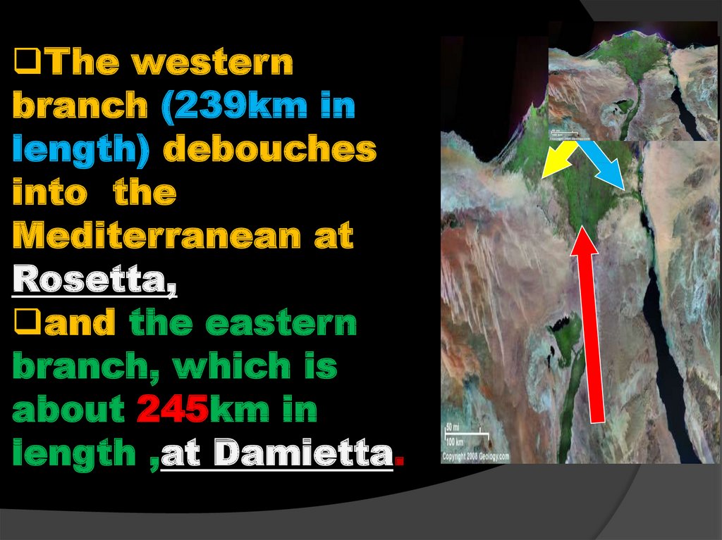
The westernbranch (239km in
length) debouches
into the
Mediterranean at
Rosetta,
and the eastern
branch, which is
about 245km in
length ,at Damietta.
69.
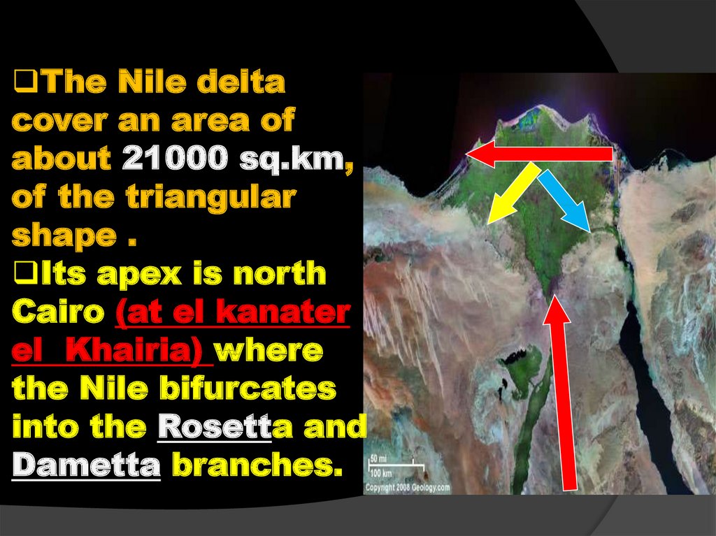
The Nile deltacover an area of
about 21000 sq.km,
of the triangular
shape .
Its apex is north
Cairo (at el kanater
el Khairia) where
the Nile bifurcates
into the Rosetta and
Dametta branches.
70.
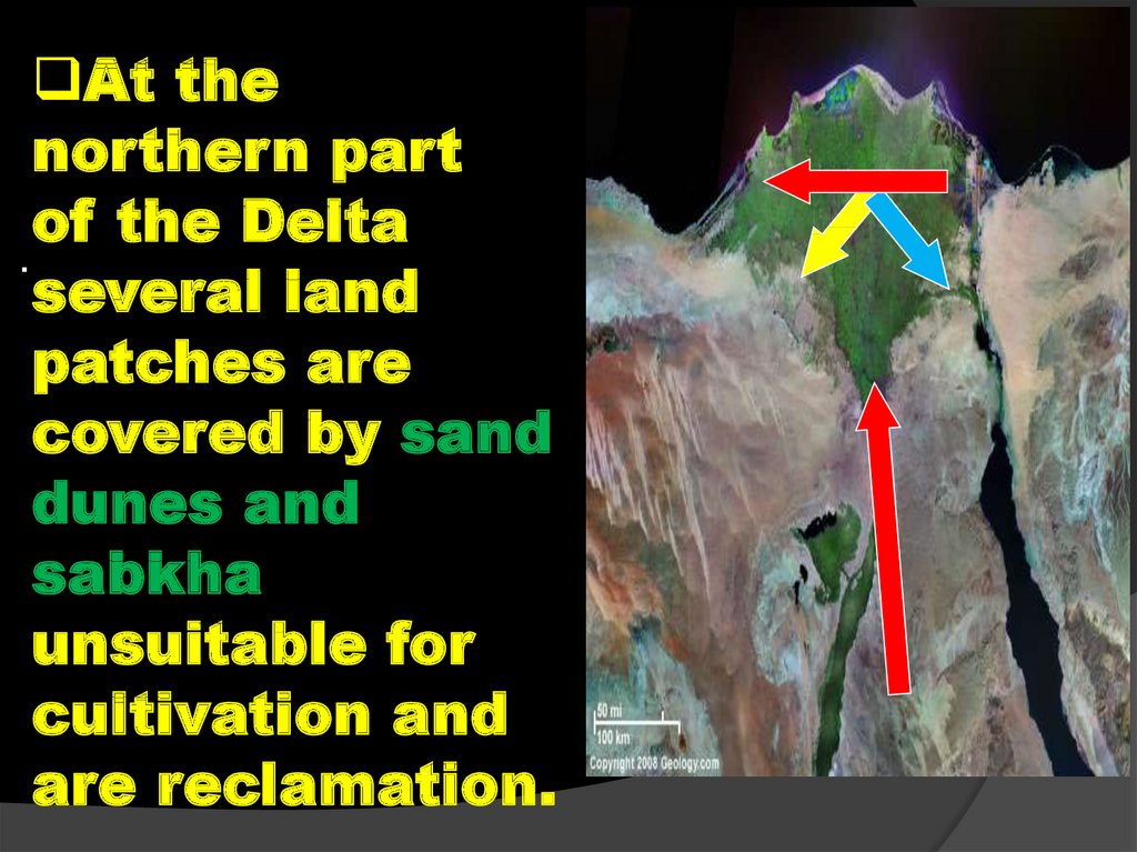
At thenorthern part
of the Delta
.
several land
patches are
covered by sand
dunes and
sabkha
unsuitable for
cultivation and
are reclamation.
71. REVIEW
Itbegins 20 km to the north of Cairo.
The
Nile Delta covers a triangular
area of about 21.000 sq. Km; its apex
is at north of Cairo (at El Kanater El
Khairia) where the Nile bifurcates
into Rosetta and Damietta branches.
These branches are the remnant of
pre-existing six branches that
crossed the Delta with the beginning
of the Holocene and in historic times.
72. REVIEW
Thefamous old branch is the
Pellusia branch that drained its
load in Lake Manzala and in the
Mediterranean Sea.
Rosetta
branch 239 km, of
northwest direction.
Damietta
branch 245 km, of
northeast direction.
73. C-The Fayum and Wadi Rayan Depressions
C-The Fayum andWadi
Rayan
.
Depressions
74. C.1-The Fayum Depression
Closelyconnected
with
.
the River Nile is
the Fayum
depression which
lies at a little
distance to the
west of the Nile
Valley
The Fayum Depression
75. The Fayum Depression
The Fayum and WadiRayan depression are
dealt with the Nile
.
Valley and Delta
geomorphic unit,
because they are close
to the Nile Valley.
The Fayum
Depression is
connected with the Nile
by the water channel
"Bahr Youssif"..
76. Birket Qarun.
The lowest part of thedepression is occupied
by a shallow brackish
lack called Birket
Qarun.
Birket Qarun
occupies its northern
part, and is delimited
from the north by an
elongate scarp of Gabal
Qatrani .
Birket Qarun is about
-45m below sea level
and about 200 km.sq.
77. C.2-Wad Rayan Depressions
Due to the south of fayumdepression lies Wadi El
Rayan depression over
-60m. Below the level .
Now, it is connected with
the Fayum depression by
subsurface canal in order to
get rid of the drainage
water of the cultivated
lands of the Fayum instead
of drain this water into
Birket Qarun.
The Fayum Depression
78. REVIEW
TheFaytum and Rayan depression
are dealt with the Nile Valley and
Delta geomorphic unit because they
are close to the Nile Valley, and the
Fayum is connected with the Nile by
the water channel "Bahr Youssif".
79. REVIEW
The Fayum depression has a total area ofabout 1700 sq. km.
Birket Qarun (-45 m, below sea level)
occupies its northern part, and is delimited
from the north by an elongate scarp of
Gabal Qatrani . Qarun, is brackish water,
and covered 200 km².
The Lake Qarun occupied much area in old
times (pre-historic) proved by the presence
of old raised beaches containing relics of
ancient man (implements), and was known
as Lake "Moeris".
80. REVIEW
Dueto the south of Fayum
depression lies Wadi El Rayan
depression being over -60 m below
sea level.
Now,
it is connected with the Fayum
depression by subsurface canal in
order to get rid of the drainage water
of the cultivated lands of the Fayum
instead of drain this water into Birket
Qarun.