
 История
Похожие презентации:


 1811-1917")


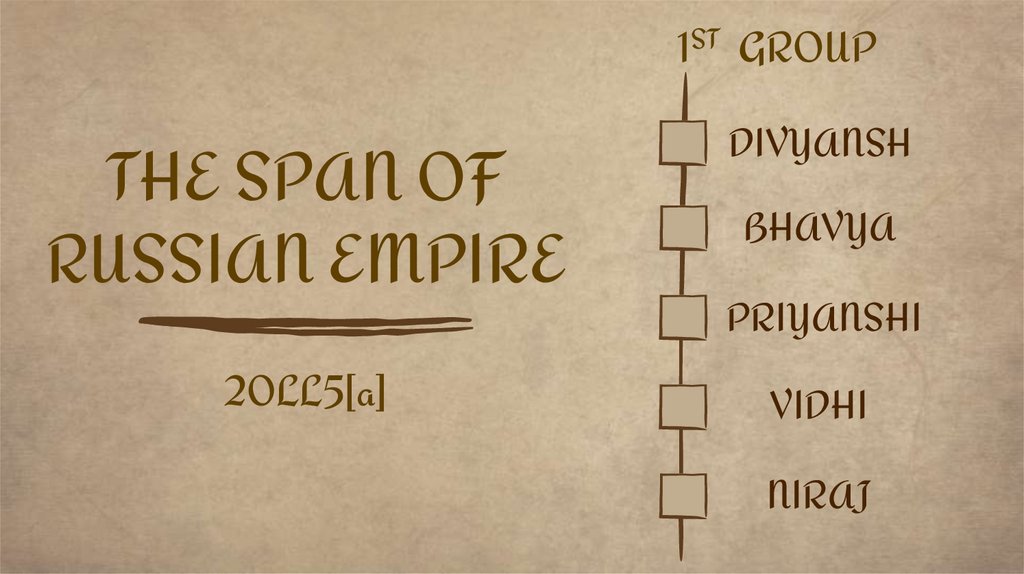
The span of russian empire
1.
1ST GROUPTHE SPAN OF
RUSSIAN EMPIRE
20LL5[a]
DIVYANSH
BHAVYA
PRIYANSHI
VIDHI
NIRAJ
2.
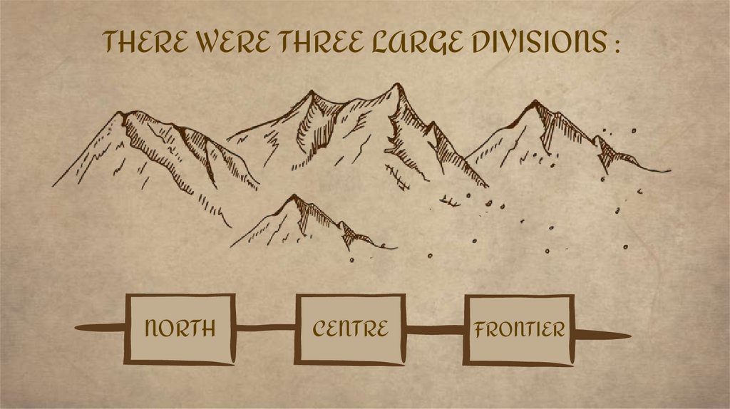
THERE WERE THREE LARGE DIVISIONS :NORTH
CENTRE
FRONTIER
3.
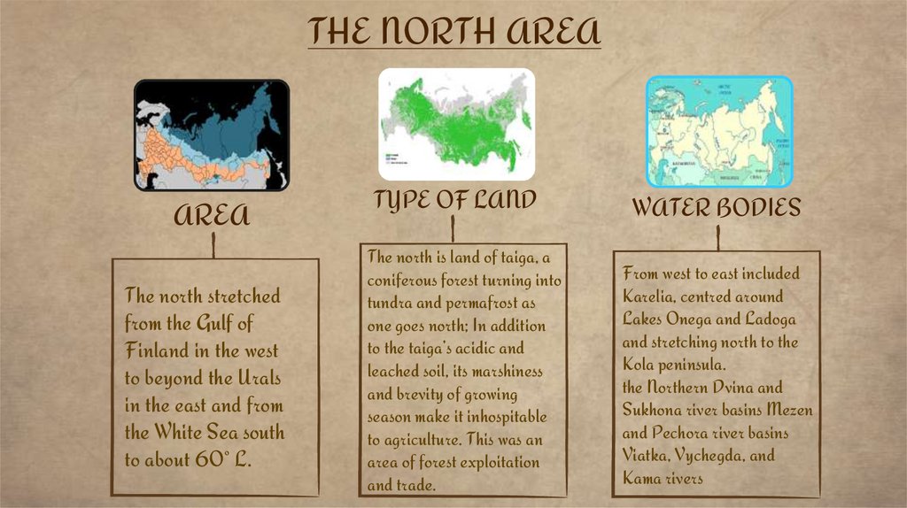
THE NORTH AREAAREA
The north stretched
from the Gulf of
Finland in the west
to beyond the Urals
in the east and from
the White Sea south
to about 60° L.
TYPE OF LAND
The north is land of taiga, a
coniferous forest turning into
tundra and permafrost as
one goes north; In addition
to the taiga’s acidic and
leached soil, its marshiness
and brevity of growing
season make it inhospitable
to agriculture. This was an
area of forest exploitation
and trade.
WATER BODIES
From west to east included
Karelia, centred around
Lakes Onega and Ladoga
and stretching north to the
Kola peninsula.
the Northern Dvina and
Sukhona river basins Mezen
and Pechora river basins
Viatka, Vychegda, and
Kama rivers
4.
INGIGENOUS POPULATIONURALIC LANGUAGE FAMILY
• Christianity came with Russian
settlement but made few inroads
among non East Slavs
throughout this time. In the
tundra band lived nomadic
reindeer herdsmen, fishermen,
and hunters.
• The Finno Ugric Lapps in
Karelia and east of them the
Nentsy who speak a Samoedic
Uralic language.
5.
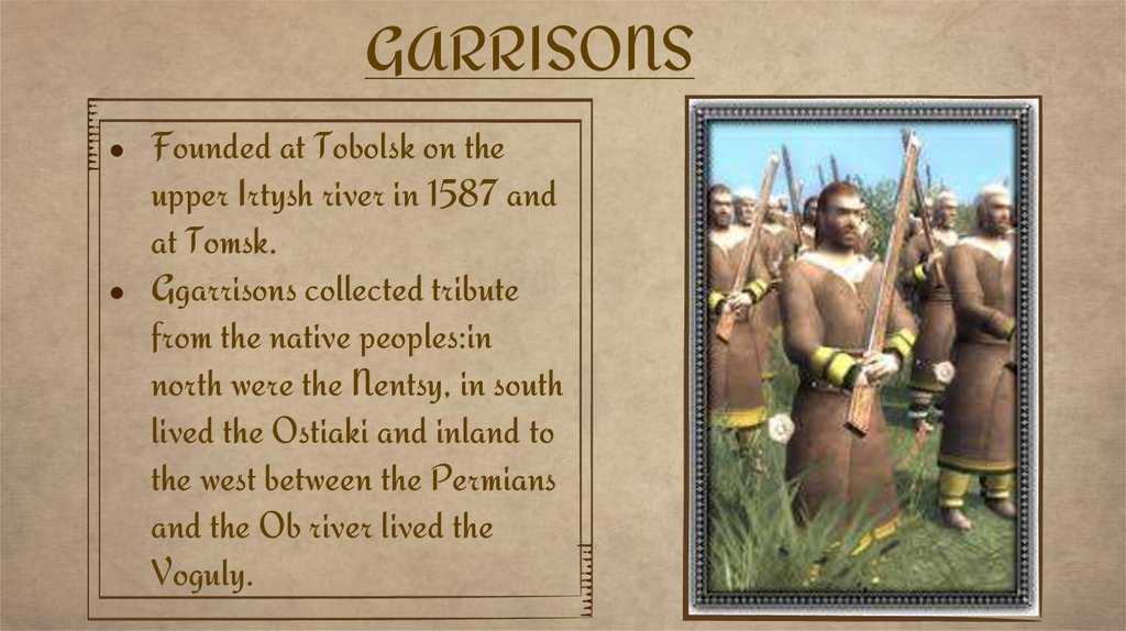
GARRISONSFounded at Tobolsk on the
upper Irtysh river in 1587 and
at Tomsk.
Ggarrisons collected tribute
from the native peoples:in
north were the Nentsy, in south
lived the Ostiaki and inland to
the west between the Permians
and the Ob river lived the
Voguly.
6.
Community of Northern Region• Since Novgorodian times the dominant social and political organization among
East Slavs and the Finno-Ugric population in the taiga lands from Karelia to Perm
was the commune (mir, volost ), composed of contemporary sources called ‘black’ or
taxed peasants.
• Northern communes differed from the 19th century Russian peasant commune
where land and labour were collectively shared. the term ‘peasant’ particularly was
inappropriate for this populace. Because members of this communes were not
primarily farmers, but were fishers, traders, artisans, etc.
7.
DEVELOPMENT• Straddling the border between the north and the centre were the Novgorod and Pskov
lands to the north-west and the Beloozero and Vologda area north of Moscow. The
north-west, including Novgorod and Pskov remained a centre of Baltic trade in the
16th century.
• The Beloozero and Vologda areas lay on active trade routes to the White Sea and
were productive centres for fish, salt, and furs. In these various lands the Russian
population outnumbered Finno-Ugric speakers by the end of the century.
• the Beloozero and Vologda areas became, from the mid-fifteenth century, magnets of
energetic monastic colonization.
8.
DEVELOPMENT• Monasteries such as the St Cyril and Ferapontov monasteries near Beloozero, the
Spaso-Prilutskii in Vologda, and the Solovetskii Monastery on the White Sea–expanded by
taking over settled peasant lands and in the course of the 16th century became major local political
and economic powers.
• Although part of the Muscovite realm from the late 1400s, the north and north-west remained
distinct as regions. When Moscow adopted at mid-century a new tax unit for arable land (the
large sokha ), for example, these areas retained the smaller, Novgorodian unit of measure.
9.
THE CENTER• The centre or ’Moscow region’in contemporary sources ,differenciated from the north and southern
borderlands by its relative ethnic homogeneity .
• By the early 16th century ,the centre stretched from beloozero and Volagda in the north to oka river and
riazan lands in the south,its western bounds were the upper Volga tver lands.
• Its eastern ones lay just beyond the lower oka and its confluence with the Volga at nizhnii Novgorod.
• An extention of Europe plain that begins at the atlantic,the region has a mixed deciduous coniferous forest.
• The winters are long and cold (January mean temperature is -10.3degree c or 13.5 degree f).
• The populace supplemented its diet with food from the forests and income from Artician work.
• The growing season commensurately short ;because the soil is not particularly fertile ,save for a triangle of
loess north west of Vladimir ,yields were at subsistence level.
10.
Social Structure Of Russian Empire In 16th CenturyThe social structure in the centre was more complex than in the north.
Settlement here was almost uniformly east Slavic ,the indigenous finno ugric peoples having been
assimilated by 16th century.
Most of The populance,whether urban or rural,was taxed.
Peasants lived in small hamets and particised cultivation systems ranging from primitive slash burn
to three field rotations. Depending upon population density and other factors.
In 1450 most peasants were still free of landlord control.,but by the end of 16th century virtually
all of these ‘black’peasants had been distributed to private landlords.
The non taxpaying landholding strata were either military or eccilesiastical.the clerical populance
was divided into black and white clergy.
11.
Church Landholding During 16th Century• Church landholding increased at a phenomenal rate
after 1450; particularly in the turbulent 1560s-70s
landlords donated land in large amounts to monasteries
,despite repeated legislation prohibiting such gifts.
• Secular landholders were all obliged to serve the Moscow
grand prince as a part of a cavalry army.
• A few select families lived in Moscow and enjoyed
hereditary privileges to a boyars, that is, counsellars of
the grand prince.
• The landholding elite was not a corporate estate with
judicial protection ,but it did enjoy freedom from taxation
,an almost claim to landownership and high status .
12.
Span of Russian Empire During The 2nd half of 16th Century• Social group developed, primarily in the centre.
• Most secretaries came from lesser cavalry ranks.
• Situated socially between taxed &nontaxed populations were noncavalry army
units & People who did not fit in those who refused to be caugh in webs of
landlord’ contral.
• Most remarkable fact that centre was its juridical diversity.
• Much of land was exempt from grand prince’s government &taxation,a
situation that rulers not only tolerated but used to their advantage.
13.
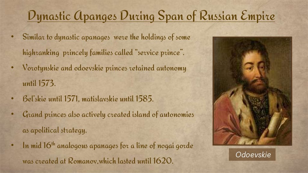
Dynastic Apanges During Span of Russian Empire• Similar to dynastic apanages were the holdings of some
highranking princely families called “service prince”.
• Vorotynskie and odoevskie princes retained autonomy
until 1573.
• Bel’skie until 1571, matislavskie until 1585.
• Grand princes also actively created island of autonomies
as apolitical strategy.
• In mid 16th analogous apanages for a line of nogai gorde
was created at Romanov,which lasted until 1620.
Odoevskie
14.
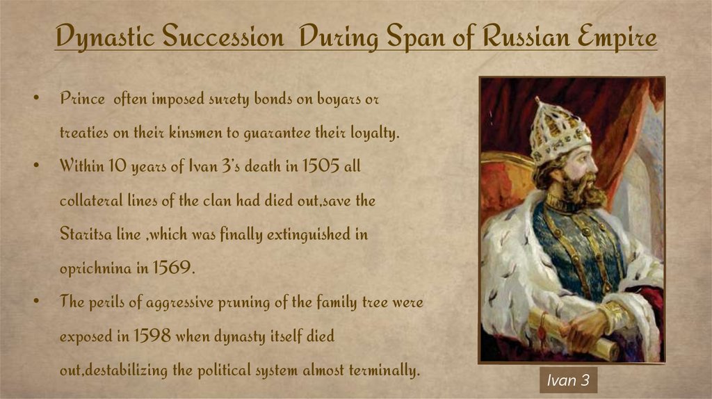
Dynastic Succession During Span of Russian EmpirePrince often imposed surety bonds on boyars or
treaties on their kinsmen to guarantee their loyalty.
Within 10 years of Ivan 3’s death in 1505 all
collateral lines of the clan had died out,save the
Staritsa line ,which was finally extinguished in
oprichnina in 1569.
The perils of aggressive pruning of the family tree were
exposed in 1598 when dynasty itself died
out,destabilizing the political system almost terminally.
Ivan 3
15.
THE FRONTIER• As diverse and dynamic as the centre was, even more volatile was the frontier on the
west and south.
• In some ways calling this area the ‘frontier’ to the exclusion of the others is inaccurate.
• The north and centre were also riddled with ‘frontiers’–between Slavs and non-Slavs,
Orthodox and non-Christians, farmers and trappers, Muslims and ‘pagans’.
• All these social interfaces generated tensions, synergies, and cross-cultural
fertilization.
• But in the west and the south the classic meaning of ‘frontier’ as outposts of defence
and conquest applies.
16.
THE FRONTIER• On the west the frontier began with the Novgorod and Pskov lands south of the Gulf of Finland
and extended south to the Smolensk area and south again to the upper Oka river region.
• This relatively narrow north-south strip, located between the sixtieth and fiftieth latitudes,
moved from taiga at the Novgorod end through deciduous-coniferous mixed forest, approaching
steppe in the south.
• These lands flanked the grand duchy of Lithuania and were hotly contested throughout the
century; between 1491 and 1595.
• Muscovy spent a total of fifty years at war on the western front. After the rout of the Livonian
War (1558–82) and the Time of Troubles (1598–1613).
17.
THE FRONTIER• Muscovy yielded lands from Karelia to beyond Smolensk to Sweden (Treaty of Stolbovo,
1617) and the Commonwealth of Poland-Lithuania (Treaty of Deulino, 1618).
• Moscow tolerated administrative and social diversity. For example, when Smolensk was
annexed in 1514.
Vasilii III affirmed by charter the landholding and judicial rights historically granted to the
region by the grand dukes of Lithuania.
• Muscovy fortified a line south of the Oka and at mid-century it conquered Kazan and
Astrakhan (1552, 1556).
• generally east-west line of fortifications pushed steadily southward from the 1550s.
18.
THANKSQuestions?
- The land of tiaga is largely covered by which forest?
- How Beloozero and Vologda areas became magnets of
energetic monastic colonization?
- When did the rate of church landholding increased?
- What was development of 16th century ?
- Where was frontier more volatile?