


 География
Похожие презентации:


The USA: Political and Physical Geography. Lecture 4.1
1.
1. A General Overview of the UnitedStates: some facts about its history,
geography and national emblems.
2. The US Political Geography.
3. The US Physical Geography.
2.
1. When and by whom was the American continentdiscovered?
2. Whom was the American continent named after?
3. How many stars (stripes) are there on the American
continent and what do they represent?
4. What animal is represented on the American coat of
arms?
5. What do you know about the Statue of liberty in the
USA?
6. What 2 American states are separated from the others?
7. What is the largest American state in area (in
population)?
8. What’s the difference between Washington and
Washington, D.C.?
9. Who was New York City founded by?
3.
Christopher Columbus (1451-1506)America was:
originally peopled by
Indians;
opened to European
colonization by
Christopher Columbus in
1492.
Columbus is honoured on
Columbus Day celebrated
on the second Monday of
October.
4.
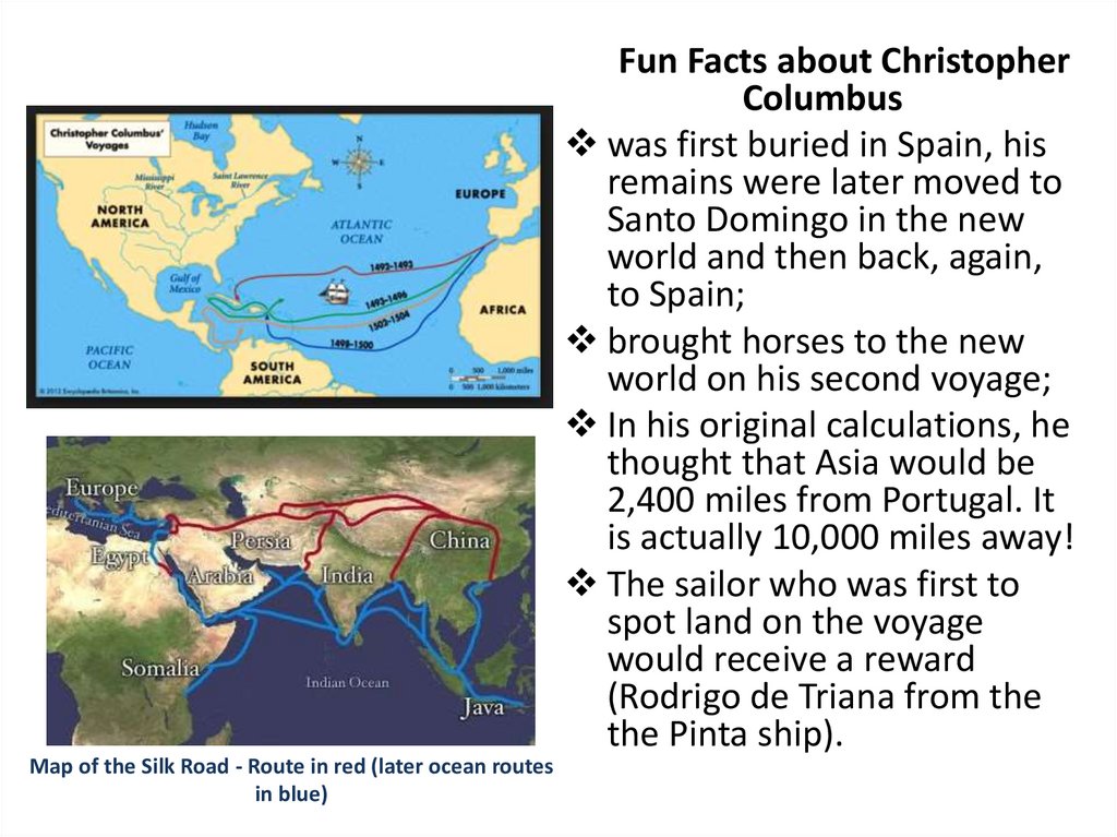
Fun Facts about ChristopherColumbus
was first buried in Spain, his
remains were later moved to
Santo Domingo in the new
world and then back, again,
to Spain;
brought horses to the new
world on his second voyage;
In his original calculations, he
thought that Asia would be
2,400 miles from Portugal. It
is actually 10,000 miles away!
The sailor who was first to
spot land on the voyage
would receive a reward
(Rodrigo de Triana from the
the Pinta ship).
Map of the Silk Road - Route in red (later ocean routes
in blue)
5.
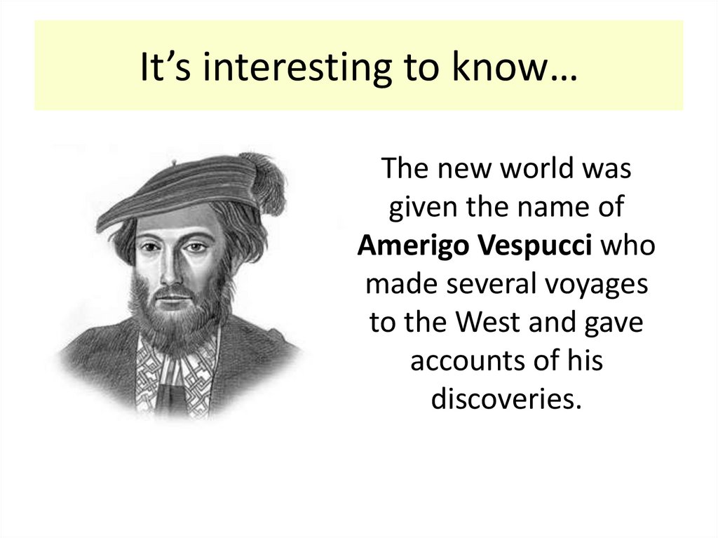
It’s interesting to know…The new world was
given the name of
Amerigo Vespucci who
made several voyages
to the West and gave
accounts of his
discoveries.
6.
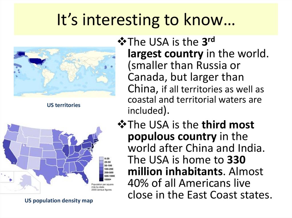
It’s interesting to know…The USA is the 3rd
largest country in the world.
(smaller than Russia or
Canada, but larger than
China, if all territories as well as
US territories
US population density map
coastal and territorial waters are
included).
The USA is the third most
populous country in the
world after China and India.
The USA is home to 330
million inhabitants. Almost
40% of all Americans live
close in the East Coast states.
7.
It’s interesting to know…More than 300 languages are
spoken in the country.
78% of all Americans say
that they speak only
English.
About 13% speak mainly
Spanish.
The USA has no “official”
national language. English is
the most common language
by use, but it is not the
national language by law.
8.
9.
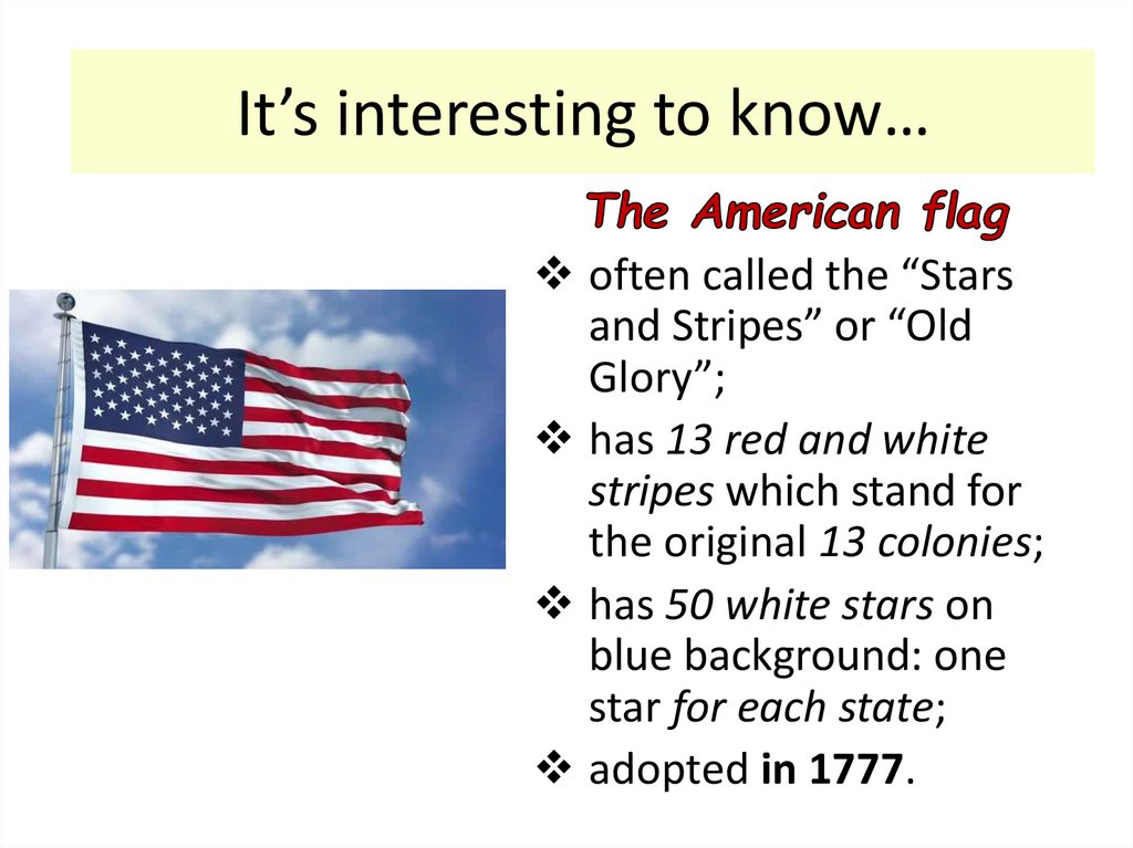
It’s interesting to know…often called the “Stars
and Stripes” or “Old
Glory”;
has 13 red and white
stripes which stand for
the original 13 colonies;
has 50 white stars on
blue background: one
star for each state;
adopted in 1777.
10.
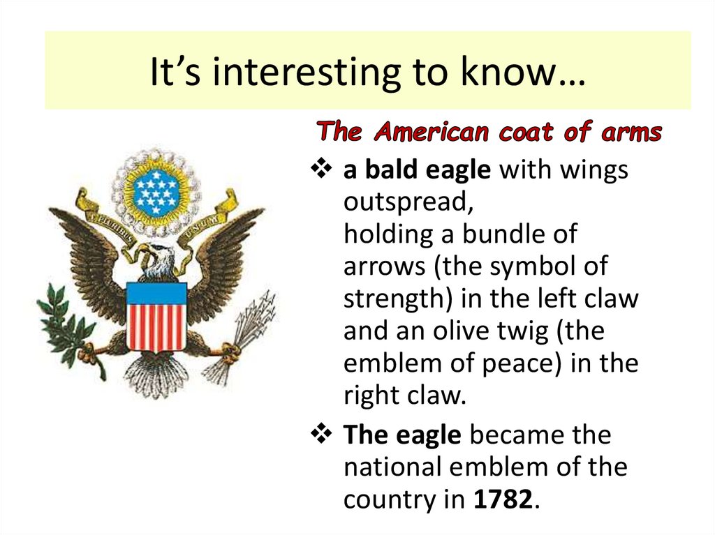
It’s interesting to know…a bald eagle with wings
outspread,
holding a bundle of
arrows (the symbol of
strength) in the left claw
and an olive twig (the
emblem of peace) in the
right claw.
The eagle became the
national emblem of the
country in 1782.
11.
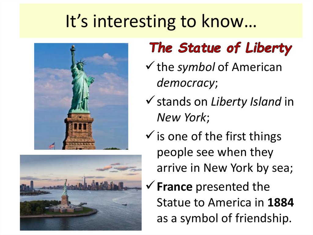
It’s interesting to know…the symbol of American
democracy;
stands on Liberty Island in
New York;
is one of the first things
people see when they
arrive in New York by sea;
France presented the
Statue to America in 1884
as a symbol of friendship.
12.
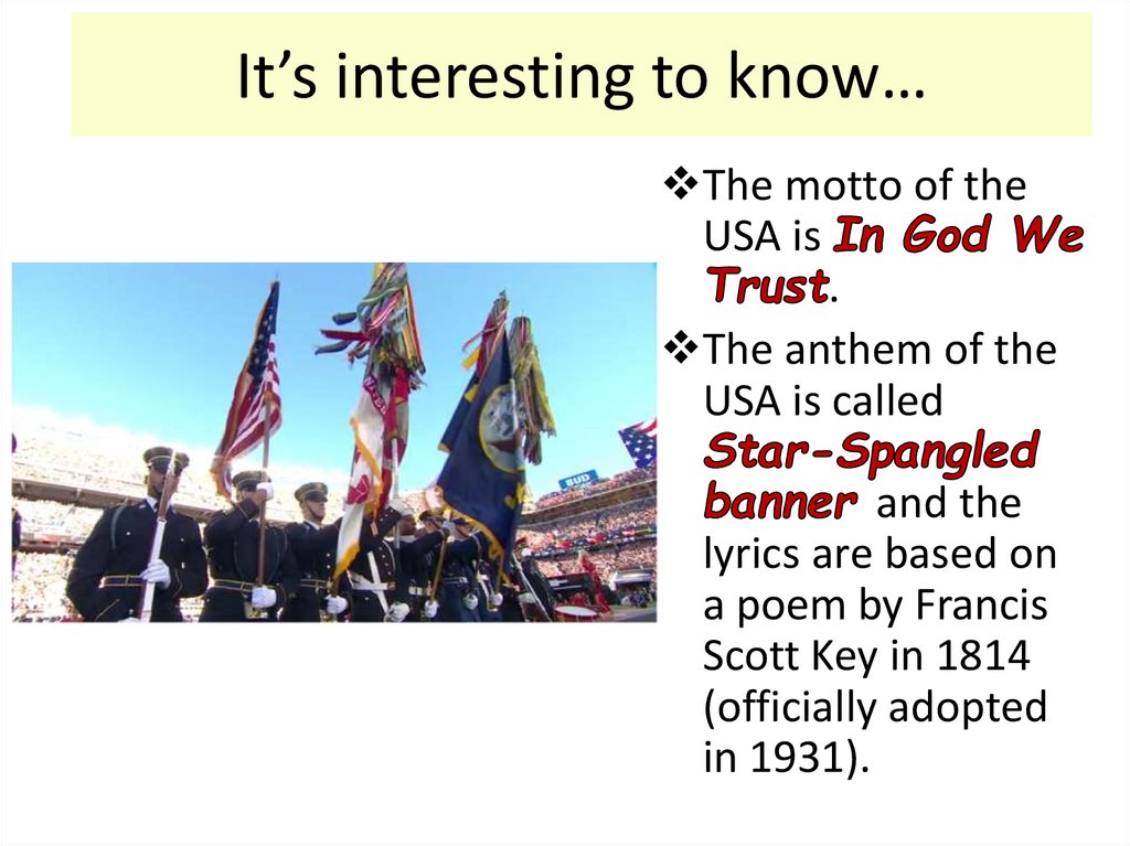
It’s interesting to know…The motto of the
USA is
.
The anthem of the
USA is called
and the
lyrics are based on
a poem by Francis
Scott Key in 1814
(officially adopted
in 1931).
13.
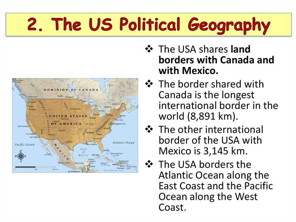
The USA shares landborders with Canada and
with Mexico.
The border shared with
Canada is the longest
international border in the
world (8,891 km).
The other international
border of the USA with
Mexico is 3,145 km.
The USA borders the
Atlantic Ocean along the
East Coast and the Pacific
Ocean along the West
Coast.
14.
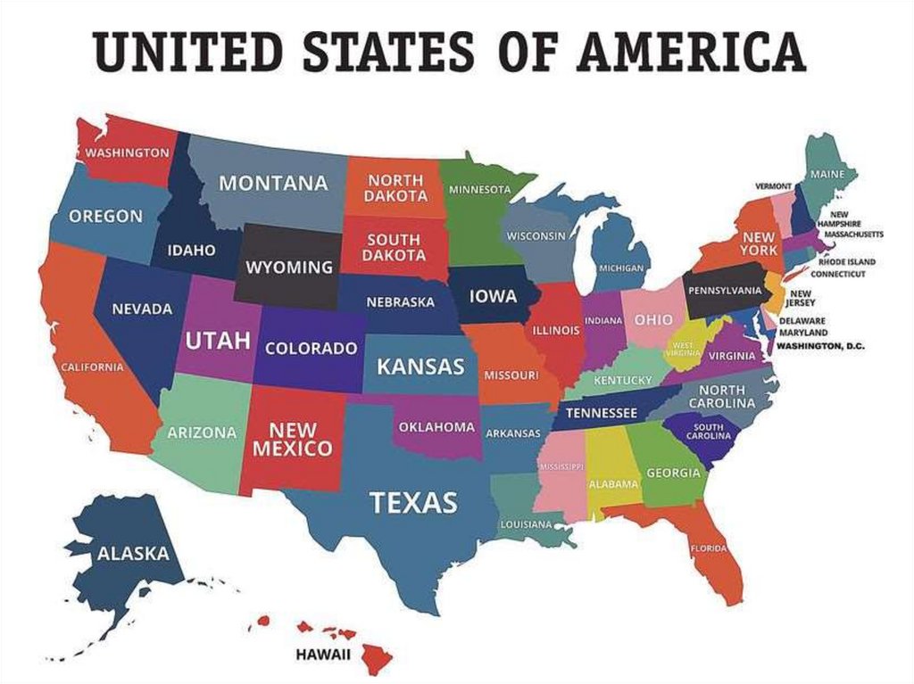
The USA consists of50 states, a federal
district (District of
Columbia) and 14
territories.
Five of the fourteen
territories are
inhabited: Puerto
Rico, Guam,
Northern Mariana
Islands, U.S. Virgin
Islands and
American
Samoa. Puerto Rico
is the biggest and
most populous
territory.
15.
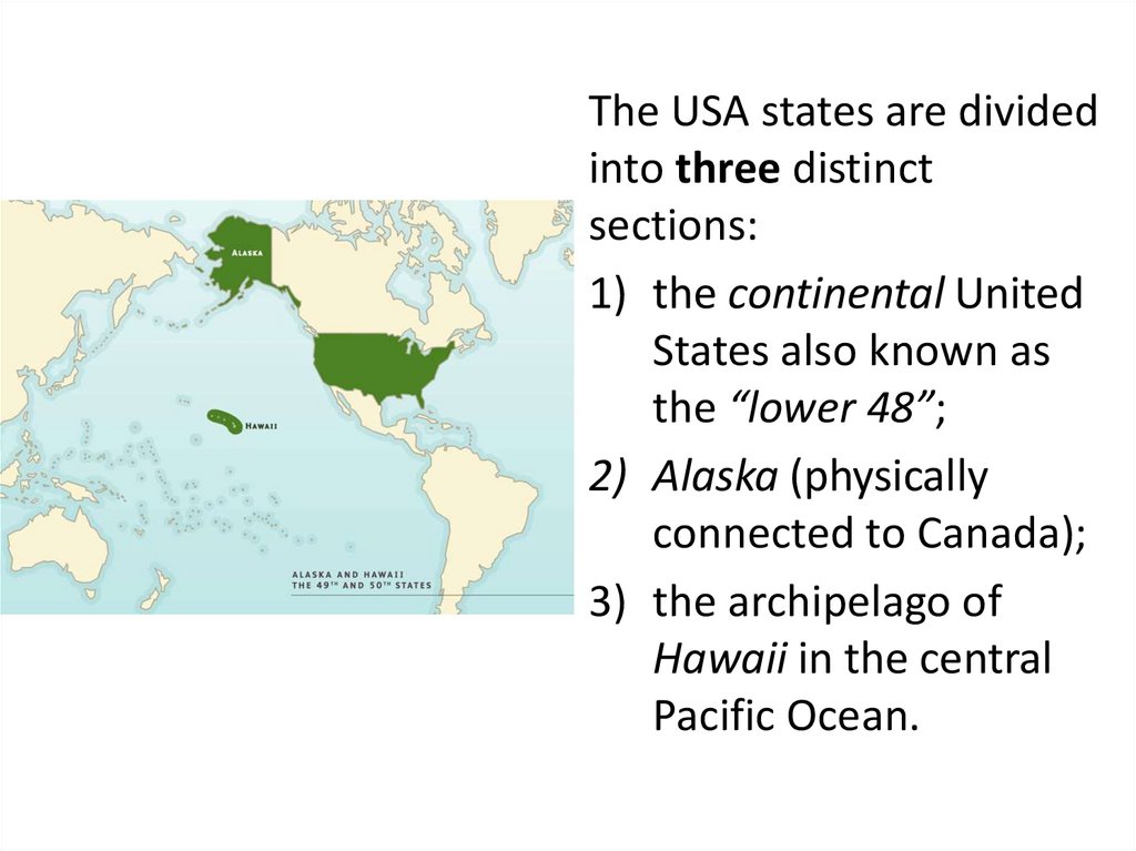
The USA states are dividedinto three distinct
sections:
1) the continental United
States also known as
the “lower 48”;
2) Alaska (physically
connected to Canada);
3) the archipelago of
Hawaii in the central
Pacific Ocean.
16.
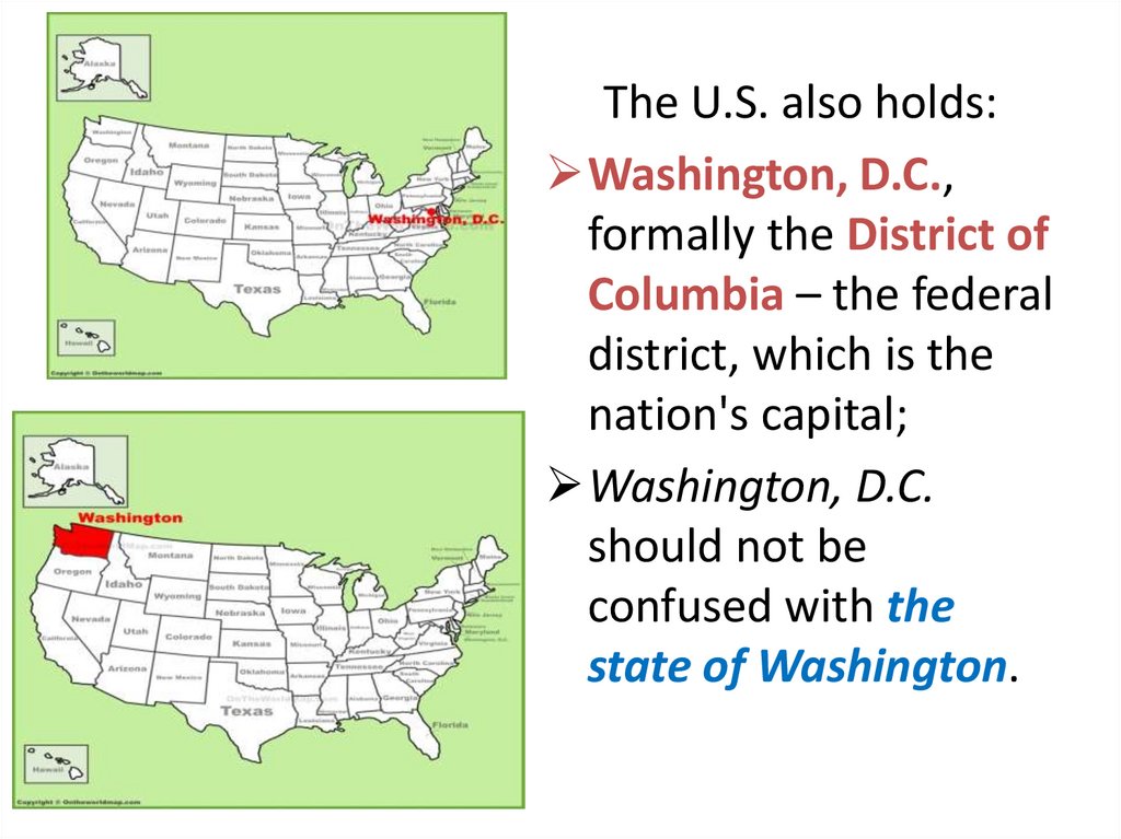
The U.S. also holds:Washington, D.C.,
formally the District of
Columbia – the federal
district, which is the
nation's capital;
Washington, D.C.
should not be
confused with the
state of Washington.
17.
Washington, D.C.In Washington, D.C.
the U.S. federal
government is located.
It serves as the
headquarters for the
World Bank and other
international (and
national) institutions.
18.
19.
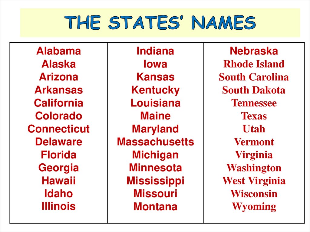
AlabamaAlaska
Arizona
Arkansas
California
Colorado
Connecticut
Delaware
Florida
Georgia
Hawaii
Idaho
Illinois
Indiana
Iowa
Kansas
Kentucky
Louisiana
Maine
Maryland
Massachusetts
Michigan
Minnesota
Mississippi
Missouri
Montana
Nebraska
Rhode Island
South Carolina
South Dakota
Tennessee
Texas
Utah
Vermont
Virginia
Washington
West Virginia
Wisconsin
Wyoming
20.
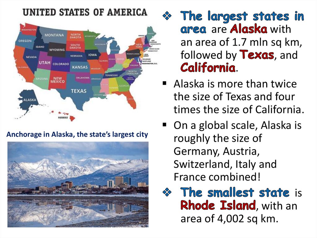
Anchorage in Alaska, the state’s largest cityare
with
an area of 1.7 mln sq km,
followed by
, and
.
Alaska is more than twice
the size of Texas and four
times the size of California.
On a global scale, Alaska is
roughly the size of
Germany, Austria,
Switzerland, Italy and
France combined!
is
, with an
area of 4,002 sq km.
21.
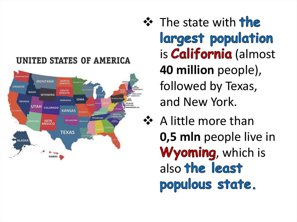
The state withis
(almost
40 million people),
followed by Texas,
and New York.
A little more than
0,5 mln people live in
, which is
also
22.
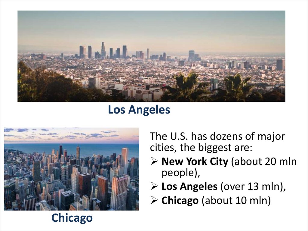
Los AngelesThe U.S. has dozens of major
cities, the biggest are:
New York City (about 20 mln
people),
Los Angeles (over 13 mln),
Chicago (about 10 mln)
Chicago
23.
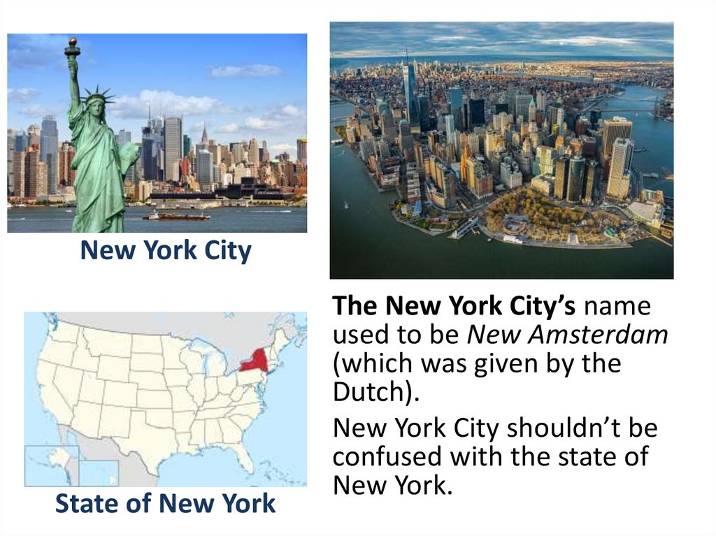
New York CityState of New York
The New York City’s name
used to be New Amsterdam
(which was given by the
Dutch).
New York City shouldn’t be
confused with the state of
New York.
24.
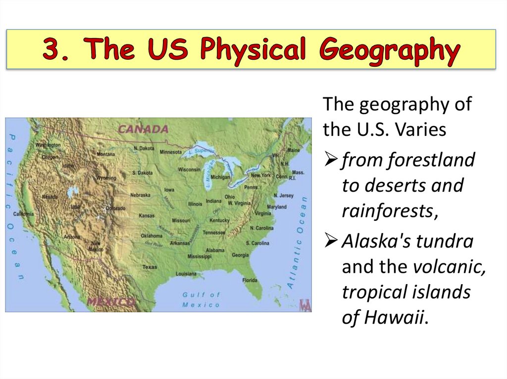
The geography ofthe U.S. Varies
from forestland
to deserts and
rainforests,
Alaska's tundra
and the volcanic,
tropical islands
of Hawaii.
25.
26.
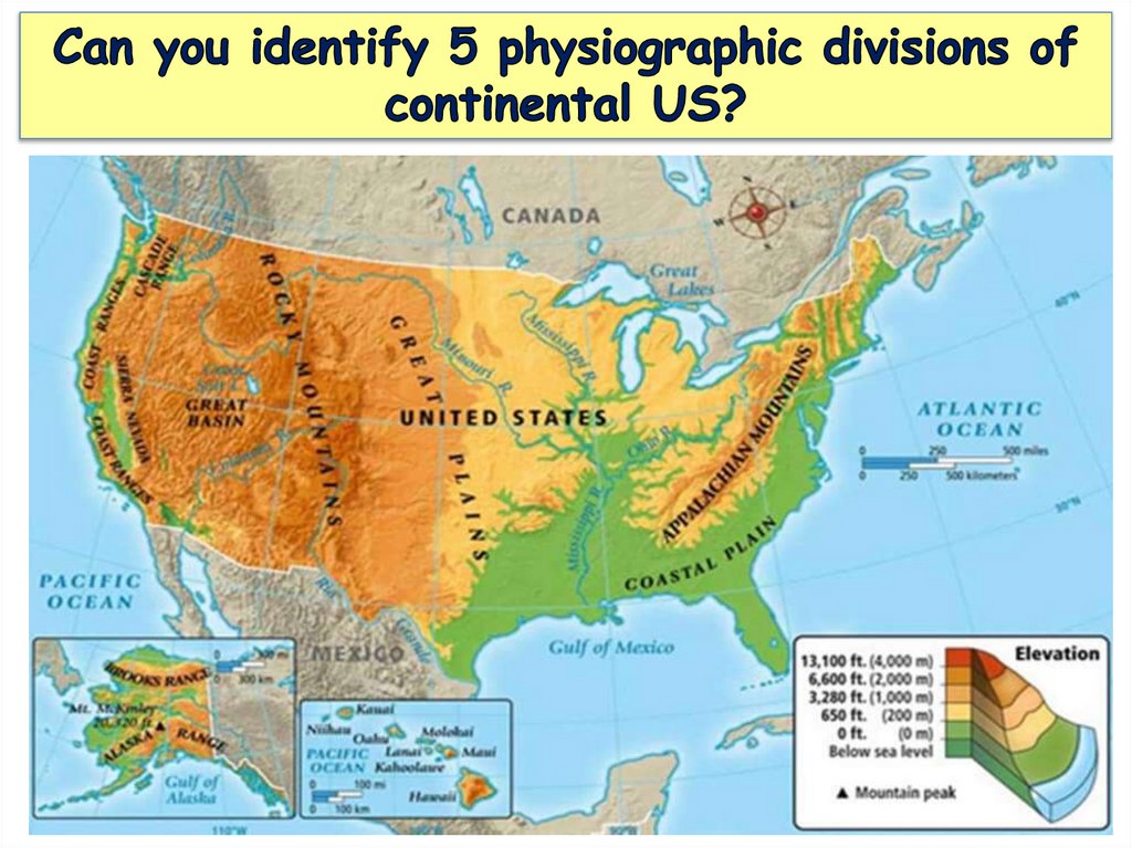
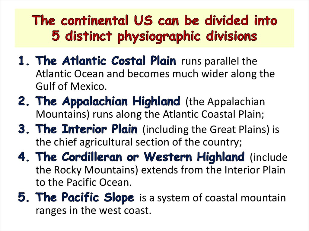
runs parallel theAtlantic Ocean and becomes much wider along the
Gulf of Mexico.
(the Appalachian
Mountains) runs along the Atlantic Coastal Plain;
(including the Great Plains) is
the chief agricultural section of the country;
(include
the Rocky Mountains) extends from the Interior Plain
to the Pacific Ocean.
is a system of coastal mountain
ranges in the west coast.
27.
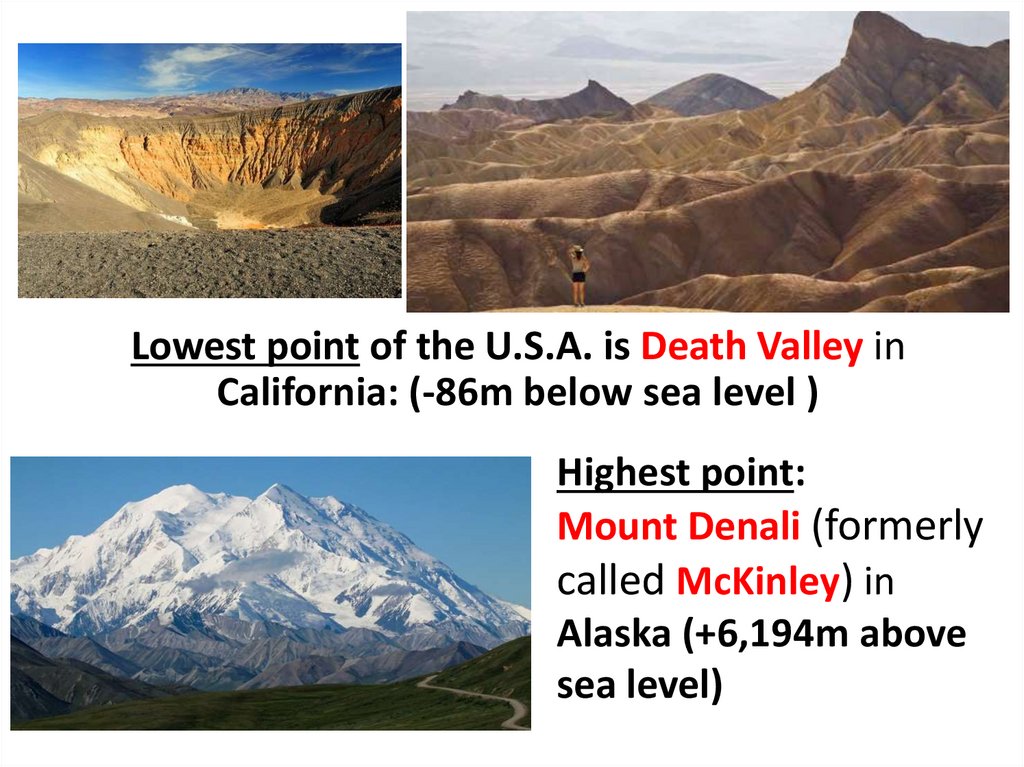
Lowest point of the U.S.A. is Death Valley inCalifornia: (-86m below sea level )
Highest point:
Mount Denali (formerly
called McKinley) in
Alaska (+6,194m above
sea level)
28.
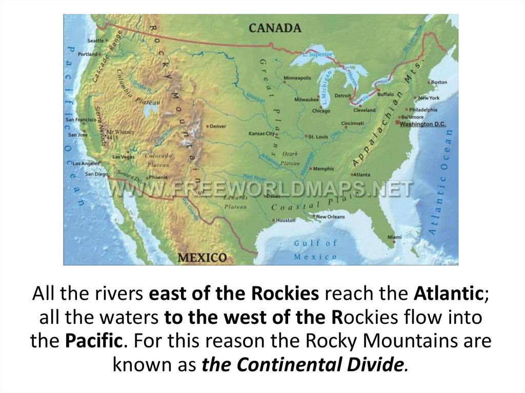
All the rivers east of the Rockies reach the Atlantic;all the waters to the west of the Rockies flow into
the Pacific. For this reason the Rocky Mountains are
known as the Continental Divide.
29.
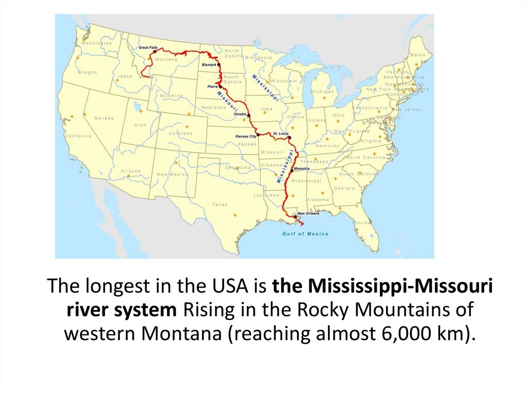
The longest in the USA is the Mississippi-Missouririver system Rising in the Rocky Mountains of
western Montana (reaching almost 6,000 km).
30.
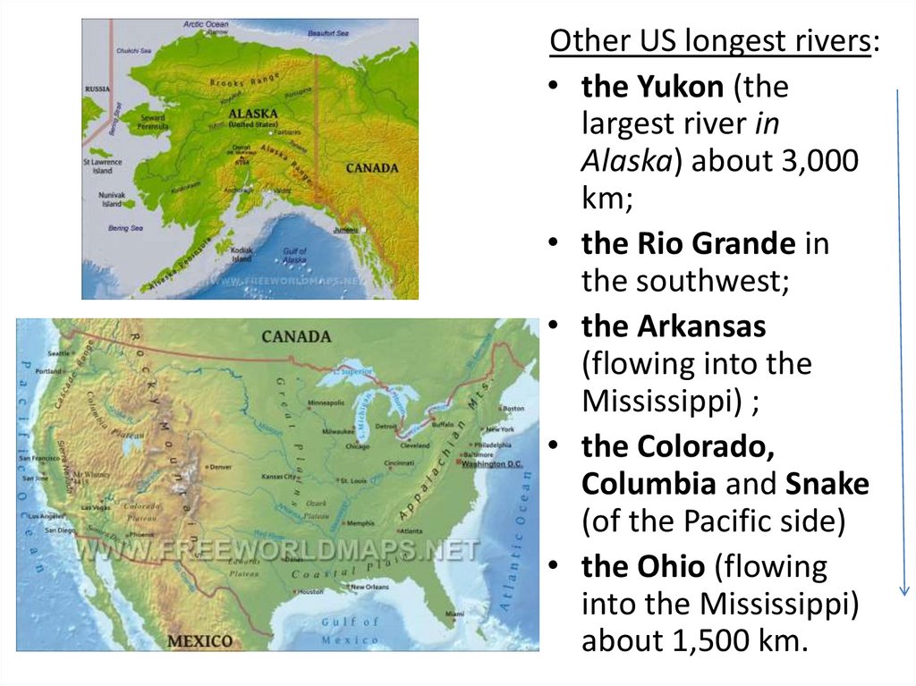
Other US longest rivers:• the Yukon (the
largest river in
Alaska) about 3,000
km;
• the Rio Grande in
the southwest;
• the Arkansas
(flowing into the
Mississippi) ;
• the Colorado,
Columbia and Snake
(of the Pacific side)
• the Ohio (flowing
into the Mississippi)
about 1,500 km.
31.
The Great Lakes: L. Superior, L. Michigan, L. Huron, L. Erie andL. Ontario.
Four of the Great Lakes are on the border between Canada and
the USA.
The other, Lake Michigan, is completely inside the United States.
32.
Four U.S. deserts: the Great Basin, theSonoran Desert, the Mohave Desert, and the
Chihuahuan Desert.
33.
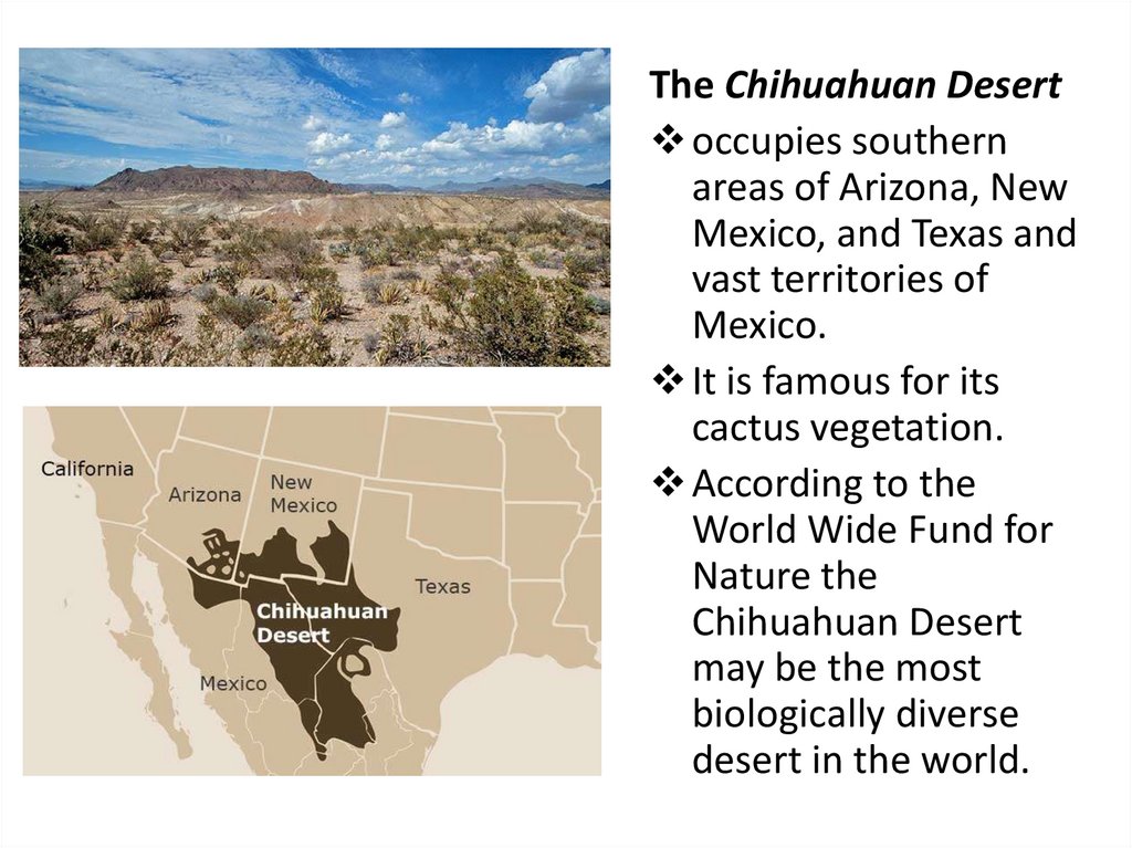
The Chihuahuan Desertoccupies southern
areas of Arizona, New
Mexico, and Texas and
vast territories of
Mexico.
It is famous for its
cactus vegetation.
According to the
World Wide Fund for
Nature the
Chihuahuan Desert
may be the most
biologically diverse
desert in the world.
34.
The climate varies along with the landscape,from tropical in Hawaii and southern Florida to
tundra in Alaska
35.
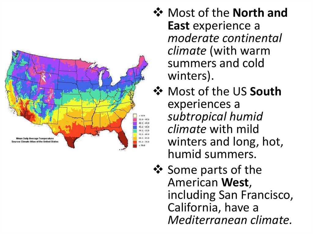
Most of the North andEast experience a
moderate continental
climate (with warm
summers and cold
winters).
Most of the US South
experiences a
subtropical humid
climate with mild
winters and long, hot,
humid summers.
Some parts of the
American West,
including San Francisco,
California, have a
Mediterranean climate.
36.
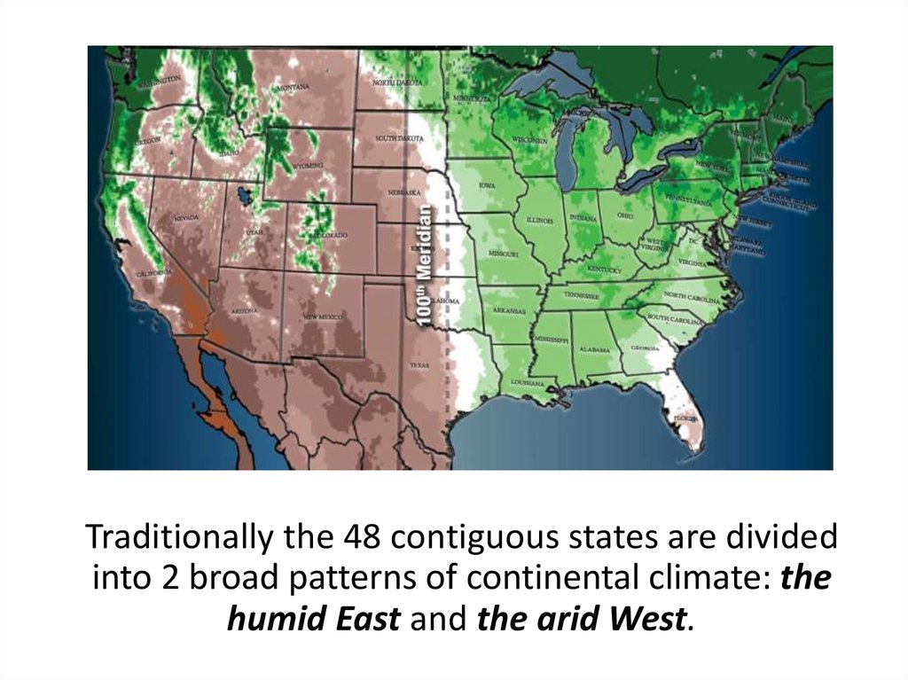
Traditionally the 48 contiguous states are dividedinto 2 broad patterns of continental climate: the
humid East and the arid West.
37.
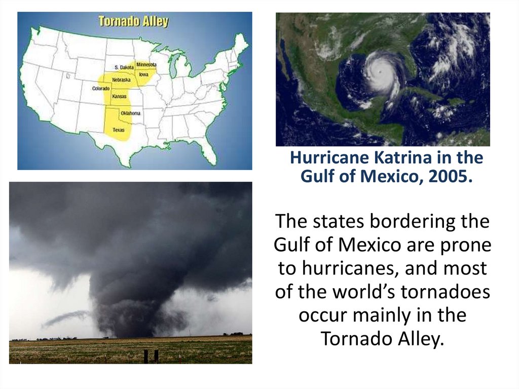
Hurricane Katrina in theGulf of Mexico, 2005.
The states bordering the
Gulf of Mexico are prone
to hurricanes, and most
of the world’s tornadoes
occur mainly in the
Tornado Alley.
38.
Monitoring Questions1. When and by whom was the American continent
discovered?
2. Whom was the American continent named after?
3. How many stars (stripes) are there on the American
continent and what do they represent?
4. What animal is represented on the American coat of
arms?
5. What do you know about the Statue of liberty in the
USA?
6. What 2 American states are separated from the others?
7. What is the largest American state in area (in
population)?
8. What’s the difference between Washington and
Washington, D.C.?
9. Who was New York City founded by?
39.
Bibliography1. Portrait of the USA. – Washington : United States Information
Agency, 1997. – 96 p.
2. The USA : geography, history, education, painting (a reader) / авт. –
сост. В.В. Ощепкова. – М. : Лист, 1999. – 189 с.
3. Abraham, P. Contact USA : a reading and vocabulary text /
P. Abraham, D. Mackey. – 3rd edition. – New Jersey : Prentice Hall
Regents, 1997. – 230 p.
4. Broukal, Milada. All about the USA: a cultural reader / M. Broukal,
P. Murphy. – New York : Longman, 1999. - 124 p.
5. Falk, Randee. Spotlight on the USA / R. Falk. – Oxford : University
Press, 1993. – 172 с.
6. Кузьминова, В.М. Страноведение. Великобритания и США /
В.М. Кузьминова. – Витебск : УО «ВГУ им. П.М. Машерова», 2009. –
120 с.
7. Криштоп, И.С. British and American Studies = Страноведение
Великобритании и США / И.С. Криштоп. – Барановичи : РИО БарГУ,
2014. – 129 с.
8. Новик, Н.А. Страноведение. США: география, история,
экономика, культура = Country Studies. USA: geography, history,
economy, culture / Н.А. Новик. – Минска : Вышэйшая школа, 2015. –
245 с.