


 География
Похожие презентации:


Geographical Outline of the United Kingdom of Great Britain and Northern Ireland. Mountains
1. Geographical Outline of the United Kingdom of Great Britain and Northern Ireland
2. Plan
1.Geographical position.2.Mountains
3.Rivers and lakes
4.Climate.
5.Mineral resources.
6.National parks, Conservation and Recreation
Areas.
7.Administrative Division.
8.National Symbols and Holidays.
3. The UK is situated on the British Isles. They consist of many islands, the larger of which is Great Britain ,the smaller is
Ireland. The totalarea of them and 500 more other islands is a
little more than 244.000.sq.km.
4.
The north-west and west of Great Britainis surrounded by the Atlantic Ocean. In
the west the country is washed by the
Irish sea,the eastern coast -by the North
Sea. The south- eastern part of Great
Britain is separated from the continent by
the English Channel ,which is 32 km wide
at its narrowest point.
5. The Uk consists of 4 main parts:England,Scotland,Wales and Nothern Ireland.It`s area is 244,000 square klm.
6. Mountains of Great Britain
7. In Scotland a large valley –the Central Lowlands,divides mountains into the Northern Uplands and the Southern Uplands. The
Northern Uplands is divided into the northwest Highlands and the Grampians where the highestpoint of the British Isles Ben Nevis is located
8. Scotland: the Grampians: one of the 3 major mountain ranges in Scotland
9. Ben Nevis, the highest point in the British Isles, 1,343 meters above sea level
10. Rivers rising in the Grampians
the Speythe Don
the Dee
the Esk
the Tay
11. Scafell Range, Cambria, England
12.
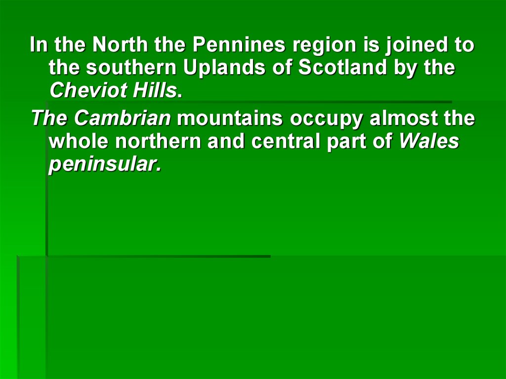
In the North the Pennines region is joined tothe southern Uplands of Scotland by the
Cheviot Hills.
The Cambrian mountains occupy almost the
whole northern and central part of Wales
peninsular.
13. The Pennines - ("backbone of England"
The Pennines - ("backbone ofEngland"
400 km
14. Lake District National Park, Scafell Pike
The highest mountain in England: 978 metresOne of three British peaks climbed as part of the
National Three Peaks Challenge.
15. Wales: Snowdonia
2170 square kilometres16. Snowdon – the highest mountain in Wales
".Snowdon – the highest
mountain in Wales
Saxon "Snow Dun“ - "snow hill".
1085 metres
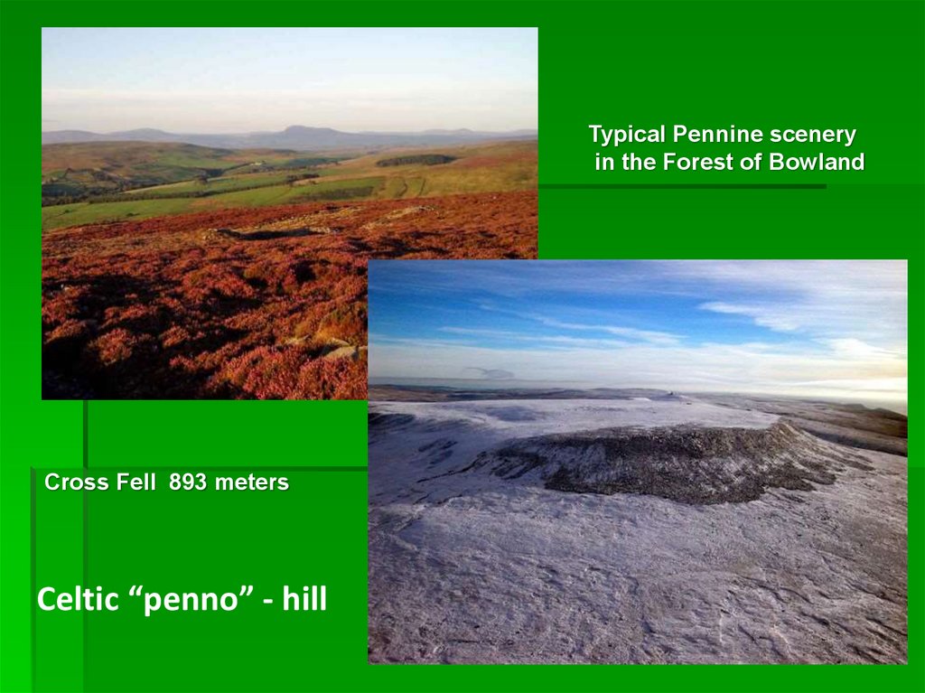
17.
Typical Pennine sceneryin the Forest of Bowland
Cross Fell 893 meters
Celtic “penno” - hill
18. The Highlands
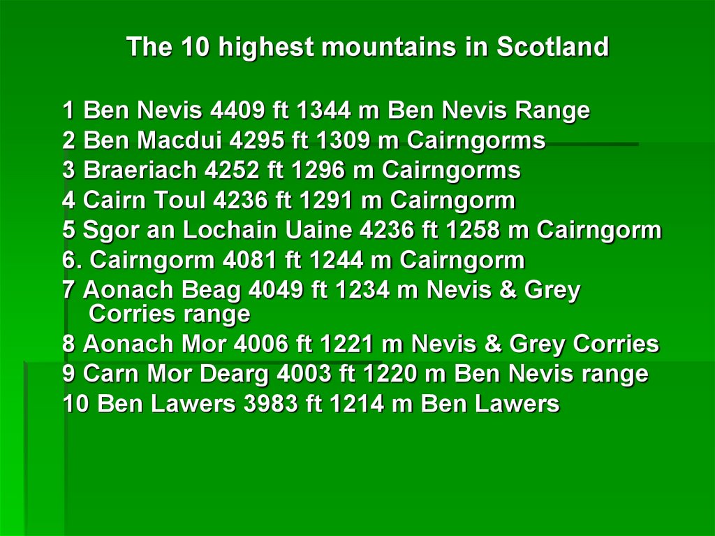
19.
The 10 highest mountains in Scotland1 Ben Nevis 4409 ft 1344 m Ben Nevis Range
2 Ben Macdui 4295 ft 1309 m Cairngorms
3 Braeriach 4252 ft 1296 m Cairngorms
4 Cairn Toul 4236 ft 1291 m Cairngorm
5 Sgor an Lochain Uaine 4236 ft 1258 m Cairngorm
6. Cairngorm 4081 ft 1244 m Cairngorm
7 Aonach Beag 4049 ft 1234 m Nevis & Grey
Corries range
8 Aonach Mor 4006 ft 1221 m Nevis & Grey Corries
9 Carn Mor Dearg 4003 ft 1220 m Ben Nevis range
10 Ben Lawers 3983 ft 1214 m Ben Lawers
20.
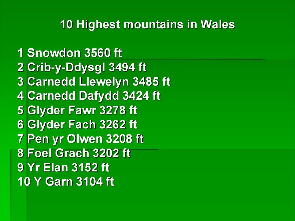
10 Highest mountains in Wales1 Snowdon 3560 ft
2 Crib-y-Ddysgl 3494 ft
3 Carnedd Llewelyn 3485 ft
4 Carnedd Dafydd 3424 ft
5 Glyder Fawr 3278 ft
6 Glyder Fach 3262 ft
7 Pen yr Olwen 3208 ft
8 Foel Grach 3202 ft
9 Yr Elan 3152 ft
10 Y Garn 3104 ft
21. Rivers The most important rivers: the Severn, the Thames, the Ouse, the Tyre, the Tees,the Eden,the Tweed, the Clyde, the Dee
.22. Lakes
There are many lakes in the UK. Thelargest of them are Lough Neagh in
Ireland, Loch Lomond and Loch Ness in
Scotland.
23. Mineral resources
Coal deposits are in England inNorthumberland,
Durham,Lancashire,Yorkshire,Nottingam,
Derby and Staffordshire.
Tin and copper are in Cornwall and
Devonshire ,lead and silver ores are
mined in Derbyshire ,Lancashire and
Cumberland.
24.
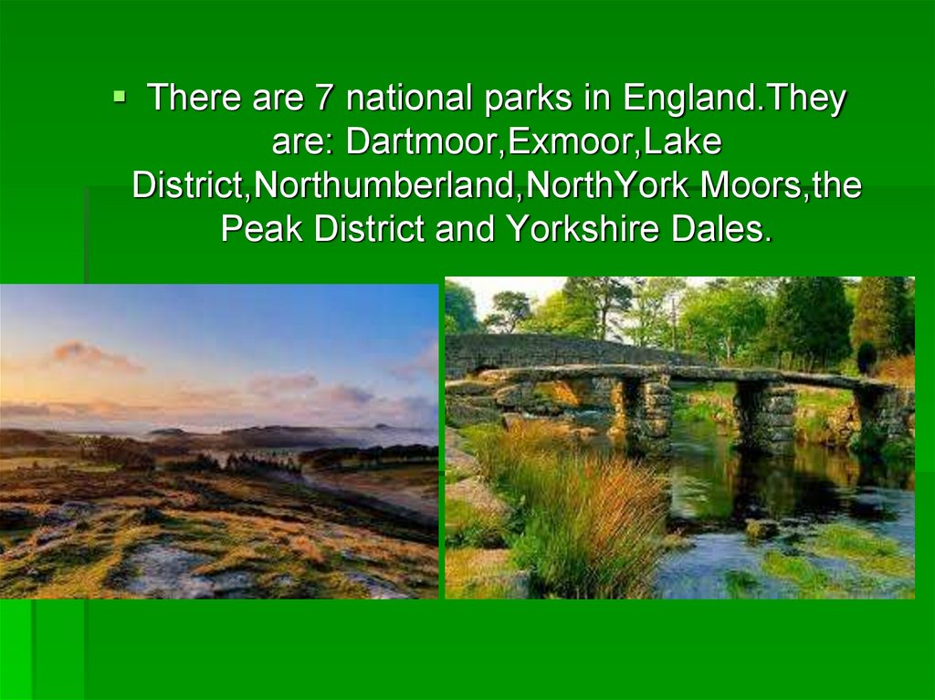
There are 7 national parks in England.Theyare: Dartmoor,Exmoor,Lake
District,Northumberland,NorthYork Moors,the
Peak District and Yorkshire Dales.
25.
In Wales there are 3 national parks.They areSnowdonia,Brecon Beacons and the
Pembrokeshire coast.In Scotland there are 3
national parks. They are Loch
Lomond,Fife,Clyde Muirshiel and Pentland
Hills.
26. In Scotland there are 4 national parks. They are Loch Lomond,Fife,Clyde Muirshiel and Pentland Hills.
27. ENGLAND
Area: 131000 sqkm
Population: 54
million people
Capital: London
Language:
English
28. THE EMBLEM OF ENGLAND
The red rosebecame the
emblem of
England after the
War of the Roses
(1455-1485)
29. WALES
Area: 20761 sqkm
Population: 3
million people
Capital: Cardiff
Language:
English, Welsh
30. THE WELSH FLAG
…shows adragon.
Saint David is the
patron saint of
Wales.
Saint David`s Day
is celebrated on 1
March.
31. THE EMBLEM OF WALES
The daffodil isWelshmen`s
national emblem.
32. SCOTLAND
Area: 78800 sqkm
Population: 5,4
million people
Capital:
Edinburgh
Language:
English,Gaelick
33. THE SCOTTISH FLAG
The SaintAndrew`s cross is
the Scottish flag.
Saint Andrew`s
Day is celebrated
on 30 November.
34. THE EMBLEM OF SCOTLAND
The thistle, thenational emblem
of Scotland was
chosen as such
because it saved
the country from
the enemy.
35. NORTHERN IRELAND
Area: 14160 sqkm
Population: 1,8
million people
Capital: Belfast
Language: Irish,
English
36. THE FLAG OF NORTHERN IRELAND
Ulster is thename used today
for six counties of
Northern Ireland.
The flag
represents these
six counties.
37. THE EMBLEM OF IRELAND
The shamrock,the emblem of the
Irish is proudly
worn on
St.Patrick`s Day,
March 17.