


 Экология
Похожие презентации:


")


Modern approaches to land resource management using geoinformation databases
1. MODERN APPROACHES TO LAND RESOURCE MANAGEMENT USING GEOINFORMATION DATABASES
Rafikov Timur, Gurskienė Virginija, Zhildikbaeva Aizhan, Mukaliev Zhandos2. Goal and Objectives
The main goal of the article is to develop and implement a geospatial database for the effectivemanagement of land resources in the East Kazakhstan region.
To achieve this goal, the following tasks have been set:
1. Create a structured vector database that includes administrative,
hydrographic, agricultural, and transport objects.
2. Develop a methodology for compiling attribute information for each
layer.
3. Methodology of research and materials
1.Geographic Information Systems
(GIS)
2.
QGIS (Quantum GIS)
3.
Arcgis (ESRI)
4. Expert Survey on Geodatabase Development
RespondentAge (years)
Experience in GIS Notable Achievements in GIS
(years)
Recommendations for Creating a Geospatial
Database for the East Kazakhstan Region
Respondent 1 (Male)35
13
Creation of a series of thematic maps of
Kazakhstan
Implementation of automated systems for data
analysis and processing
Respondent 2
(Female)
63
41
Development of a methodology for aerial
photo interpretation
Development of multilingual interfaces to
improve data accessibility
Respondent 3 (Male)40
18
Registered copyright certificates for
translating maps into Kazakh
Training personnel to effectively use new
technologies
Respondent 4
(Female)
30
7
Transition to newer software at the
production level using her own
methodology
Optimization of data processing workflows to
enhance productivity
Respondent 5 (Male)44
22
Creation of a seamless operational network Development of standards for integrating
for remote sensing image processing
various data sources into a unified database
software
5. The data were processed using a methodology that included several stages:
1.Multilingualism. All data were translated into three main languages used for map creation (Russian, Kazakh, English).
2.
Data standardization. To ensure compatibility and integration of data from various sources, data format standards were
developed and implemented.
3.
Process automation. Based on expert recommendations, automated systems for data processing and analysis were
implemented.
Personnel training. To ensure the effective use of new technologies and methodologies, training seminars and workshops
were conducted for employees.
4.
5.
Optimization of data processing. Algorithms were developed to optimize data processing workflows, which increased
productivity and reduced computational resource costs.
6.
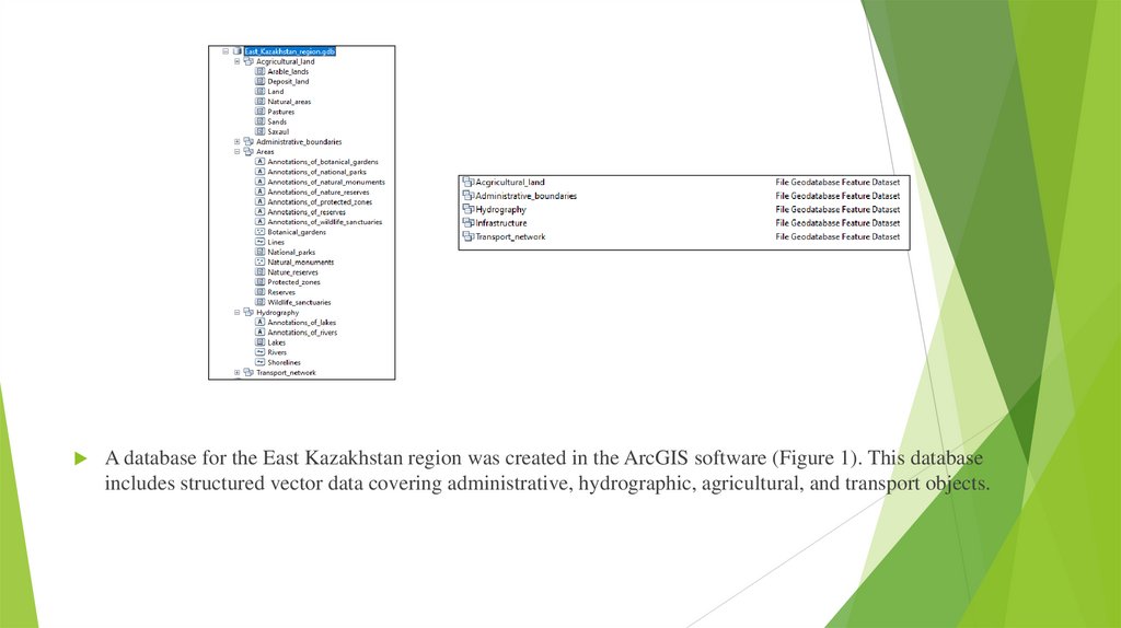
A database for the East Kazakhstan region was created in the ArcGIS software (Figure 1). This databaseincludes structured vector data covering administrative, hydrographic, agricultural, and transport objects.
7. Methodology for Developing Attribute Information in the Geodatabase
Processes of the MethodologyMethods and Tools
Result
1. Defining the Structure of Attribute
Information
- Analysis of research objectives.
- Consultations with experts.
- Use of GIS standards.
A list of attributes for each layer, specifying their data types.
2. Data Collection
- Use of open sources (QGIS, OpenStreetMap).
- Field studies.
- Requests to state registries.
A dataset ready for processing and integration into the GIS.
3. Creating an Attribute Table
- Use of software (ArcGIS, QGIS).
- Manual or automated data entry.
An attribute table linked to the layer's objects.
4. Data Verification
- Comparison with other sources.
- Use of data validation tools in GIS.
Cleaned and verified data ready for integration into the GIS.
5. Data Integration into GIS
- Use of GIS tools for data linking.
- Configuration of layers and attributes.
A completed layer with attribute information, ready for analysis and
visualization.
6. Data Utilization
- Use of GIS analytical tools.
- Creating queries and filtering data.
Analysis results, visualizations, and reports used for decision-making.
8.
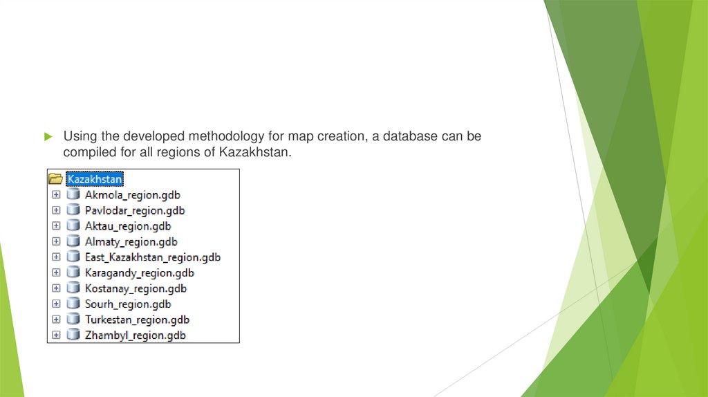
Using the developed methodology for map creation, a database can becompiled for all regions of Kazakhstan.
9. Conclusions and proposals
QGIS and OpenStreetMap provided accurate, up-to-date data on the region’sgeography, infrastructure, and natural features, enabling efficient integration
and analysis essential for land resource management.
A multi-level catalog structure was created, organizing data into categories
like administrative boundaries, hydrography, protected areas, agriculture,
and transport. This streamlined analysis and decision-making through clear
attribute definitions.
The resulting geospatial database for East Kazakhstan is a vital tool for land
management, supporting sustainable development, strategic planning, and
responsive monitoring of land use changes.
10.
Thank you foryour attention