


 География
Похожие презентации:


Geography of Kyrgyz Republic Subject: Climatic conditions
1. Lesson: Geography of Kyrgyz Republic Subject: Climatic conditions
Lecturer: Emilbek Zholdoshbekovemilbek.zholdoshbekov@alatoo.edu.kg
2.
Outline of the presentation• Introduction, basic concepts.
• Analysis of climate-forming factors.
• Basic climatic elements.
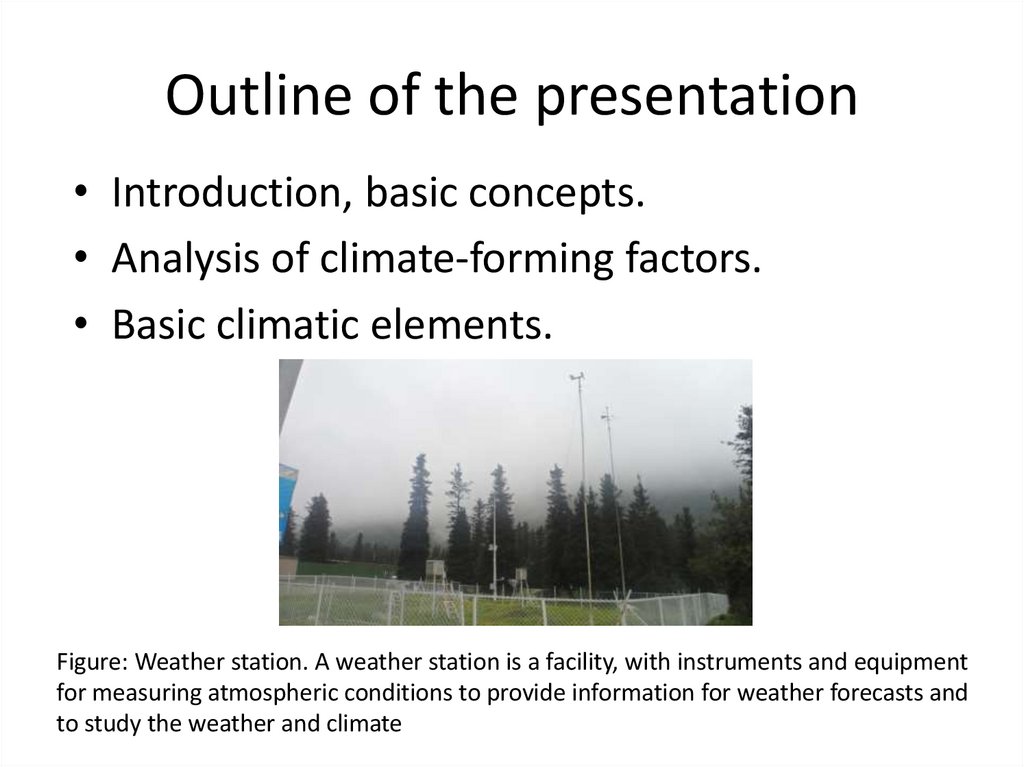
Figure: Weather station. A weather station is a facility, with instruments and equipment
for measuring atmospheric conditions to provide information for weather forecasts and
to study the weather and climate
3. Introduction, basic concepts
• Climate is the weather conditions prevailing in anarea in general or over a long period (30 years).
• Weather is the state of the atmosphere at a
particular place and time as regards heat,
cloudiness, dryness, sunshine, wind, rain, etc.
• A weather station is a facility, either on land or
sea, with instruments and equipment for
measuring atmospheric conditions to provide
information for weather forecasts and to study
the weather and climate
4. Introduction, basic concepts
Eratosthenes (276 -194 BC)During the calculating the size of the Earth,
Eratosthenes found a connection between climatic
conditions and the angle of incidence of sun rays.
5. Analysis of climate-forming factors
• In Kyrgyzstan, a mountainous country of central Asia, the climate iscontinental, with cold winters, often frosty, and warm and sunny
summers, sometimes scorching hot at low altitudes, but cooler in
the mountains. Precipitation is moderate in the west, while the
centre-east of the country is arid, and even desert at lower
elevations. From the vast deserts of the neighbouring countries,
winds able to bring sandstorms can blow.
6. Analysis of climate-forming factors
• The climate of the Kyrgyz Republic, like any other territory, is determinedby its geographic location and is formed as a result of the interaction of
three main factors: solar radiation, atmospheric circulation and the
underlying surface.
• Solar radiation reaching the earth's surface is one of the main climateforming factors. Its arrival is determined by the height of the Sun above
the horizon, which varies from 23-25° in December to 69-70° in June.
• The duration of sunshine is determined by the conditions for the
formation of clouds and the closedness of the horizon: Thus, in the narrow
valleys of Chon-Kyzyl-Suu and Jeti-Oguz, the average annual duration of
sunshine is 1700-1800, while in open spaces it is 2500-2900 hours per
year.
• The annual amount of solar radiation under average cloudiness conditions
increases with terrain altitude from 5547 MJ / m² in the Chui Valley
(Bishkek meteorological station, 756 m above sea level) to 6660 MJ / m² in
the high mountain zone (Tien Shan meteorological station, 3610 m above
sea level) ... The increase in solar radiation with height is most pronounced
in the warm season.
7. Analysis of climate-forming factors
• Atmospheric circulation plays an important role in the formation ofthe climate. During the cold season, most of the territory of
Kyrgyzstan is under the influence of the Siberian anticyclone. Lowcloud, frosty weather with pronounced air temperature inversions
prevails. Precipitation is associated with the passage of cold
atmospheric fronts of the western, northwestern, northern
incursions, as well as the outcrops of southern cyclones, which have
the greatest impact on Southwestern Kyrgyzstan (Osh, Jalal-Abad
and Batken regions).
• In the warm period of the year, Kyrgyzstan is located away from the
main air currents, in connection with which a low-gradient field of
reduced pressure prevails, in June-August a thermal depression can
be established, followed by western, north-western or northern
invasions, proceeding as dry and low-cloud in the valley areas and
accompanied by thunderstorms and precipitation in the mountains.
8. Analysis of climate-forming factors
• The underlying surface has a great influence on the formation ofthe climate. The mountainous nature of the relief determines the
vertical zoning of climatic zones. When climbing from the foot of
the mountains to the peaks, the same change in climatic zones is
observed as when moving from the subtropics to the Arctic coast.
Vertical climatic zoning is complicated by the orographic structure:
highly indented mountain ranges and intermontane basins have a
significant impact on the formation of climatic conditions.
9. Basic climatic elements
• Thermal regime. The warmest months in Kyrgyzstan are July andAugust. The absolute maximum temperatures (43-44°С) were
recorded in the north of the Chuy valley and in the foothills of the
Fergana ridge. In the middle mountains in summer, daytime
temperatures do not exceed 20°C, high in the mountains they are
close to 0°C, at night - freezing temperatures. The average monthly
temperature in July in Kyrgyzstan varies from 25-27°С (foothills of
the Fergana Valley) to 4°С (at an altitude of 3600 m, Central TenirToo).
• In January, the difference in the average monthly temperature
between separate districts at the same altitude reaches 15°С,
because the influence of the features of the relief affects. The
lowest air temperatures in winter are observed in highmountainous basins and closed valleys (Ak-Sai, Arpa, Suusamyr,
etc.). The absolute minimum was recorded in the Ak-Sai valley at 53°С.
10. Basic climatic elements
• Air pressure. Due to the elevated position of theterritory of the republic, the air pressure is lower
here than at sea level. The values of atmospheric
pressure vary from 950 mb in low-mountainous
districts to 660 mb in highlands (or from 715 to
500 mm of mercury barometer).
11. Basic climatic elements
Precipitation. The northern slopes of
the elongated ridges also receive
somewhat more moisture. The
amount of precipitation there
reaches 400-500 mm per year,
increasing with a height of up to 900
mm or more. The inner regions,
obscured by high ridges, receive less
precipitation: from 100 mm inside
this area to 300-400 mm to its
peripheral parts. The maximum
amount of precipitation was recorded
in the southwestern slope of the
Fergana ridge, in the village of
Akterek-Gava, 1090 mm. The
minimum in the city of Balykchy is
144 mm. The greatest amount of
precipitation falls in spring and
autumn, minimum in summer and
winter.
Figure: impact of mountains to
the precipitation
12. Basic climatic elements
Wind. A distinctive feature of the wind regime is mountain-valley circulation, which
is characterized by a regular change in direction: at night the wind blows from the
mountains to the valleys, in the daytime from the valleys to the mountains. During
cold incursions, westerly winds occur. For the coast of the lake. Issyk-Kul is
characterized by breezes - during the day the wind blows on the coast, at night from
the mountains and coast to the lake.
Mountain ranges hinder the development of high wind speeds, so the average
annual speed ranges from 1 to 3 m / s. However, during cold incursions, strong
westerly winds occur, associated with gusts of cumulonimbus, squalls; at the outlets
of southern cyclones, there are mainly eastern and southeastern dryers. The
number of days with strong winds (≥15 m / s) is small and ranges from 2-4 to 15-20
per year.
In the Issyk-Kul basin, the frequency of strong winds is higher. In the central and
eastern parts - on average, 20-50 days are noted, in the western part of the basin more than 70, in some years up to 120 days with strong winds. The west wind
"Ulan" blows mainly along the lake, in the eastern part - the east wind "San-Tash".
When these winds occur simultaneously, they form the storms.
13. Basic climatic elements
Figure: the see breezeFigure: the vectors of mountain-valley wind
14. Glossary
• Precipitation : water that falls from the clouds towards the ground,especially as rain or snow.
• Atmosphere: the envelope of gases surrounding the earth or another
planet.
• Troposphere: the lowest and densest region of the Earth's atmosphere,
extending from the Earth's surface to the tropopause (9-18 km above the
land surface).
• Air masses: a large body of air with generally uniform temperature and
humidity.
• Anticyclone: a weather system with high barometric pressure at its centre,
around which air slowly circulates in a clockwise (northern hemisphere)
or anticlockwise (southern hemisphere) direction. Anticyclones are
associated with calm, fine weather.
• Greenhouse gases: the main gases responsible for the greenhouse effect
(which increases air temperature) include carbon dioxide, methane,
nitrous oxide, and water vapour.
• Westerlies: the prevailing winds blowing from the west on the poleward
sides of the horse latitudes, often bringing depressions and anticyclones.