


 География
Похожие презентации:


Utah constituent state of the United States of America
1.
Utah2.
Utahconstituent state of the United States of America.
Mountains, high plateaus, and deserts form most of its
landscape. The capital, Salt Lake City, is located in the
north-central region of the state. The state lies in the
heart of the West and is bounded by Idaho to the
north, Wyoming to the northeast, Colorado to the
east, Arizona to the south, and Nevada to the west.
At Four Corners, in the southeast, Utah meets
Colorado, New Mexico, and Arizona at right angles, the
only such meeting of states in the country. Utah became
the 45th member of the union on January 4, 1896.
3.
Utah represents a unique episode in the settlement of theUnited States, a story of a religious group that trekked
across three-fourths of the continent in search of a
“promised land” where they could be free from persecution.
Salt Lake City is the world headquarters of the Church of
Jesus Christ of Latter-day Saints, commonly known as
the Mormon church, and the spiritual home of adherents
throughout the world. With Mormons making up nearly
seven-tenths of the state’s population, the beliefs and
traditions of the Mormon church continue to exert profound
influences on many facets of the state’s life and institutions.
4.
Mormon church5.
Before the arrival of the first Mormon pioneers, Utahwas inhabited by several Native American tribes,
including the Ute, for whom the state is named. From the
beginning of Mormon settlement in 1847, the pioneers
set about wresting a green land from the deserts,
gradually supplementing their crops with the products
of industry and the earth. The economy of present-day
Utah is based on manufacturing, tourism, and services,
in addition to agriculture and mining. Area 84,898
square miles (219,884 square km). Population (2010)
2,763,885; (2019 est.) 3,205,958.
6.
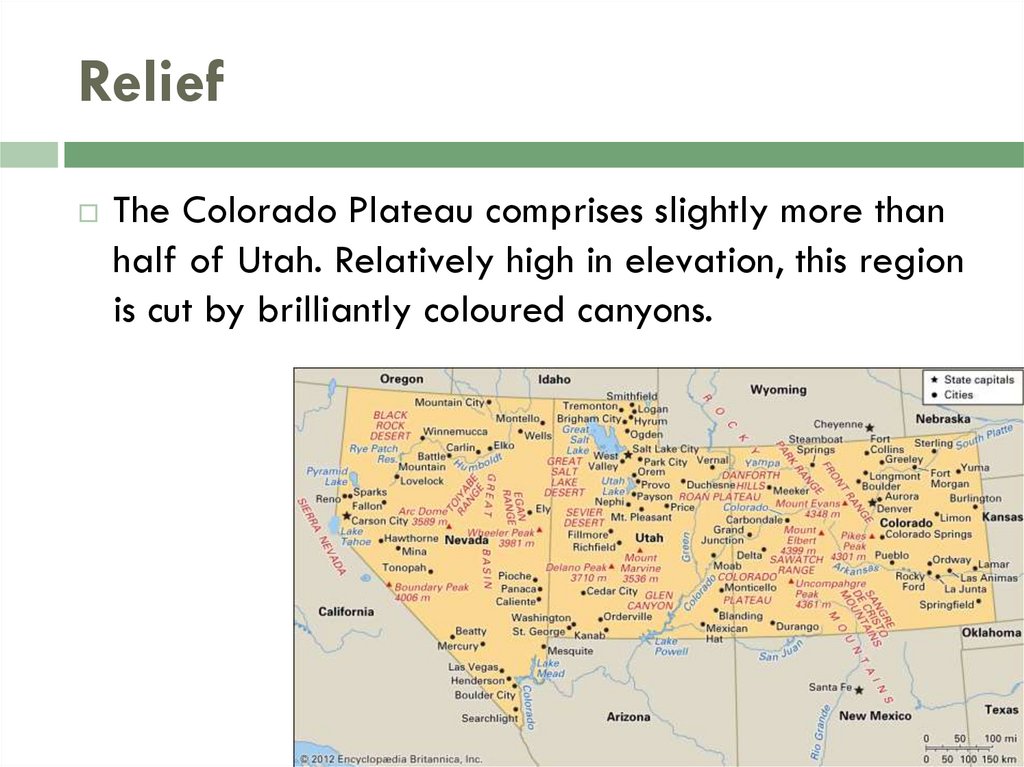
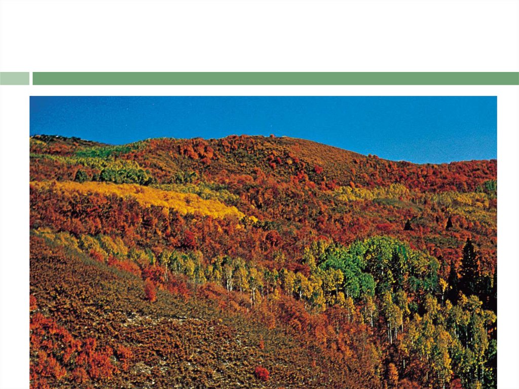
ReliefThe Colorado Plateau comprises slightly more than
half of Utah. Relatively high in elevation, this region
is cut by brilliantly coloured canyons.
7.
The western third of the state is part of the Great Basin of the Basinand Range Province, a broad, flat, desertlike area with occasional
mountain peaks. The Great Salt Lake lies in the northeastern part of
the region. To the southwest of the lake is the Great Salt Lake
Desert, covering some 4,000 square miles (10,500 square km),
which include the Bonneville Salt Flats, the site of many automobile
and motorcycle land-speed trials.
The Middle Rockies in the northeast comprise the Uinta Mountains,
one of the few mountain ranges in the United States running in an
east-west direction, and the Wasatch Range. Along the latter runs a
series of valleys and plateaus known as the Wasatch Front. The
Wasatch Range exhibits many glacially formed features such as
cirques and moraines. Canyons have been formed by various
streams.
8.
Elevations range from 13,528 feet (4,123 metres)at Kings Peak in the Uintas to about 2,350 feet (715
metres) in the southwestern corner of the state. The
Oquirrh and Deep Creek ranges of the Great Basin are
important for their deposits of copper, gold, lead, and
zinc.
9.
DrainageUtah contributes to three major drainage areas—
the Colorado and Columbia rivers and the Great Basin.
The Colorado and its tributary, the Green, drain
eastern Utah. The Colorado River Storage Project
includes several dams and many lakes in that area.
Rivers in the central and western parts of the state
include the Bear, Weber, Provo, Jordan, and Sevier, all
of which flow into the Great Basin. The Raft River and
Goose Creek, in the northwestern corner of the state,
feed into the Snake River, part of the Columbia River
drainage. All of the river systems are important for
their irrigation and power potential.
10.
11.
Irrigation was among the first Mormon pioneer efforts in 1847, andsince then irrigation and water conservation have become
increasingly important. The irrigation complex in Utah comprises a
number of dams, reservoirs, canals and ditches, pipelines, and
flowing wells, exclusive of the large Glen Canyon and Flaming
Gorge dams. State boards and departments regulate water use,
while the division of health maintains water-quality standards under
the Water Pollution Control Act of 1953.
During the Pleistocene Epoch (about 2,600,000 to 11,700 years
ago), the region’s huge Lake Bonneville covered an area as large
as Lake Michigan. The Great Salt Lake, saline Sevier Lake, and
freshwater Utah Lake are the major remnants of Lake Bonneville
12.
SoilsThe desert soil that covers most of the state lacks
many organic materials but contains lime. Lack of
adequate drainage in the Great Basin has
damaged surrounding soils with saline materials
and alkali salts. The richest soils are in the centre of
the state, from the Idaho border almost to Arizona,
where most farming is done. Mountain soils provide
a habitat for conifers and other trees.