


 География
Похожие презентации:


Introduction to geography of Kyrgyz Republic
1.
Lesson: Geography of Kyrgyz RepublicSubject: Introduction to geography of Kyrgyz Republic
Lecturer: Emilbek Zholdoshbekov
emilbek.zholdoshbekov@alatoo.edu.kg
2.
Why we study geography?• With the growing importance of issues such as climate change,
migration, environmental degradation, spatial epidemiology
and inequalities, geography is one of the most relevant courses
you could choose to studyGeographic location.
• If you are interested in pressing global issues and enjoy
learning about people and their societies, economies, cultures
and the environment.
• To understand the spatial organisation of society and see order
in what often appears to be random scattering of people and
places.
• To understand global interdependence and to become a better
global citizen.
3.
Why we study geography?4.
Outline of the presentation• Introduction to geography of Kyrgyz Republic
• Geographic location
• State borders
• Brief history of investigations the territory of
Kyrgyz Republic
5.
Introduction• География — это изучение физических характеристик
земли и ее атмосферы, а также человеческой
деятельности, поскольку она влияет на них и находится
под их влиянием, включая распределение населения и
ресурсов, а также политическую и экономическую
деятельность.
• Physical geography is the branch of geography concerned
with natural features of the earth’s surface as landforms,
water objects, climate, soil, vegetation and animals.
• Human geography is the branch of geography that studies the
people and their communities, cultures, economies and
interactions with environment by studying their relations
with and across geospatial
6.
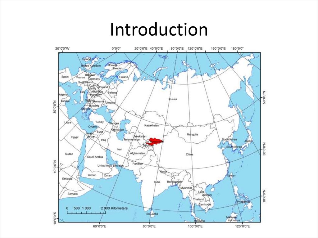
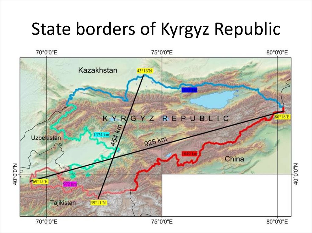
Introduction• Kyrgyz Republic is landlocked country in Central Asia, in the
north-east of Central Asia between 39°14ʹ (The glacier on
Altyn-Daira catchment) and 43°16ʹ (8 km northern from
Kamyshanovka settlement) north latitude and 69°15ʹ (The
left watershed divide of Ak-Suu river) and 80°18ʹ (The
watershed divide on Meridianen range) east longitude.
• The distance between the northernmost point to Arctic
Ocean is 3380 km, from southernmost point to Indian
ocean is 1670 km, from easternmost point to Pacific Ocean
is 6210 km, from westernmost point to Atlantic Ocean is
5530 km.
• Territory of Kyrgyzstan extends from east to west 925 km,
from north to south 454 km. Total area is 198.5 km².
7.
Introduction8.
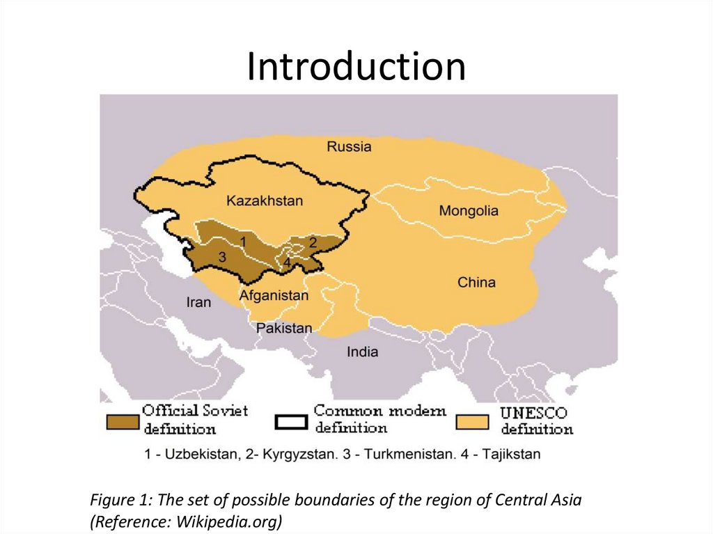
IntroductionFigure 1: The set of possible boundaries of the region of Central Asia
(Reference: Wikipedia.org)
9.
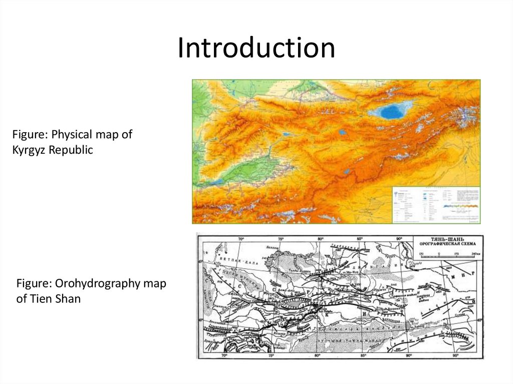
Introduction• Largely mountainous, the country is dominated by the western
reaches of the Tien Shan range in the northeast and the Pamir-Alay
in the southwest. The highest mountain is Victory Peak (7 439 m
above sea level) at the eastern tip of the country, on the border
with China. About 94% of the country rises over 1 000 m, and 40%
at more than 3 000 m above sea level. Much of the mountain
region is permanently covered with ice and snow and there are
many glaciers, covering about 4 percent of the territory. The
Fergana mountain range, running from the northwest across the
country to the central-southern border region, separates the
eastern and central mountain areas from the Fergana valley in the
west and southwest. Other lowland areas include the Chu and Talas
valleys near the northern border with Kazakhstan. The world’s
second largest crater-lake, is Issyk-Kul, in the northeast with a
surface area of 6 236 km2.
10.
IntroductionFigure: Physical map of
Kyrgyz Republic
Figure: Orohydrography map
of Tien Shan
11.
State borders of Kyrgyz Republic• According to standard definitions, borders are geographic
boundaries of political entitles or legal jurisdictions, such as
governments, sovereign states and other subnational units. Borders
separates and combine countries.
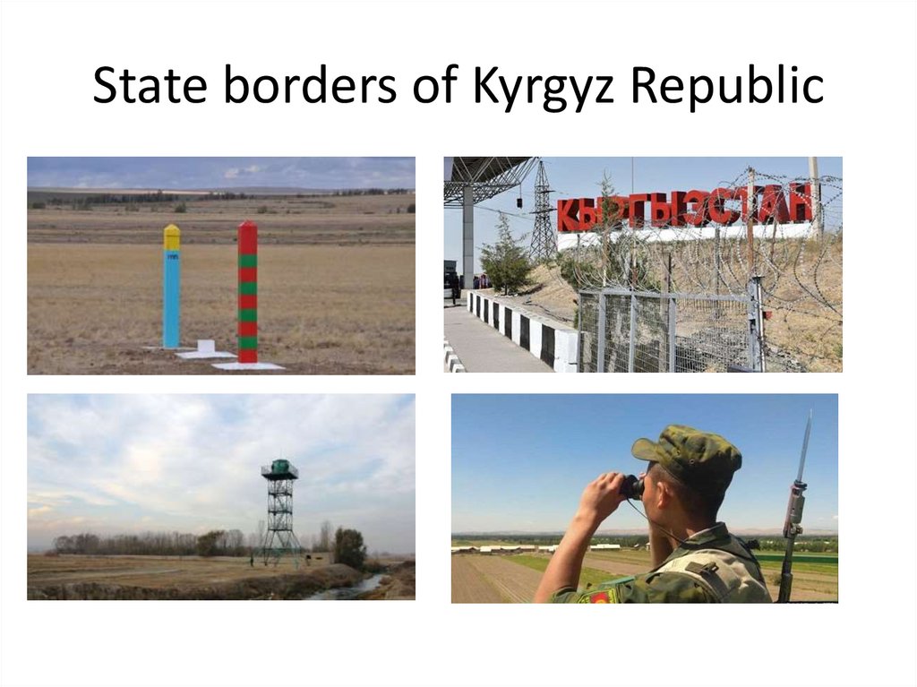
• Borders are established thorough agreements between political
entitles that control those areas. The creation of border
agreements is called boundary delimitation. After completing the
delimitation sides will fix the border with sign, walls, and custom
checking points. That border fixing process called as demarcation.
• The Republic borders on Kazakhstan in the north, on China in the
south-east and east, on Tajikistan in the south-east, and on
Uzbekistan in the west. The length of Kyrgyzstan’s borders is 4508
km. The most part of boundaries concomitant with natural
formations such as mountains ranges and rivers.
12.
State borders of Kyrgyz Republic13.
State borders of Kyrgyz Republic14.
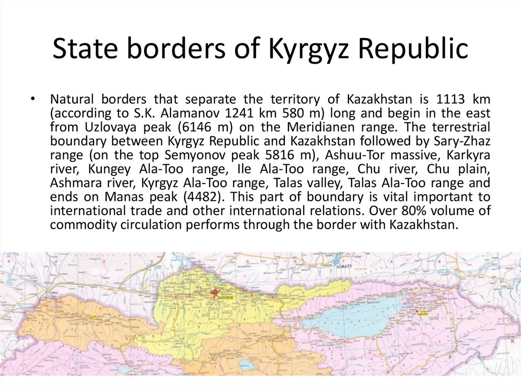
State borders of Kyrgyz Republic• Natural borders that separate the territory of Kazakhstan is 1113 km
(according to S.K. Alamanov 1241 km 580 m) long and begin in the east
from Uzlovaya peak (6146 m) on the Meridianen range. The terrestrial
boundary between Kyrgyz Republic and Kazakhstan followed by Sary-Zhaz
range (on the top Semyonov peak 5816 m), Ashuu-Tor massive, Karkyra
river, Kungey Ala-Too range, Ile Ala-Too range, Chu river, Chu plain,
Ashmara river, Kyrgyz Ala-Too range, Talas valley, Talas Ala-Too range and
ends on Manas peak (4482). This part of boundary is vital important to
international trade and other international relations. Over 80% volume of
commodity circulation performs through the border with Kazakhstan.
15.
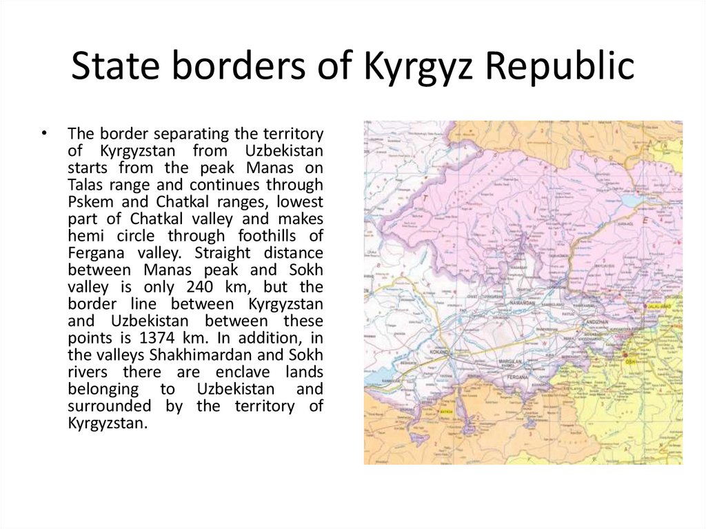
State borders of Kyrgyz RepublicThe border separating the territory
of Kyrgyzstan from Uzbekistan
starts from the peak Manas on
Talas range and continues through
Pskem and Chatkal ranges, lowest
part of Chatkal valley and makes
hemi circle through foothills of
Fergana valley. Straight distance
between Manas peak and Sokh
valley is only 240 km, but the
border line between Kyrgyzstan
and Uzbekistan between these
points is 1374 km. In addition, in
the valleys Shakhimardan and Sokh
rivers there are enclave lands
belonging to Uzbekistan and
surrounded by the territory of
Kyrgyzstan.
16.
State borders of Kyrgyz Republic• An enclave is a territory (or a part of one) that is entirely
surrounded by the territory of one other state. Enclaves may also
exist within territorial waters. Enclave is sometimes used
improperly to denote a territory that is only partly surrounded by
another state. The Vatican City State and San Marino, enclaved
by Italy, and Lesotho, enclaved by South Africa, are completely
enclaved sovereign states.
• An exclave is a portion of a state or territory geographically
separated from the main part by surrounding alien territory (of one
or more states). Many exclaves are also enclaves. Unlike an enclave,
an exclave can be surrounded by several states.
The Azerbaijani exclave of Nakhchivan is an example of an exclave.
17.
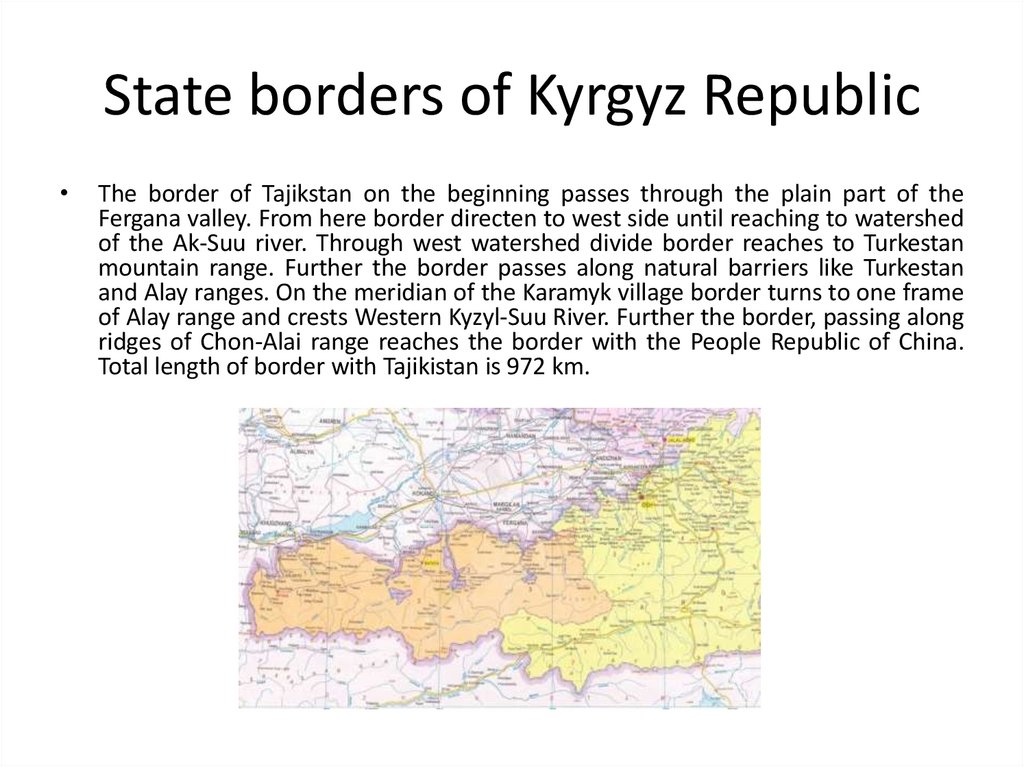
State borders of Kyrgyz RepublicThe border of Tajikstan on the beginning passes through the plain part of the
Fergana valley. From here border directen to west side until reaching to watershed
of the Ak-Suu river. Through west watershed divide border reaches to Turkestan
mountain range. Further the border passes along natural barriers like Turkestan
and Alay ranges. On the meridian of the Karamyk village border turns to one frame
of Alay range and crests Western Kyzyl-Suu River. Further the border, passing along
ridges of Chon-Alai range reaches the border with the People Republic of China.
Total length of border with Tajikistan is 972 km.
18.
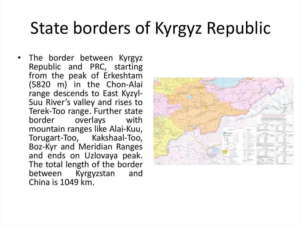
State borders of Kyrgyz Republic• The border between Kyrgyz
Republic and PRC, starting
from the peak of Erkeshtam
(5820 m) in the Chon-Alai
range descends to East KyzylSuu River’s valley and rises to
Terek-Too range. Further state
border
overlays
with
mountain ranges like Alai-Kuu,
Torugart-Too, Kakshaal-Too,
Boz-Kyr and Meridian Ranges
and ends on Uzlovaya peak.
The total length of the border
between Kyrgyzstan and
China is 1049 km.
19.
Brief history of investigations theterritory of Kyrgyz Republic
• History of geographical representations in ancient time can be judged
from written sources belonging to most ancient agricultural people as well
as one data. The earliest geographical information relating to the territory
of Central Asia, including Tien Shan and Pamir mountains are contained in
the “Avesta”, the sacred book of the Zoroastrians. The establishment and
development of trade between Middle East, South and East Asia, frequent
wars and other historical events in the 1st millennium BC led to the
establishment of political and economical ties, mutual exchanges of ideas,
knowledge and goods. Due to these important events geographical
knowledge and oikumene started to cover large areas and first
geographical information about those territories were recorded. The
historical writings of the autors of the Greco-Roman world (Herodotus,
Strabo, Ptolemy, etc.), Chinese (Zhang Qian, Aan Gu, etc.) give brief often
fragmentary information about the territory of Kyrgyzstan. Those
knowledge can be used to make general idea about its nature, the main
water bodies, mountains and human population and their socio-economic
and political system, type of incomes. On that term geographical units like
Tien-Shan and Pamir mountains, Amudarya, Sirdarya rivers, Issyk-Kul lake
and tribes like Usun, Scythians were described.
20.
Brief history of investigations theterritory of Kyrgyz Republic
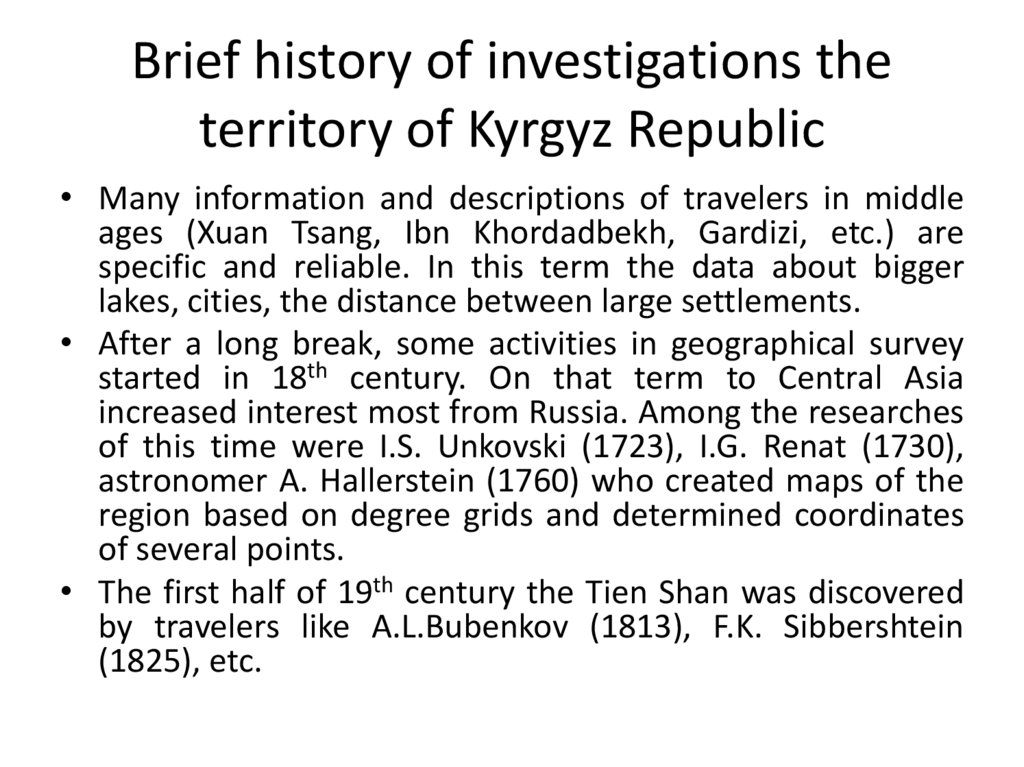
• Many information and descriptions of travelers in middle
ages (Xuan Tsang, Ibn Khordadbekh, Gardizi, etc.) are
specific and reliable. In this term the data about bigger
lakes, cities, the distance between large settlements.
• After a long break, some activities in geographical survey
started in 18th century. On that term to Central Asia
increased interest most from Russia. Among the researches
of this time were I.S. Unkovski (1723), I.G. Renat (1730),
astronomer A. Hallerstein (1760) who created maps of the
region based on degree grids and determined coordinates
of several points.
• The first half of 19th century the Tien Shan was discovered
by travelers like A.L.Bubenkov (1813), F.K. Sibbershtein
(1825), etc.
21.
Brief history of investigations theterritory of Kyrgyz Republic
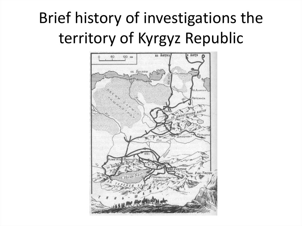
• On 1856 the chairman of Russian Geographic Society P.P. Semyonov (later
Semyonov Tyan-Shanski) reached to Issyk-Kul lake, central part of Tien
Shan Mountains. He explored headwaters of biggest river in the country
Naryn River. He made various discoveries: one of the first determined
features of geological structures refuted volcanic origin of Tien Shan
Mountains which created by A. Humbold, described valley glaciers,
estimated equilibrium line of glaciers, made altitudinal zonation of the
landscape. Further expeditions are donated by Russian Geographic
Society. Scientist like Ch. Valihanov, N.A. Severtsov, A.V. Kaulbars, A.P.
Fedchenko, I.V. Mushketov provided more than 70 expeditions and
researched in several branches. On last years of 19th century in larger
settlements established first hyrdometeorologial stations. The monitoring
process to some elements of nature was started. Representatives of the
local people population played a significant role in geographical study.
Although the main part of studies were carried by scientific institutions
from St. Petersburg, Moscow, Omsk, in the process of field work they
could not research without the help of the local people. As they know
better local topography, possible trails. Therefore local people took direct
and indirect part in geographical researches.
22.
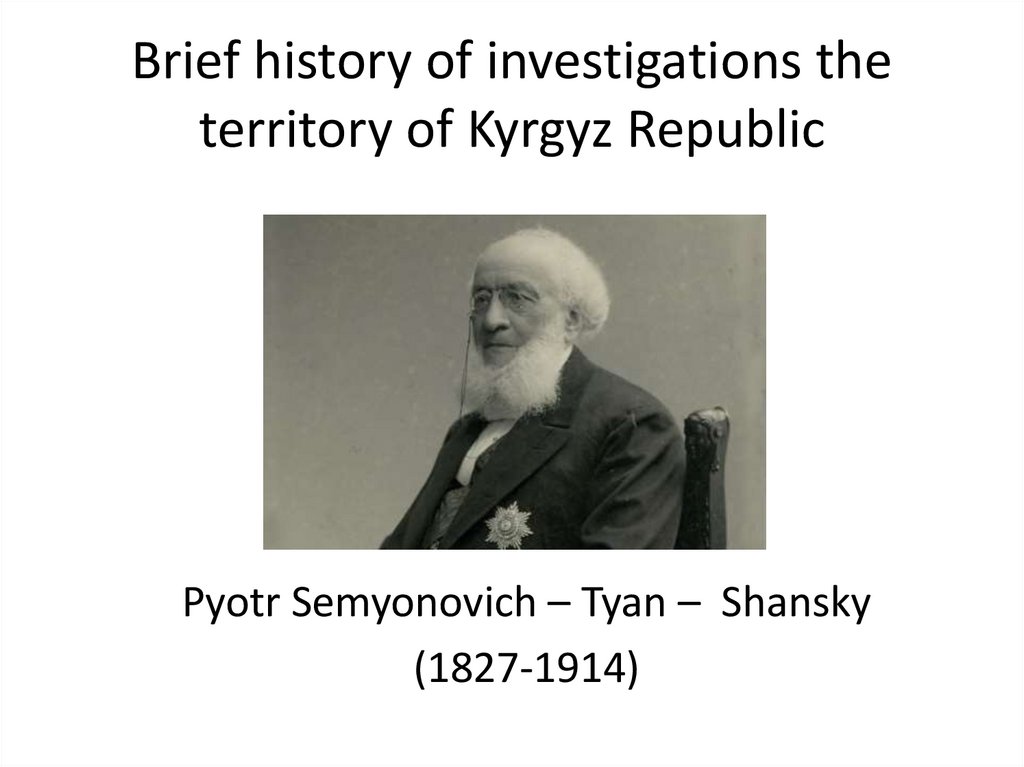
Brief history of investigations theterritory of Kyrgyz Republic
Pyotr Semyonovich – Tyan – Shansky
(1827-1914)
23.
Brief history of investigations theterritory of Kyrgyz Republic
24.
Brief history of investigations theterritory of Kyrgyz Republic
• After October revolution geographical researches in Kyrgyzstan
gained new specifics. The most researches provided under
systematic manual according to world standard in large scale in
geography and related fields. The numbers of observing stations
were increased and covered every inner mountains valley and each
zone. In research works involved local scientists from Academy in
science in Central Asia (founded in 1924), Central Asian State
University (SAGU, founded in 1925), Tashkent State University
(1918), Kyrgyz Geological Administration (1938), Geographical
Society of Kyrgyzstan (1947), Kyrgyz State University (1951),
Subdivision of Academy of Science in Kyrgyzstan (1954), etc. After
gaining the independence due to economic crisis the funding in
geographical surveys were declined. Due to shortage of resource
scientific society mostly concentrated on important branches
according to their vision.