


 Информатика
Похожие презентации:


")


Spatial data catalogues
1.
1Theme 4. SPATIAL DATA CATALOGUES
2.
24.1. General provisions on Spatial Data Catalogues
1. Spatial data that are stored for use in local databases can often
be used in external applications once they are published.
2. Spatial Data Catalogues are presented as a means to
publish descriptions of spatial data holdings in a standard
way to permit search across multiple servers.
3. Spatial Data Catalogues are discovery and access systems
that use metadata as the target for query on raster, vector, and
tabular geospatial information.
4. The principles described in this theme can be interpreted
and applied in a range of information management conditions
from non-digital collections of map information, through
small digital catalogues, to integrated repositories of data and
metadata.
5. Spatial metadata elements are stored and served through a
user-accessible catalogue of spatial information.
3.
36. Support of a discovery and access service for spatial information
is known variously within the geospatial community as:
1) 'Catalogue services' (OpenGIS Consortium);
2) 'Spatial Data Directory' (Australian Spatial Data Infrastructure);
3) 'Clearinghouse' and the 'Geospatial One-Stop Portal'
(U.S. FGDC).
7. Although they have different names, the goals of
discovering spatial data through the metadata properties they
report are the same.
8. For the purpose of consistency within this theme, these
services will be referred to as 'Catalogue Services'.
9. Further integration of these services with web mapping,
live access to spatial data, and additional services can lead to
exciting user environments in which data can be discovered,
evaluated and used in problem-solving, which can expand the
capabilities of proper spatial data infrastructure.
4.
4Notes.
1. Clearinghouse:
1) A distributed network of spatial data producers,
managers, and users linked electronically;
2) Incorporates the data discovery and distribution
components of a spatial data infrastructure.
2. Gateway – one of the Web devices/services.
5.
54.2. Distributed Spatial Data Catalogue concept
1. The Catalogue Gateway and its user interface allow a user
to query distributed collections of spatial information through
their metadata descriptions.
2. This information may take the form of “data” or of services
available to interact with spatial data, described with
complementary forms of metadata.
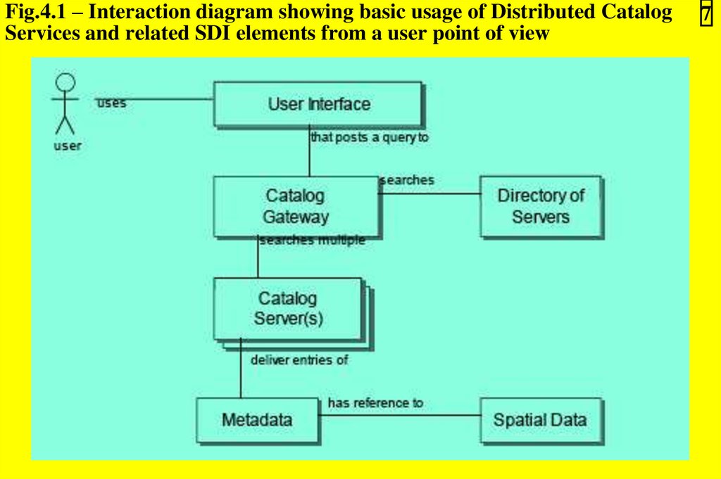
3. Figure 4.1 shows the basic interactions of various
individuals or organizations involved in the advertising and
discovery of spatial data.
4. A user interested in locating spatial information uses a
search user interface, fills out a search form, specifying
queries for data with certain properties.
6.
65. The search request is passed to the Catalogue Gateway and
poses the query of one or more registered catalogue servers.
6. Each catalogue server manages a collection of metadata
entries.
7. Within the metadata entries there are instructions on how
to access the spatial data being described.
8. There are a variety of user interfaces available in this type
of Catalogue search in various national and regional SDIs
around the world.
9. Interoperable search across international Catalogues can be
achieved through use of:
1) A common descriptive vocabulary (metadata);
2) A common search and retrieval protocol;
3) A registration system for servers of metadata collections.
7.
Fig.4.1 – Interaction diagram showing basic usage of Distributed CatalogServices and related SDI elements from a user point of view
7
8.
810. The Distributed Catalogue environment is more than just
a catalogue of locator records.
11. The Distributed Catalogue includes reference and/or
access to data, ordering mechanisms, map graphics for data
browsing, and other detailed use information that are
provided through the Metadata Entries.
12. This metadata acts in three roles:
1) Documenting the location of the information;
2) Documenting the content and structures of the
information;
3) Providing the end-user with detailed information on its
appropriate use.
9.
4.3. Organizational approach to Distributed Spatial Data 9Catalogue (Fig.4.2)
Fig.4.2 – Interaction diagram showing basic usage of Catalog Services and related SDI elements
10.
104.3.1. Terminology of Distributed Spatial Data Catalogue
architecture
1. Data Set – a specific packaging of spatial information
provided by a data producer or software, also known as a
feature collection, image, or coverage.
2. Metadata – a formalized set of descriptive properties that is
shared by a community to include guidance on expected
structures, definitions, repeatability, and conditionality of elements.
3. Metadata Entry – a set of metadata that pertains
specifically to a Data Set.
4. Catalogue – a single collection of Metadata Entries that is
managed together.
5. Catalogue Service – a service that responds to requests for
metadata in a Catalogue that comply with certain browse or
search criteria.
11.
116. Catalogue entry – a single Metadata Entry made accessible
through a Catalogue Service or stored in a Catalogue.
7. Service entry – the metadata for an evocable service or
operation, also known as operation or service metadata.
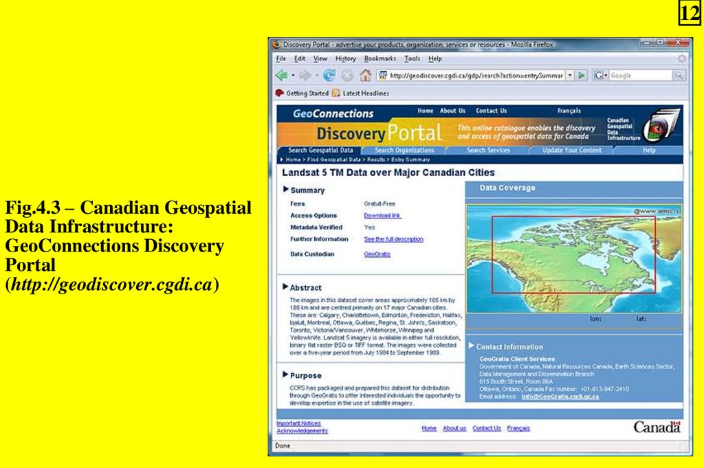
8. Portal (Web Portal) – a Web resource that provides
access to a broad array of related resources and services
(Fig.4.3). It uses portlets to allow many different programs to
operate within the same Web page.
9. Portlet:
1) A standard Web portal component that processes
requests and generates dynamic content;
2) Portlets are used in portals as pluggable user interfaces
to add specialized content, such as weather information,
news, or maps, to Web pages;
3) Users can customize the content, appearance, and
position of a portlet.
12.
12Fig.4.3 – Canadian Geospatial
Data Infrastructure:
GeoConnections Discovery
Portal
(http://geodiscover.cgdi.ca)
13.
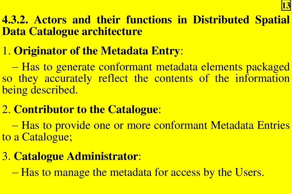
134.3.2. Actors and their functions in Distributed Spatial
Data Catalogue architecture
1. Originator of the Metadata Entry:
– Has to generate conformant metadata elements packaged
so they accurately reflect the contents of the information
being described.
2. Contributor to the Catalogue:
– Has to provide one or more conformant Metadata Entries
to a Catalogue;
3. Catalogue Administrator:
– Has to manage the metadata for access by the Users.
14.
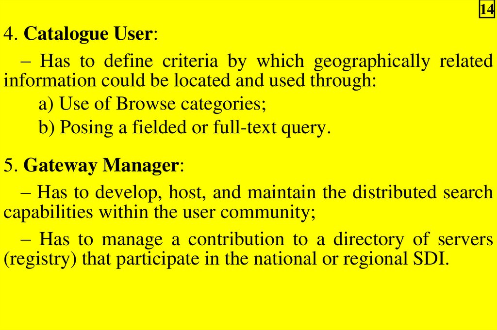
144. Catalogue User:
– Has to define criteria by which geographically related
information could be located and used through:
a) Use of Browse categories;
b) Posing a fielded or full-text query.
5. Gateway Manager:
– Has to develop, host, and maintain the distributed search
capabilities within the user community;
– Has to manage a contribution to a directory of servers
(registry) that participate in the national or regional SDI.
15.
154.3.3. Catalogue Server/Service organizational development
1. The construction of a Catalogue Service capability for
spatial information is built upon on the commitment to collect
and manage some level of spatial metadata within an
organization.
2. The following use case scenario for the publishing of a
Metadata Entry:
1) A Contributor of Metadata receives the description of
a new spatial data set developed by other professional staff;
2) This metadata is generated in a transferable encoding
format to allow exchange of the metadata without loss of
context or information content;
3) This metadata entry is passed to a Catalogue
Administrator for consideration and loading to the
catalogue;
16.
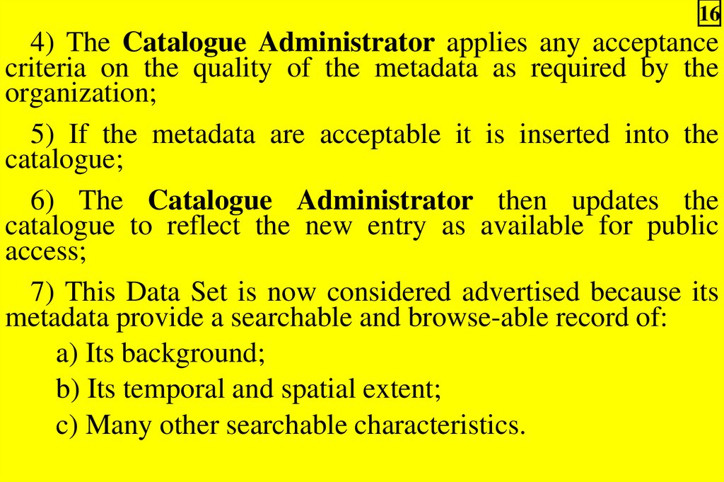
164) The Catalogue Administrator applies any acceptance
criteria on the quality of the metadata as required by the
organization;
5) If the metadata are acceptable it is inserted into the
catalogue;
6) The Catalogue Administrator then updates the
catalogue to reflect the new entry as available for public
access;
7) This Data Set is now considered advertised because its
metadata provide a searchable and browse-able record of:
a) Its background;
b) Its temporal and spatial extent;
c) Many other searchable characteristics.
17.
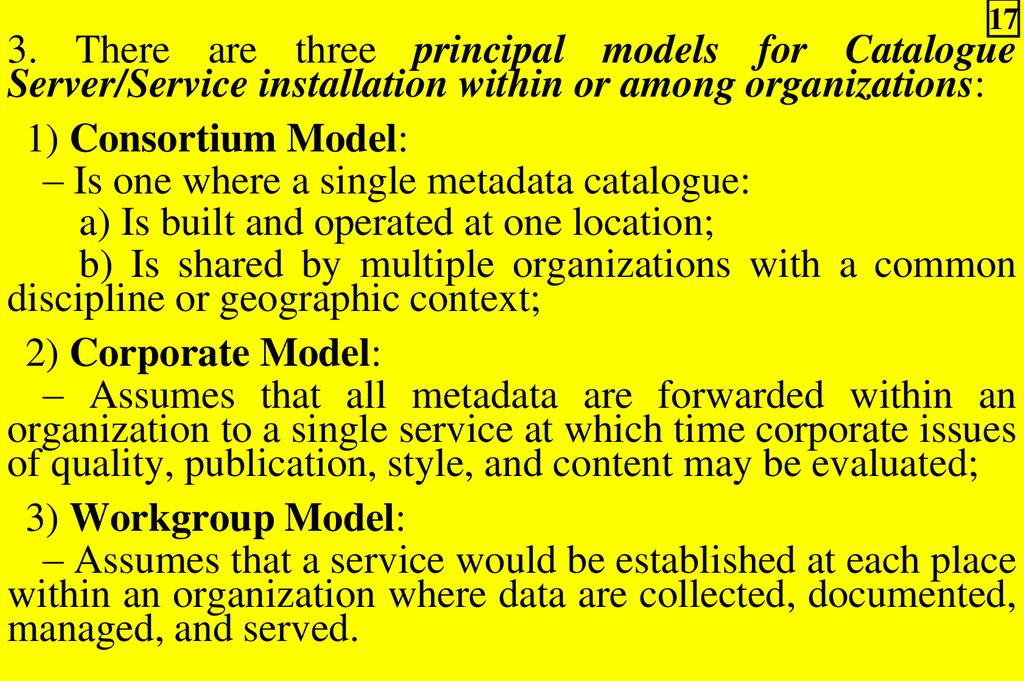
173. There are three principal models for Catalogue
Server/Service installation within or among organizations:
1) Consortium Model:
– Is one where a single metadata catalogue:
a) Is built and operated at one location;
b) Is shared by multiple organizations with a common
discipline or geographic context;
2) Corporate Model:
– Assumes that all metadata are forwarded within an
organization to a single service at which time corporate issues
of quality, publication, style, and content may be evaluated;
3) Workgroup Model:
– Assumes that a service would be established at each place
within an organization where data are collected, documented,
managed, and served.
18.
184.3.4. Catalogue Gateway and access interface
organizational development
1. Problem can be divided into two related parts that must interrelate:
1) A User Interface (Search/Browse Interface, fig 4.2);
2) A query distributor (Catalogue/Gateway Portal, fig 4.2).
2. Figure 4.4 shows the possible configurations of a
Catalogue Gateway and the User Interface:
1) Client A accesses a User Interface that is downloaded
(as forms or an applet) from a host on the Internet that is also
managing multiple connections to servers;
2) Client B is accessing a User Interface from a location
that is different from that of the Gateway supporting the
construction of customized user interfaces for a community;
3) Client C is a client-side "desktop" application that is fully
self-contained and includes the User Interface and distributed
query capabilities for direct connection to remote servers.
19.
193. Two styles of interaction are known to exist in Web
search interfaces that are equally well applied to Distributed
Catalogue access:
1) The first style is query in which the user specifies
search criteria for search using simple to advanced interfaces;
2) The second style is a browse interface in which the user
is presented with categories of information and selects paths
or groupings, often in hierarchical form, to traverse.
20.
20Notes.
1. The challenge of constructing and supporting browse
mechanism across a global collection of servers is the work
required in building and supporting a universal vocabulary
for classification and its hierarchy or word space, known as
ontology.
2. Ontology – a controlled, hierarchical vocabulary for
describing a knowledge system.
21.
214.3.5. Organizational registering of Catalogue Servers
1. The nature of Distributed Catalogues requires that the
knowledge of the existence and properties of any given
catalogue participating in a community be known to the
community.
2. The Directory of Servers' concept allows an individual
catalogue operator to construct and register service metadata
with a central authority.
3. National listings of compatible catalogue servers have
already been built.
4. The operation of a global network of Catalogue Servers
within GSDI will require that a common Directory of Servers
be built and managed to assure current content, distributed
ownership, and authoritative reference to servers.
22.
225. The features of the Directory of Servers may include:
1) One descriptive entry per service collection (server
metadata);
2) Ability for a donor to contribute or update a record in the
directory;
3) Ability to validate access to a server, as advertised;
4) User browse access of online server metadata;
5) Software search access of server metadata;
6) Management of active/inactive records, accessibility
statistics.
6. Several national Distributed Catalogue activities support
management services for server-level metadata and contain
references to servers predominantly in their country.
23.
237. The GSDI now sponsors a global directory of catalogue
servers for all countries to utilize:
1) With delegation of authority made to participating
countries to manage and validate host information for their
servers (http://registry.gsdi.org/registry);
2) But it does not provide for the cataloguing of all service
types at this time.
8. The UDDI (http://www.uddi.org) offers the potential of a
public, replicated “universal business registry” hosted by
IBM, Microsoft, and SAP, that could be used by SDI
publishers to advertise the existence of their services.
9. Research into the use of the UDDI as a service directory
for the GSDI is underway.
24.
24Key standardization efforts in access to catalogues are
found in the:
1) ISO 23950 Search and Retrieve Protocol:
2) The OpenGIS Consortium
Specification Version 1.0;
Catalogue
Services
3) Relevant standards or "recommendations" of the World
Wide Web Consortium (W3C).
25.
254.4. Implementation approach to Distributed Spatial Data
Catalogue
1. The development of operational Distributed Catalogue
Services has been taking place in a number of countries
including the United States, Canada, Mexico, Australia, and
South Africa as primary examples.
2. The software systems used to implement the ISO 23950
and Web based services has been developed largely through
governmental support, resulting in both open source and
commercial software solutions.
3. The evolution of protocols and industry practices are
difficult to predict, but this theme provides a review of
available solutions.
26.
264. Let's review a technical use case scenario for access to a
Distributed Catalogue:
1) A User uses client software to discover that a Distributed
Catalogue search service exists. This may be done through:
a) A search of Web resources;
b) A saved bookmark, reference from a referring page;
c) Word-of-mouth referral;
2) User opens the User Interface and assembles the
parameters required to narrow down a search of available
information;
3) The search request is passed to one or more servers based
on user requirements through a Gateway service:
– The search may be iterative, repeating or refining queries
based on new interactions with the user;
27.
274) Results are returned from each server and are collated and
presented to the User. Types of response styles may include:
a) A list of "hits" in title and link format;
b) A brief formatting of information;
c) A full presentation of metadata;
d) Display of Data Set locations on a map, thematic
groupings, or temporal extent.
5) User selects:
a) The relevant Metadata Entry by name or reference;
b) The presentation content (brief, full, other) and the
format (HTML, XML, Text, other) for further review;
6) User decides whether to acquire the Data Set through
linkages in the metadata.
28.
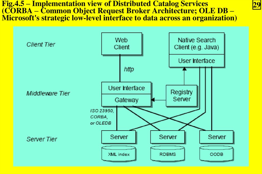
285. The Distributed Catalogue is implemented using a multitier software architecture that includes (Figure 4.5):
1) A Client Tier;
2) A Middleware or “Gateway” Tier;
3) A Server Tier.
29.
Fig.4.5 – Implementation view of Distributed Catalog Services(CORBA – Common Object Request Broker Architecture; OLE DB –
Microsoft's strategic low-level interface to data across an organization)
29
30.
304.4.1.
Catalogue
development
Server/Service
implementation
1. To encourage widespread participation in the
Clearinghouse, Catalogue Service software has been
developed under direction of the FGDC and other
coordination organizations around the world.
2. Reference implementations of software exist to provide a
free or low-cost example of metadata management and
Distributed Catalogue service that can be quickly
implemented.
3. The software can also be used as reference by commercial
developers to test anticipated functionality and
interoperability and to develop value-added products.
31.
314. A Catalogue Service that participates in a Distributed
Catalogue should fulfill the following requirements:
1) Support of a standard protocol (ISO 23950 preferred) for
search and retrieval on an Internet-accessible server;
2) Linkage to an indexed metadata management system that:
a) Supports multi-field queries on text, numeric, and
extended data types;
b) Can return entries in a structured form that are or can be
converted into a requested report in HTML, XML, and text.
This may be:
– A relational database;
– An object-relational database;
– An XML database;
– Even a request to a remote catalogue to perform
cascading catalogue services;
32.
323) Ability to translate public fields/attribute structures into
names and structures used in the metadata management
system using a national or international vocabulary (ISO
19115, when available);
4) Ability to add, update or delete Metadata Entries in the
metadata management system.
33.
334.4.2. Catalogue Gateway
implementation development
and
access
interface
1. As depicted in Figures 4.4 and 4.5, there is often a need for
an intermediary to provide application integration for an end
user.
2. Known as "Application servers" or Middleware, these
hosts allow for the storage, construction, and download of
user interfaces to end users and communicate with multiple
Catalogue Servers simultaneously – a feat not supported by
many web browsers due to security settings.
34.
343. Software systems, such as Application Servers, that
integrate catalogue search and other GIS and mapping
functions benefit from the community development of
software development kits (SDKs) based on standards.
4. SDKs can provide client and server libraries for catalogue
search and other services based on standard interfaces.
5. Through component architecture, these SDKs expedite
development of advanced software by combining appropriate
pieces of software together as needed, reducing the need for a
programmer to learn the intricacies of a given service.
35.
354.4.3. Implementation registering of Catalogue Servers
1. The operation of a growing network of Distributed
Catalogue Servers requires the management of server-level
information in a central location.
2. This registry server, shown in Figure 4.5, essentially
houses server or collection-level metadata for search and
retrieval and use in distributed query.
3. In this way a search may be first made of the Registry of
Servers to identify candidate servers to target the query:
– And as a broker, the registry returns the list of likely
targets based on criteria such as geographic and temporal
extent and other search limits.
36.
364. A registry facility greatly improves the scalability of a
national, regional or global network of Catalogues.
5. In the context of the GSDI, a coordinated registry of
catalogue (and other) services is needed.
6. If all Catalogues were registered into a common and
distributed registry, resolution of appropriate hosts of spatial
information globally will be enabled.
7. A coordinated registry between the U.S. and Canada is
proposed through an interagency agreement between the
FGDC/GSDI Secretariat and Geomatics Canada:
– As a model for other countries to follow in managing and
coordinating their own national catalogue entries with the
global system.