


 География
 Культурология
Похожие презентации:


")


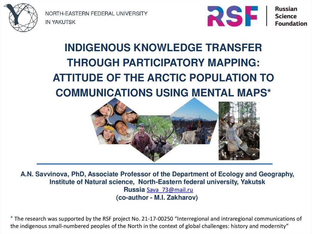
Indigenous knowledge transfer through participatory mapping: attitude of the arctic population to communications
1.
INDIGENOUS KNOWLEDGE TRANSFERTHROUGH PARTICIPATORY MAPPING:
ATTITUDE OF THE ARCTIC POPULATION TO
COMMUNICATIONS USING MENTAL MAPS*
A.N. Savvinova, PhD, Associate Professor of the Department of Ecology and Geography,
Institute of Natural science, North-Eastern federal university, Yakutsk
Russia Sava_73@mail.ru
(co-author - M.I. Zakharov)
* The research was supported by the RSF project No. 21-17-00250 “Interregional and intraregional communications of
the indigenous small-numbered peoples of the North in the context of global challenges: history and modernity”
2.
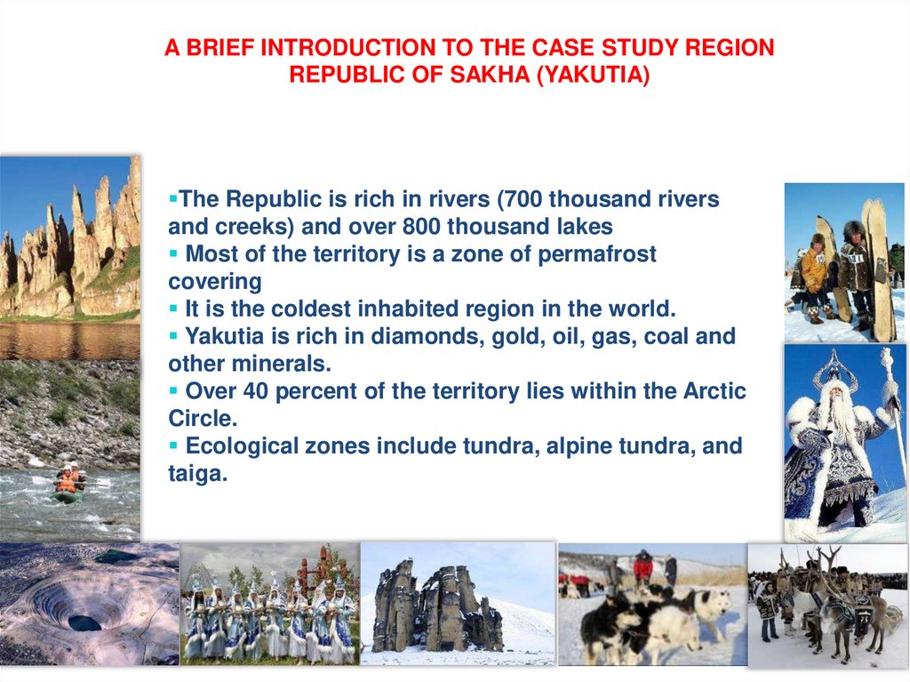
A BRIEF INTRODUCTION TO THE CASE STUDY REGIONREPUBLIC OF SAKHA (YAKUTIA)
The Republic is rich in rivers (700 thousand rivers
and creeks) and over 800 thousand lakes
Most of the territory is a zone of permafrost
covering
It is the coldest inhabited region in the world.
Yakutia is rich in diamonds, gold, oil, gas, coal and
other minerals.
Over 40 percent of the territory lies within the Arctic
Circle.
Ecological zones include tundra, alpine tundra, and
taiga.
3.
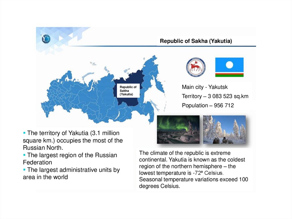
Republic of Sakha (Yakutia)Republic of
Sakha
(Yakutia)
Main city - Yakutsk
Territory – 3 083 523 sq.km
Population – 956 712
The territory of Yakutia (3.1 million
square km.) occupies the most of the
Russian North.
The largest region of the Russian
Federation
The largest administrative units by
area in the world
The climate of the republic is extreme
continental. Yakutia is known as the coldest
region of the northern hemisphere – the
lowest temperature is -72º Celsius.
Seasonal temperature variations exceed 100
degrees Celsius.
4.
2. PROBLEMS FACED BY THEINHABITANTS OF THE NORTHERN
REGIONS
Problems of Traditional Nature Use associated with Industrial
Development – case of the Southern Yakutia
“It is necessary to obtain
permission to enter through the
territory of the pipeline” (resident)
“Industrial companies do not pay compensation to
the municipality, but only negotiate one-time
compensation directly with the tribal communities
through which the oil and gas pipeline passes… Do
not provide jobs for our youth” (resident)
5.
Problems in the reindeer herding in Yakutia“The laws do not protect us.
Industrial enterprises, prospecting
cooperatives cheat, they take our
reindeer meat but do not pay the
money” (resident)
“Last year I lost ¼ of my reindeer
herd to wolves” (resident).
6.
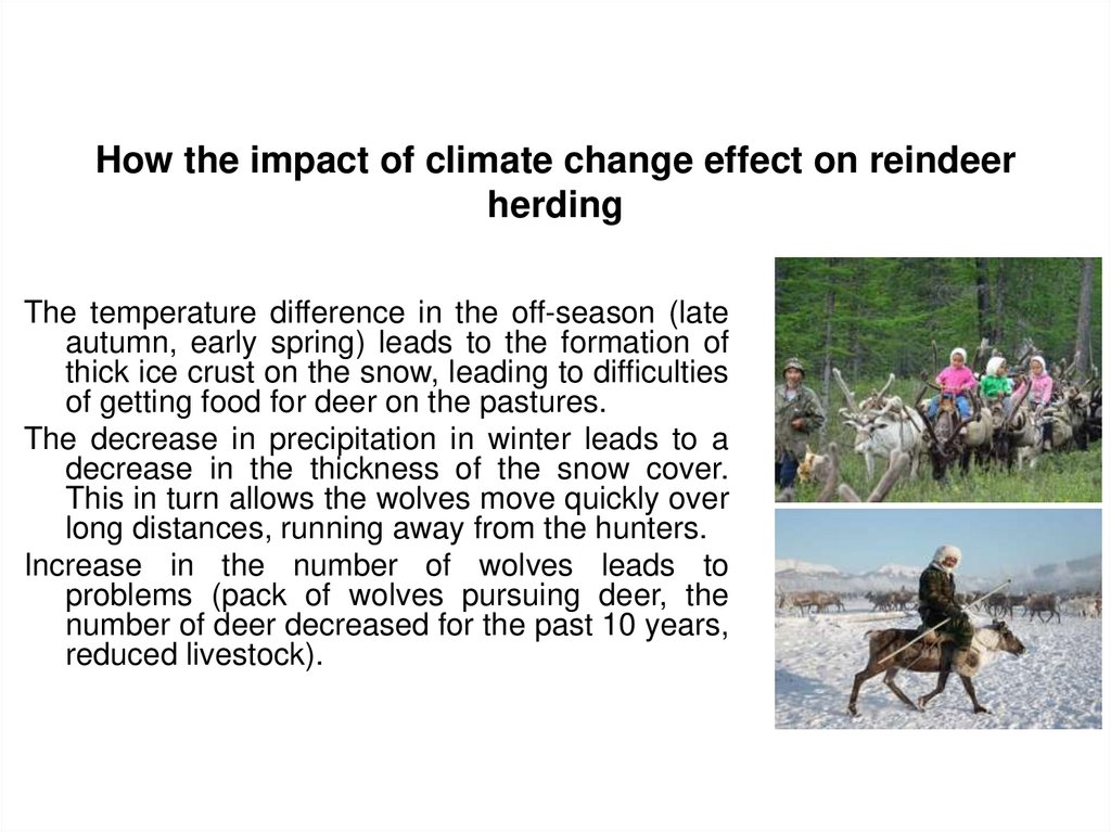
How the impact of climate change effect on reindeerherding
The temperature difference in the off-season (late
autumn, early spring) leads to the formation of
thick ice crust on the snow, leading to difficulties
of getting food for deer on the pastures.
The decrease in precipitation in winter leads to a
decrease in the thickness of the snow cover.
This in turn allows the wolves move quickly over
long distances, running away from the hunters.
Increase in the number of wolves leads to
problems (pack of wolves pursuing deer, the
number of deer decreased for the past 10 years,
reduced livestock).
7.
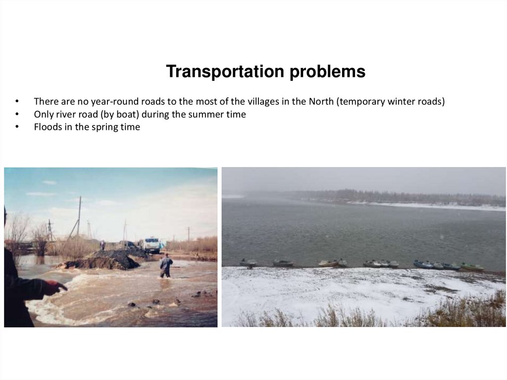
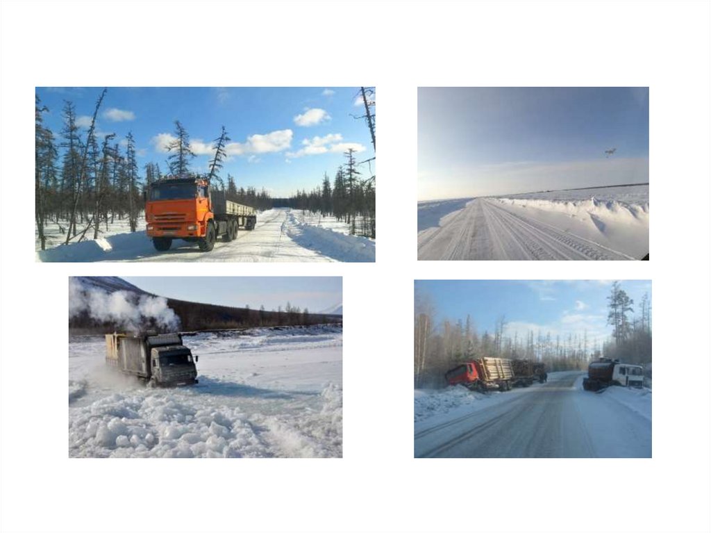
Transportation problemsThere are no year-round roads to the most of the villages in the North (temporary winter roads)
Only river road (by boat) during the summer time
Floods in the spring time
8.
indigenousmaps.com9.
indigenousmaps.com10.
indigenousmaps.com11.
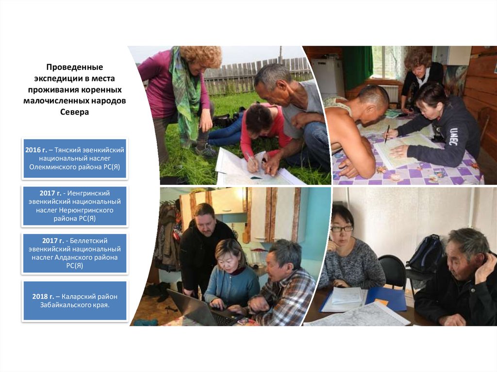
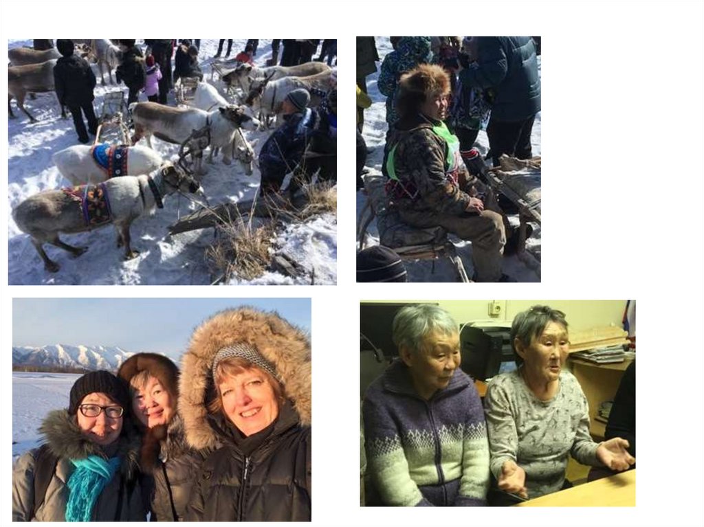
Проведенныеэкспедиции в места
проживания коренных
малочисленных народов
Севера
2016 г. – Тянский эвенкийский
национальный наслег
Олекминского района РС(Я)
2017 г. - Иенгринский
эвенкийский национальный
наслег Нерюнгринского
района РС(Я)
2017 г. - Беллетский
эвенкийский национальный
наслег Алданского района
РС(Я)
2018 г. – Каларский район
Забайкальского края.
12.
13.
14.
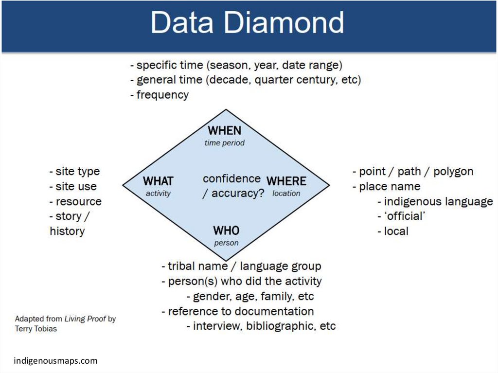
MAPPING METHODOLOGYGeneration of New Information using
Indigenous knowledge
Information about the real traditional land
use territories and comparing these
boundaries with an official land use
boundaries
What is the difference between these
two kinds of land use???
15.
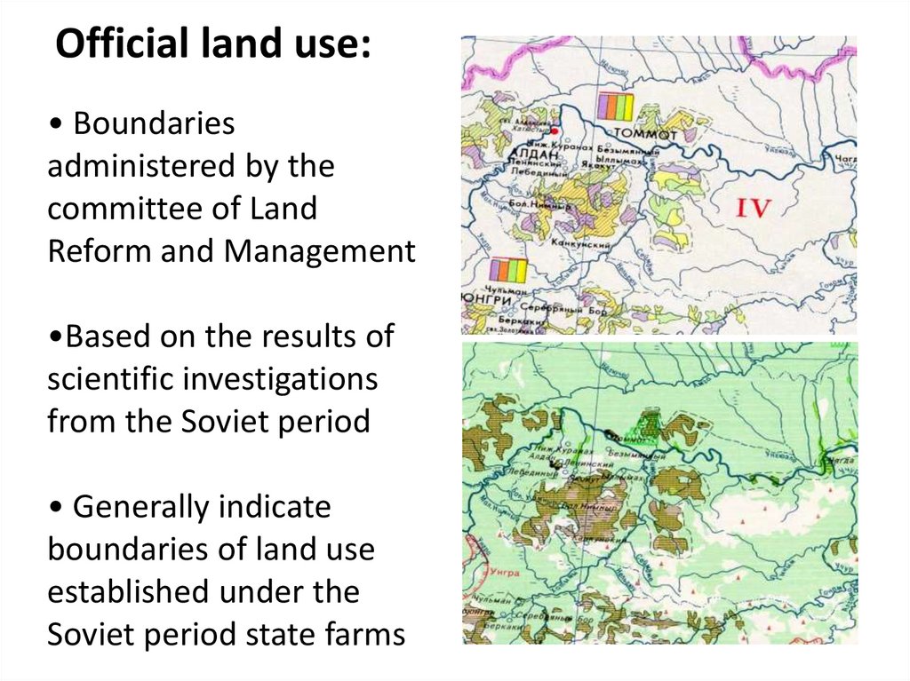
Official land use:• Boundaries
administered by the
committee of Land
Reform and Management
•Based on the results of
scientific investigations
from the Soviet period
• Generally indicate
boundaries of land use
established under the
Soviet period state farms
16.
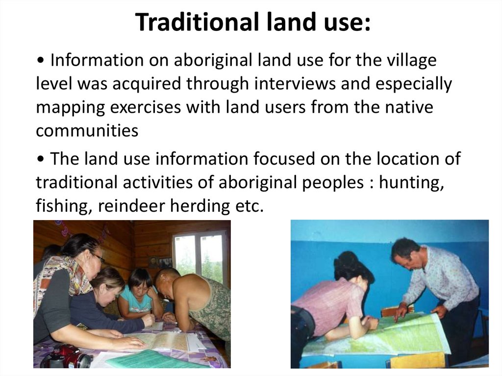
Traditional land use:• Information on aboriginal land use for the village
level was acquired through interviews and especially
mapping exercises with land users from the native
communities
• The land use information focused on the location of
traditional activities of aboriginal peoples : hunting,
fishing, reindeer herding etc.
17.
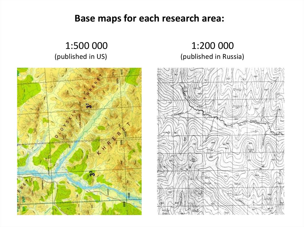
Base maps for each research area:1:500 000
(published in US)
1:200 000
(published in Russia)
18.
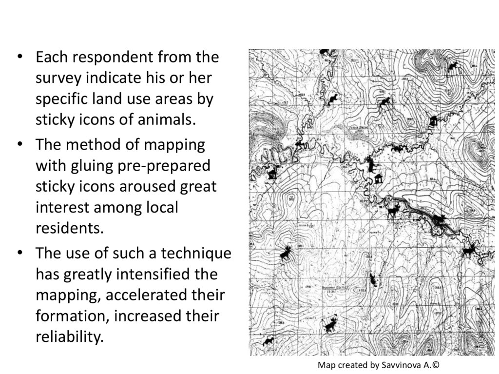
• Each respondent from thesurvey indicate his or her
specific land use areas by
sticky icons of animals.
• The method of mapping
with gluing pre-prepared
sticky icons aroused great
interest among local
residents.
• The use of such a technique
has greatly intensified the
mapping, accelerated their
formation, increased their
reliability.
Map created by Savvinova A.©
19.
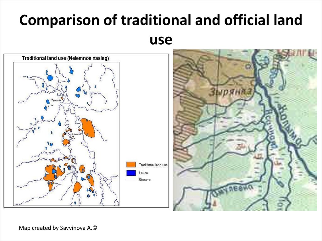
Comparison of traditional and official landuse
Map created by Savvinova A.©
20.
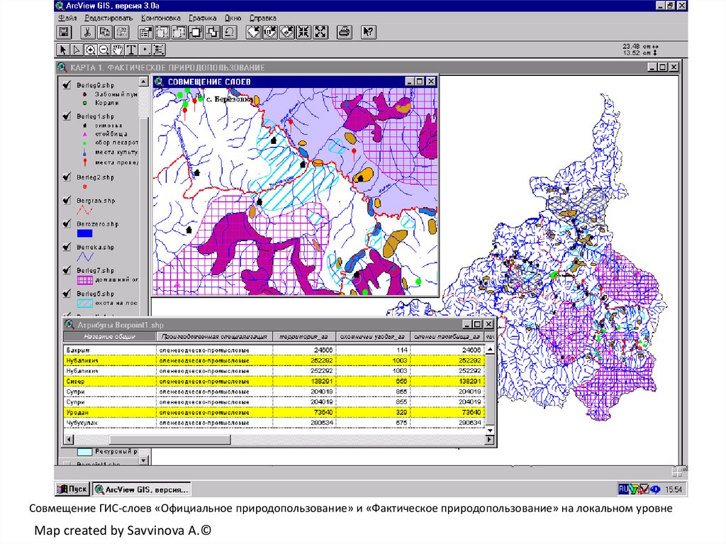
Совмещение ГИС-слоев «Официальное природопользование» и «Фактическое природопользование» на локальном уровнеMap created by Savvinova A.©
21.
Maps created by Savvinova A.©v22.
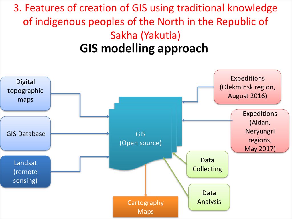
3. Features of creation of GIS using traditional knowledgeof indigenous peoples of the North in the Republic of
Sakha (Yakutia)
GIS modelling approach
Digital
topographic
maps
Expeditions
(Olekminsk region,
August 2016)
GIS Database
Expeditions
(Aldan,
Neryungri
regions,
May 2017)
GIS
(Open source)
Data
Collecting
Landsat
(remote
sensing)
Cartography
Maps
Data
Analysis
23.
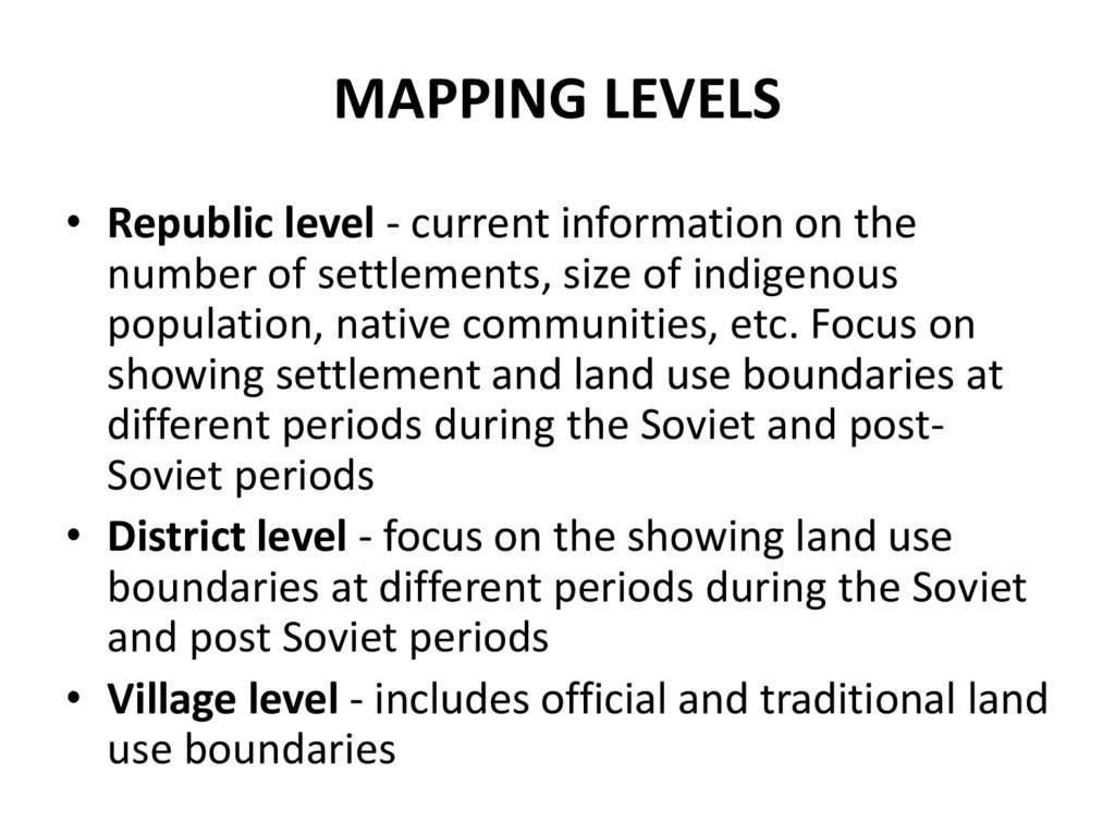
MAPPING LEVELS• Republic level - current information on the
number of settlements, size of indigenous
population, native communities, etc. Focus on
showing settlement and land use boundaries at
different periods during the Soviet and postSoviet periods
• District level - focus on the showing land use
boundaries at different periods during the Soviet
and post Soviet periods
• Village level - includes official and traditional land
use boundaries
24.
Example of a map at the republican levelTerritories of traditional land use
Mineral resource mining areas
Territories of overlaps
Map created by Savvinova A.©
25.
Example of a map Regional level(Pipeline crossing territories of tribal communities)
Map created by Savvinova A.©
26.
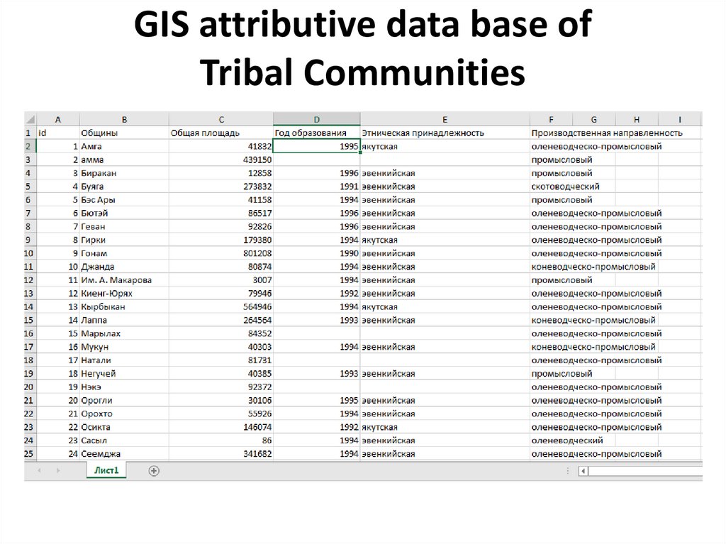
GIS attributive data base ofTribal Communities
27.
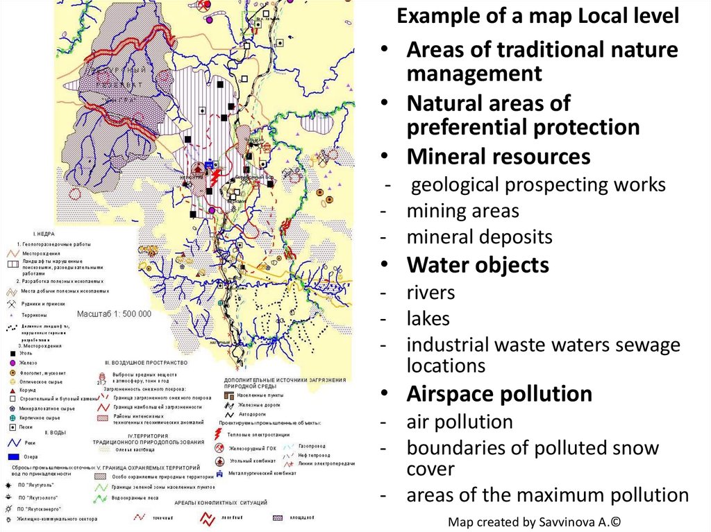
Example of a map Local level• Areas of traditional nature
management
• Natural areas of
preferential protection
• Mineral resources
- geological prospecting works
- mining areas
- mineral deposits
• Water objects
- rivers
- lakes
- industrial waste waters sewage
locations
• Airspace pollution
- air pollution
- boundaries of polluted snow
cover
- areas of the maximum pollution
Map created by Savvinova A.©
28.
CREATING 3D GIS - MODELS FOR ANALYSISOF POTENTIAL EFFECTS OF OIL SPILLS ALONG THE ROUTE OF THE
PIPELINE "EASTERN SIBERIA - PACIFIC OCEAN" THAT CROSSES THE TRIBAL
COMMUNITY TERRITORIES
29.
4. CARTOGRAPHIC APPROACH TO DECREASING TERRITORIALCONFLICTS BETWEEN INDIGNEOUS PEOPLE AND INDUSTRY
IN YAKUTIA
Types of conflicts:
• Potential conflicts: those that threaten to develop if natural
resource use by Indigenous peoples is constrained due to industrial
development in areas in a Specially Protected Territories.
• Existing conflicts: real controversies and confrontations between
industrial developers and Indigenous people over types and
volumes of resource extraction and related infrastructure
development (e.g., mining, electric lines, roads, pipeline
construction in the areas allocated to Indigenous peoples for
traditional activities), as well as over compensation for damages
and revenue sharing.
In some cases conflict can result from misunderstandings on the part
of one or both of the parties (usually such situations arise from the
lack of the awareness of one or both of the parties).
30.
Challenges and opportunities of the use ofdifferent interviewing methods
a) Features of the multi-temporal survey
The survey questionnaire is a method of direct or indirect
collection of primary information by socio-psychological
interaction between interviewer and interviewee.
31.
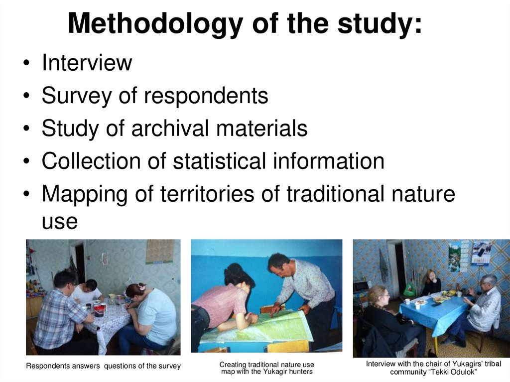
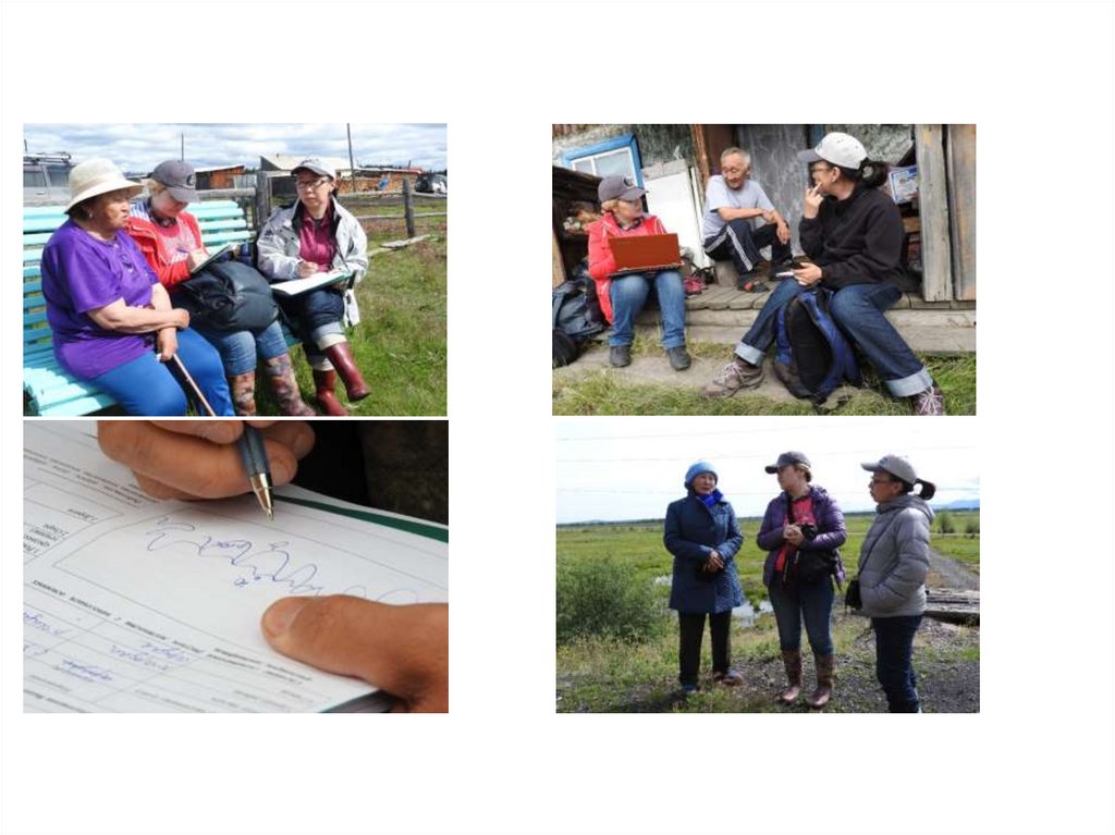
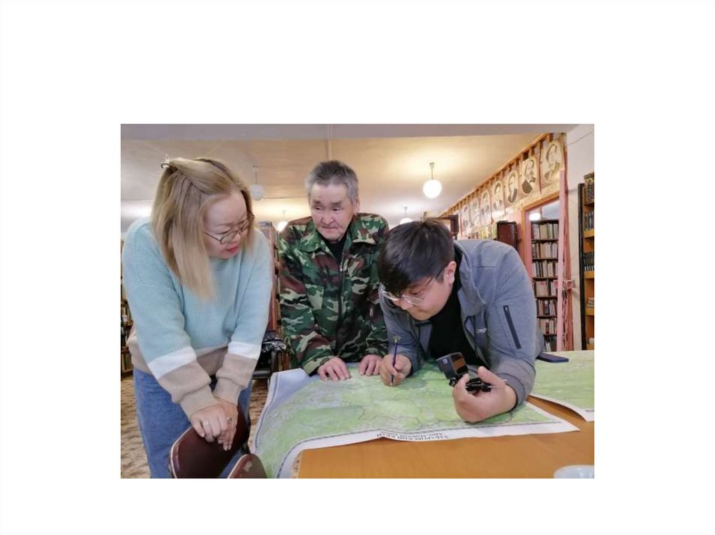
Methodology of the study:• Interview
• Survey of respondents
• Study of archival materials
• Collection of statistical information
• Mapping of territories of traditional nature
use
Respondents answers questions of the survey
Creating traditional nature use
map with the Yukagir hunters
Interview with the chair of Yukagirs’ tribal
community “Tekki Odulok”
32.
3233.
b) The Survey of expert opinion• Another type of research, which was applied in the study of
indigenous peoples of the North, as well as to identify
problematic issues existing in land use of indigenous peoples, is
a survey of expert opinion, carried out in the form of open
ended interviews with representatives of government
structures involved in the formation of policy of ethnic
territoriality.
Фото
34.
С) Personal interview• The method of personal interview was selected for this study
with the purpose of reception of answers to questions of high
complexity, because personal communication involves a more
narrative and in-depth study of the issues.
• Face-by-face meetings with the representatives of the
Indigenous peoples of the North, parliament members and an
active defenders of the interests of Indigenous peoples in 3
levels (republic, district (ulus) and local communities and the
tribal communities) .
35.
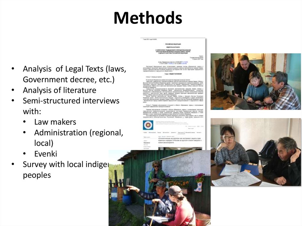
Methods• Analysis of Legal Texts (laws,
Government decree, etc.)
• Analysis of literature
• Semi-structured interviews
with:
• Law makers
• Administration (regional,
local)
• Evenki
• Survey with local indigenous
peoples
36.
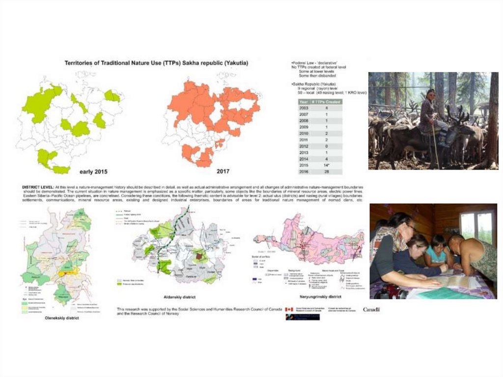
Territories of Traditional Nature Use (TTPs) Sakha Republic (Yakutia)This project seeks to understand how new spaces for indigenous peoples
are being created in the Russian Federation by legal means, what types of
spaces are being created and what values and perceptions underpin the
laws that enable these spaces; and how the law and the spaces it has
authorized have evolved over the past quarter century.
37.
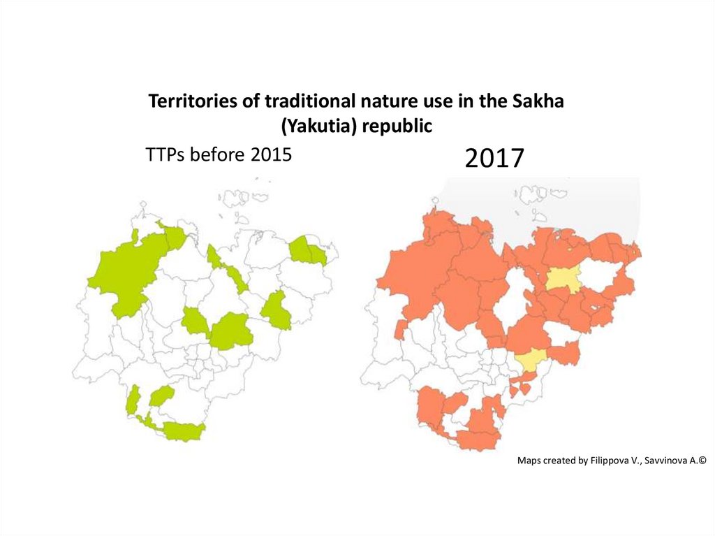
Territories of traditional nature use in the Sakha(Yakutia) republic
TTPs before 2015
2017
Maps created by Filippova V., Savvinova A.©
38.
D) Focus-group survey method andcomparative studies of different
regions
A focus group is a qualitative research method, which consists
in providing group depth interviews. The purpose of focus
groups is to clarify the relation of the participants to the
problem of the research.
• Focus group: in the framework of identifying problems.
Can be held as a round table with representatives of
population, living in the local communities. A focus group is
a qualitative research method, which consists in providing
group depth interviews.
• The purpose of focus groups is to clarify the relation of the
participants to the problem of the study.
39.
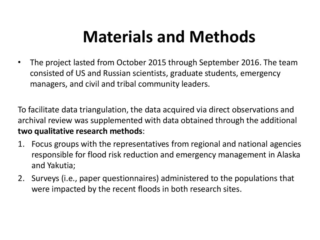
Materials and Methods• The project lasted from October 2015 through September 2016. The team
consisted of US and Russian scientists, graduate students, emergency
managers, and civil and tribal community leaders.
To facilitate data triangulation, the data acquired via direct observations and
archival review was supplemented with data obtained through the additional
two qualitative research methods:
1. Focus groups with the representatives from regional and national agencies
responsible for flood risk reduction and emergency management in Alaska
and Yakutia;
2. Surveys (i.e., paper questionnaires) administered to the populations that
were impacted by the recent floods in both research sites.
40.
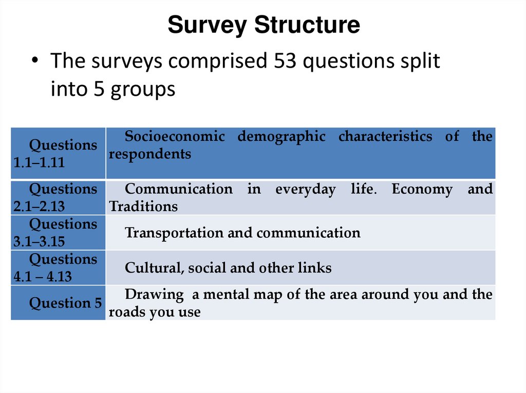
Survey Structure• The surveys comprised 53 questions split
into 5 groups
Socioeconomic demographic characteristics of the
Questions
respondents
1.1–1.11
Questions
Communication in everyday life. Economy and
2.1–2.13
Traditions
Questions
Transportation and communication
3.1–3.15
Questions
Cultural, social and other links
4.1 – 4.13
Drawing a mental map of the area around you and the
Question 5
roads you use
41.
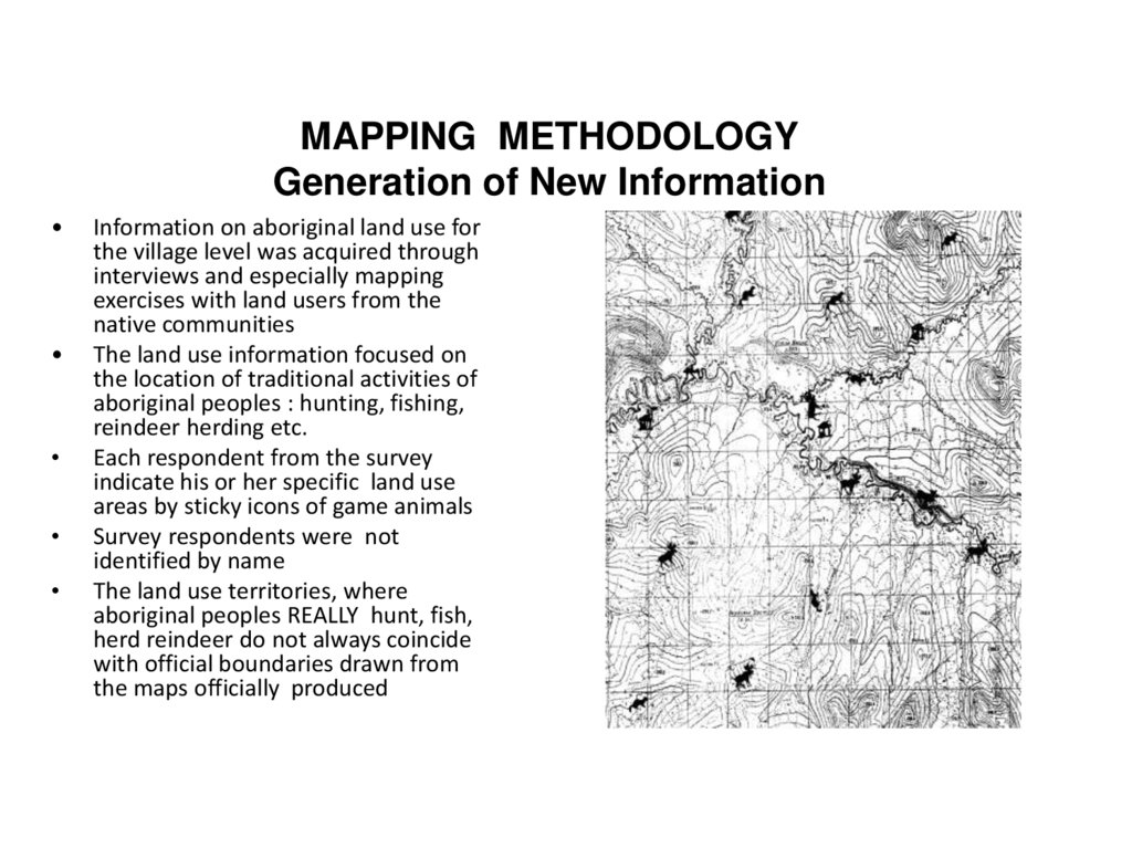
MAPPING METHODOLOGYGeneration of New Information
Information on aboriginal land use for
the village level was acquired through
interviews and especially mapping
exercises with land users from the
native communities
The land use information focused on
the location of traditional activities of
aboriginal peoples : hunting, fishing,
reindeer herding etc.
Each respondent from the survey
indicate his or her specific land use
areas by sticky icons of game animals
Survey respondents were not
identified by name
The land use territories, where
aboriginal peoples REALLY hunt, fish,
herd reindeer do not always coincide
with official boundaries drawn from
the maps officially produced
42.
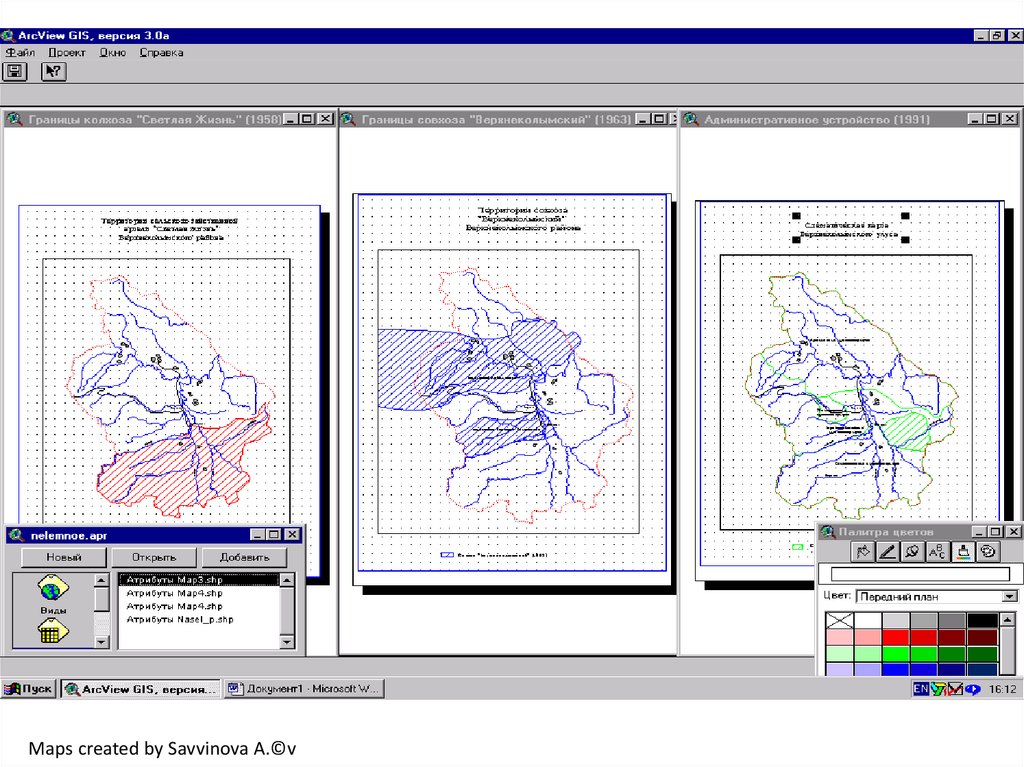
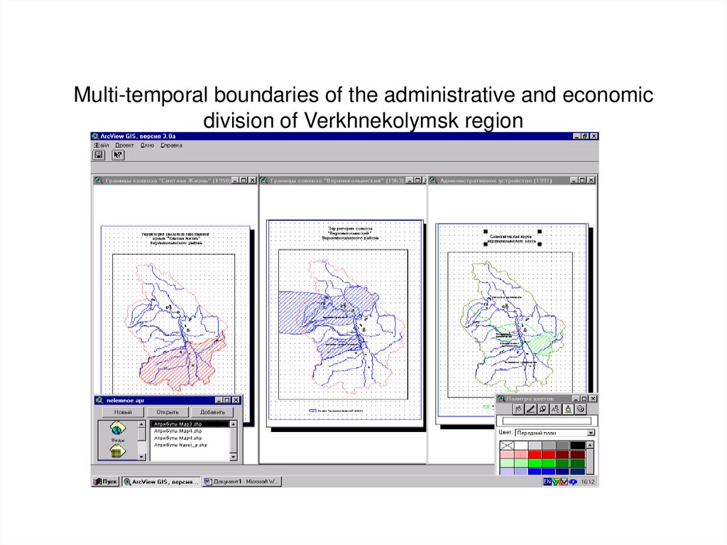
Multi-temporal boundaries of the administrative and economicdivision of Verkhnekolymsk region
43.
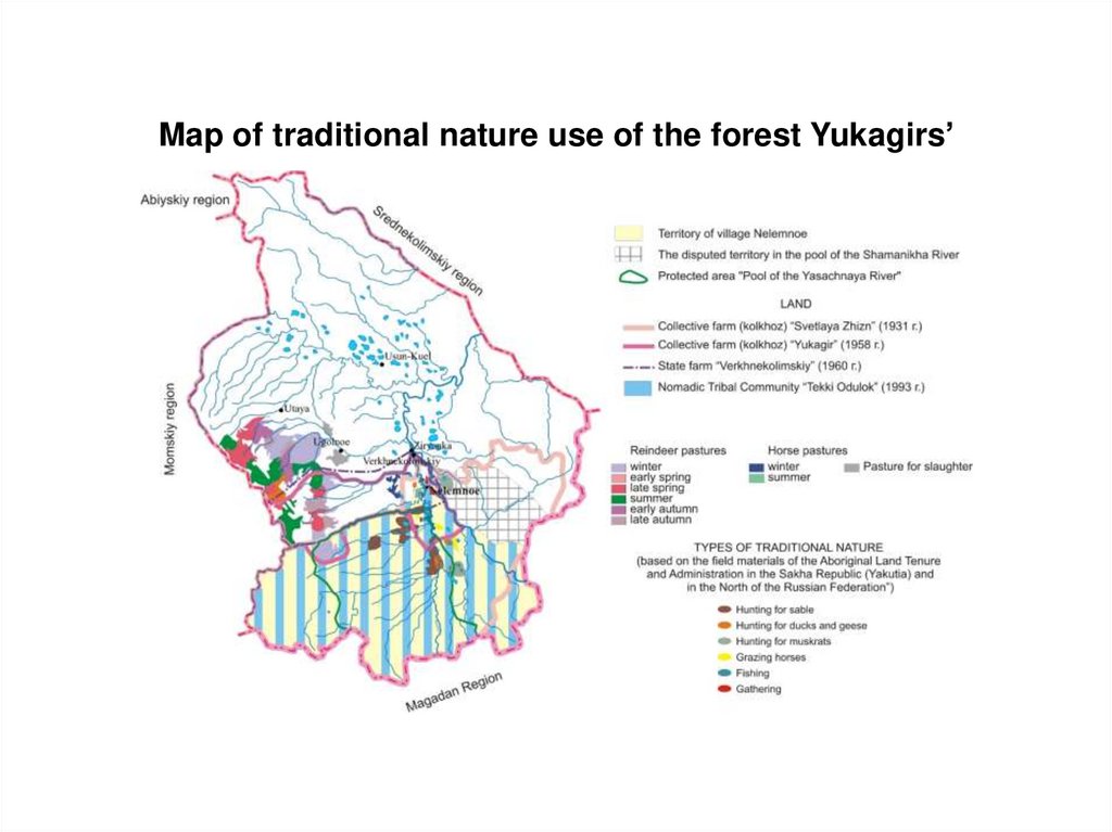
Map of traditional nature use of the forest Yukagirs’44.
Conclusions:1) Conflict situations arising due to unsustainable use of natural
resources in the Southern Yakutia can be identified and classified
through mapping
2) A series of specific maps of negative impacts and conflict
situations in Sakha Republic (Yakutia) have been developed for the
three levels: Republican, Regional (Southern Yakutia) and local
(district) level
3) These maps demonstrate an integrated cartographic evaluation of
the consequences of negative impacts and conflicts for the nature
management in some regions of Yakutia.
4)
The results of the study will facilitate the development of
proposals and advice concerning how to address conflicts between
industrial development and traditional land uses, and regarding
programmes aimed at the socio-economic development of
indigenous small-numbered peoples of the North and for the
protection of their traditional homelands.
45.
46.
47.
48.
Maps of accessibility of settlements of Nizhnekolymsky district by winterroads and water transport from the center of the district – Chersky town
Automobile accessibility of settlements
from the Chersky on autozymniks
The zone of accessibility by water transport of
settlements from the Chersky
49.
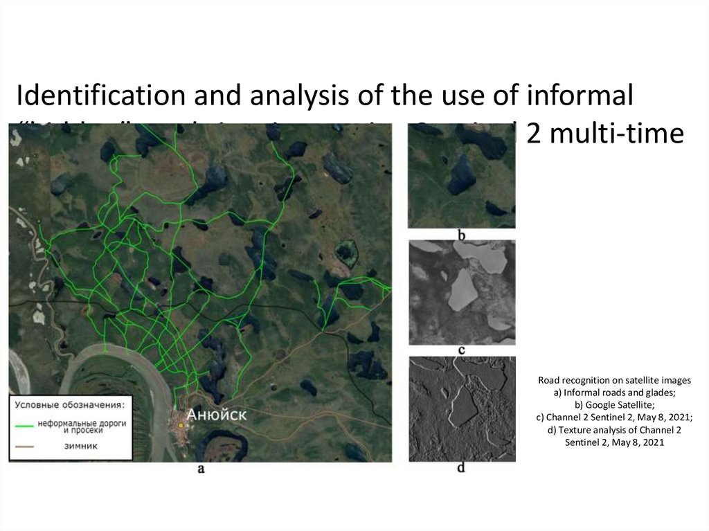
Identification and analysis of the use of informal“hidden” roads in winter using Sentinel 2 multi-time
images
Road recognition on satellite images
a) Informal roads and glades;
b) Google Satellite;
c) Channel 2 Sentinel 2, May 8, 2021;
d) Texture analysis of Channel 2
Sentinel 2, May 8, 2021
50.
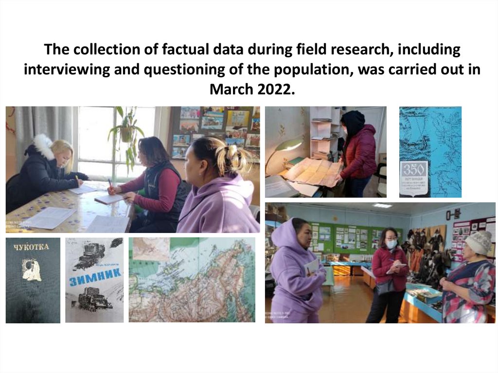
The collection of factual data during field research, includinginterviewing and questioning of the population, was carried out in
March 2022.
51.
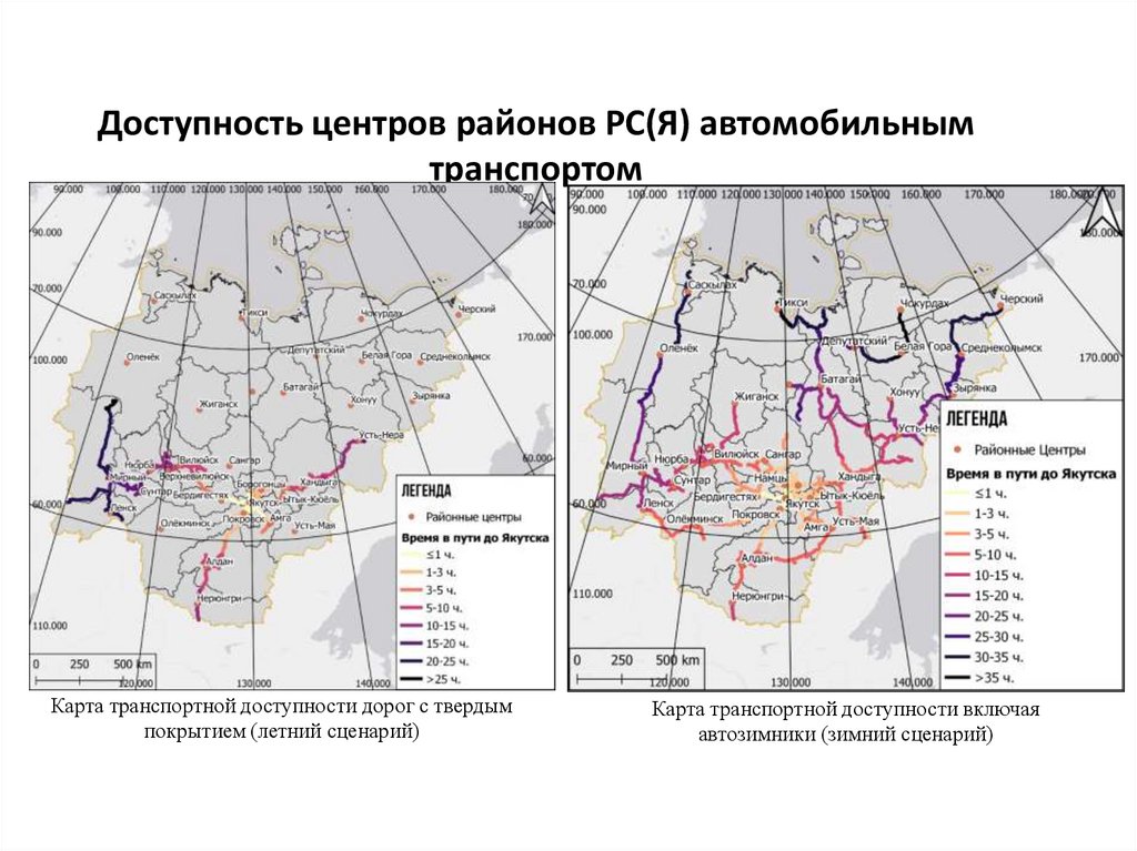
Доступность центров районов РС(Я) автомобильнымтранспортом
Карта транспортной доступности дорог с твердым
покрытием (летний сценарий)
Карта транспортной доступности включая
автозимники (зимний сценарий)
52.
53.
• Information on indigenous knowledge and aboriginal nature use wasasquired through interviews, mapping exercises with land users from the
native communities. To get this issues we interviewed individuals from a
number of different groups. We used an open-ended interviewing
technique.
• Depending on the person’s responsibilities and authority, questions
covered the following topics:
1. Land and resource use (fights of different stakeholders, conflict over usage,
preferred types of ownership and management, effectiveness of reforms)
2. Indigenous tribal communities (history, development, successes and
features)
3. Local self-government (spheres of authority, relations between different
levels of government)
4. Special rights for Indigenous peoples, effectiveness of laws and legal
reforms.
54.
Mapping of Indigenous knowledge andterritories
of
traditional
nature
use
•
The land use information focused on the
location of traditional activities of
aboriginal peoples: hunting, fishing, reindeer herding etc.
Each respondent from the survey indicate his or her
specific land use areas
by sticky icons of game animals
Survey respondents were not identified by name
The land use territories, where aboriginal peoples
REALLY hunt, fish, herd
reindeer do not always coincide with official boundaries
drawn from the maps
officially produced
55.
RESULTS AND CONCLUSION• 1. Traditional knowledge mapping involved elders, members of
nomadic tribal communities of our research areas in Yakutia,
villagers, including reindeer herders, hunters, fishermen, men and
women have been created.
• 2. It is gratifying to note the excellent knowledge of the place
names, natural map literacy, which is associated with a constant
nomadic and fishing lifestyle of population,
with excellent and mandatory skills of spatial and fast enough
map orientation.
• 3. An important part of the traditional nature use mapping is
comparison of the boundaries of a real traditional nature use
territories with an official land use boundaries.
• 4. The land use territories, where aboriginal peoples really hunt,
fish, herd reindeer do not always coincide with official boundaries
drawn from the maps officially produced.
56.
• Conclusions: Due the spatial nature of traditionalcultural and ecological knowledge, GIS
technology can facilitate the inclusion of
traditional indigenous knowledge in the
• decision making process. Scientific investigations
has a tradition of respect for indigenous cultures
and many scientists believe that there are
important lessons to be
• learned from studying the traditional life styles
and nature use of indigenous people.
57.
We can adapt to everything,but we can't adapt without
our lands and traditional
activities
Changing Arctic and Indigenous Peoples’ Prospects: Creating
new partnership 11 Jan 2017